Building the Future: How Point Cloud Surveys are Revolutionising Construction
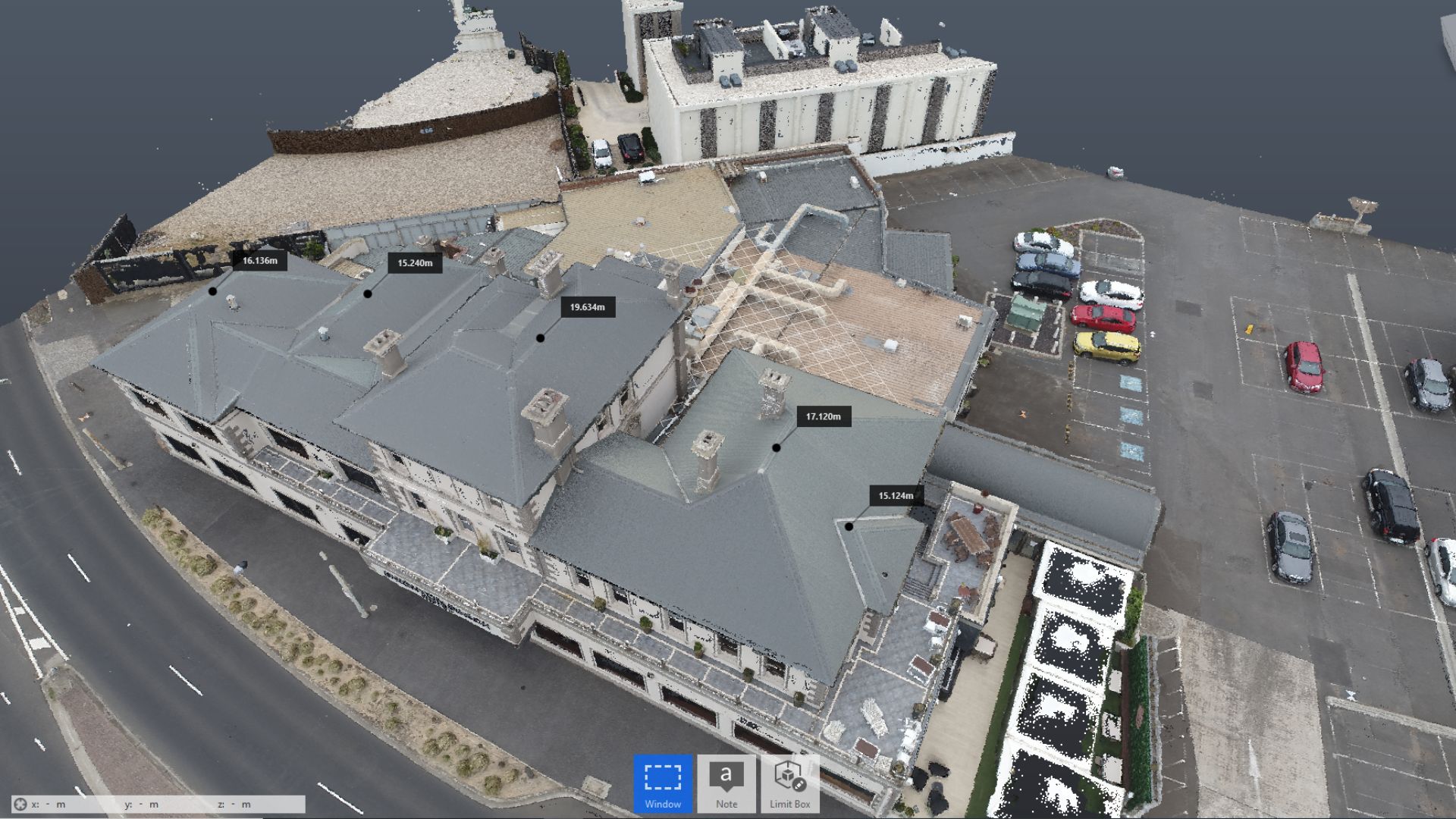
Point Cloud Surveys have emerged as the cornerstone revolutionising the industry in the dynamic arena of modern construction, where accuracy and efficiency reign supreme. Consider an exact digital replica of the real world made up of millions of points precisely collected in three-dimensional space. This is the heart of Point Cloud
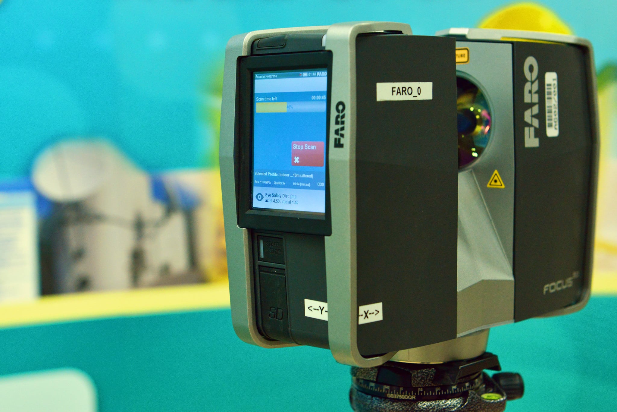
Avian’s 3D Laser Scanning & Surveying Equipment List [Updated 2024]
IntroductionFor architects, LiDAR scanning, also known as 3D laser scanning, is an absolute table-turner as it can drastically help in re-imagining the interiors, model structures, and building setups that can be digitally visualised with 2D and 3D laser scanning equipment. In the AEC (Architecture, Engineering & Construction) Industry, typically each project
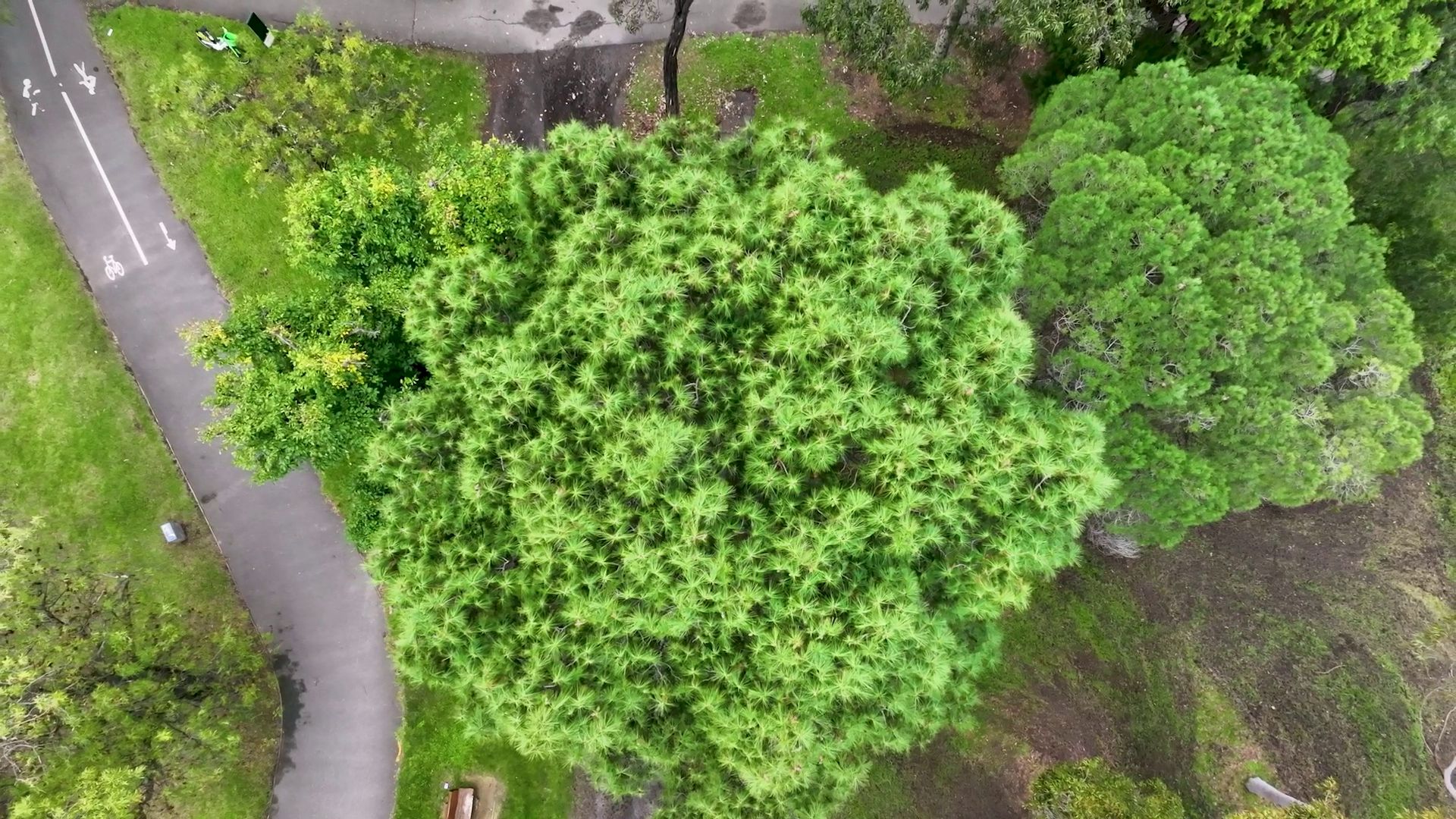
Visual Tree Assessment Techniques for Comprehensive Tree Safety Audits
Trees play an important part in our symbiotic balance with nature, and it is all the more critical now as to how we nurture breathing pockets in our urban landscape. However, this comes with a list of challenges where trees can be hazardous when they break or fall with or

Comprehensive Guide to Corridor Mapping with Commercial Drones
In the dynamic realms of engineering, project management, and urban planning, the demand for precise and efficient corridor mapping is an ever-present challenge. Enter drones - the transformative force reshaping our approach to topographical modelling and understanding the immediate environment in the rapidly evolving world of modern technology. Among the

Enhancing Construction site assessment & monitoring with technology in 2023
In the ever-evolving landscape of construction and surveying, technology has brought about transformative changes. The integration of advancements such as GPS, microprocessors, drones, laser scanning, and the Internet of Things (IoT) has significantly streamlined operations for project managers, builders, surveyors, and engineers within the Architecture, Engineering, and Construction (AEC) sectors.One
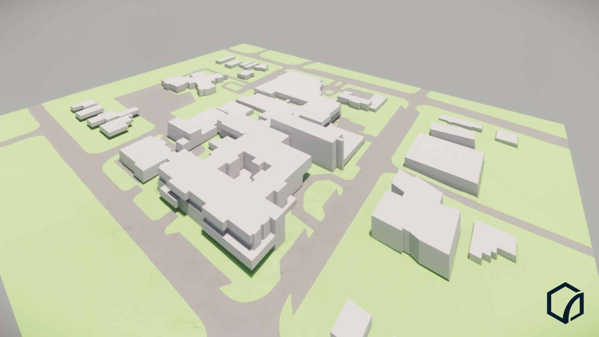
Unlocking Efficiency in Engineering and Construction: The Role of Reality Capture in Project Management
In the world of engineering and construction, where accuracy and efficiency are paramount, embracing innovative technologies is crucial for success. One such technology that has revolutionised the industry is reality capture. Reality capture refers to the process of capturing and creating precise digital representations of physical objects, environments, buildings and

Comparing Aerial Drone Scanning and Ground-Based Laser Scanning
If you’re working on an AEC project that needs accurate spatial data, you have two main scanning options: send a drone up, or set up a laser scanner on the ground. Both produce point clouds. Both feed into CAD drawings, BIM models and digital twins. But they capture very different
How Digital Twin Technology Uses 3D Scan Data in Construction
A BIM model tells you what was planned. An as-built survey tells you what was built. A digital twin goes further: it tells you what’s happening right now, and what’s likely to happen next. By layering real-time sensor data onto a verified 3D model, digital twins provide construction and operations

Construction timelapse Costing Guide 2026 + Key Recommendations
Construction timelapse videos help AEC professionals summarise key events during the project and condense a passage of time into a short, compelling format. Time lapse videos make for great communications and marketing material to inform stakeholders, the public and potential clients.Over the years, timelapse videos have become increasingly popular, and
Unveiling the Process of GIS Mapping Services 2026
The construction industry has made significant strides from its past practices, where manual inspections were relied upon by builders and construction managers for gathering site information.Today, we are fortunate to have an array of technologies such as GPS, laser scanners, drones, and other advanced tools, which facilitate efficient data gathering,