Drone Surveying Services: Faster, Accurate, Innovative.
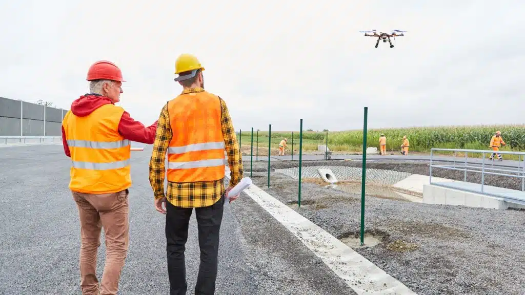
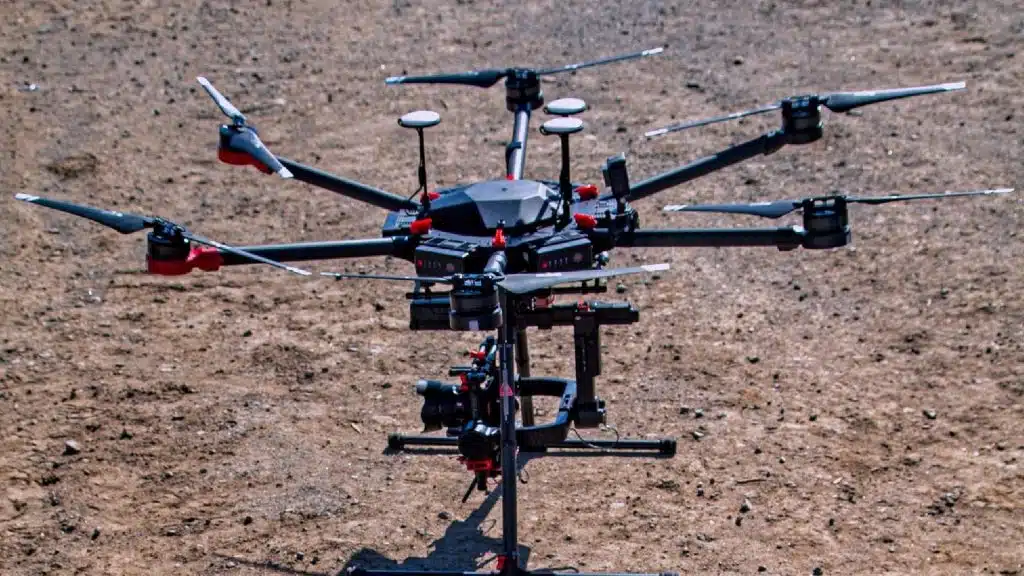
As one of the leading drone surveying and mapping companies in Australia, we empower your decisions with data-based insights, delivered with unprecedented efficiency, quality and survey-grade accuracy. Our comprehensive drone services in Melbourne can be used across a wide range of projects and applications.
Ideal for: Land Developers, Civil Construction, Urban Planners, Environmental Managers, Town Planners, Surveying Firms
Key Industries: Civil Construction, Property Development, Environmental and Urban Planning
Benefits:
– Capture vast terrain efficiently with accurate data acquisition and delivery.
– Capture comprehensive site coverage, ensuring no site detail is missed.
– Benefit from detailed topographical analysis, contours and improved site context.
– Receive completed drawings/plans in DXF, DWG and other compatible formats (STL, FBX, OBJ)
– Deliver a faster project turnaround, saving you time and money.
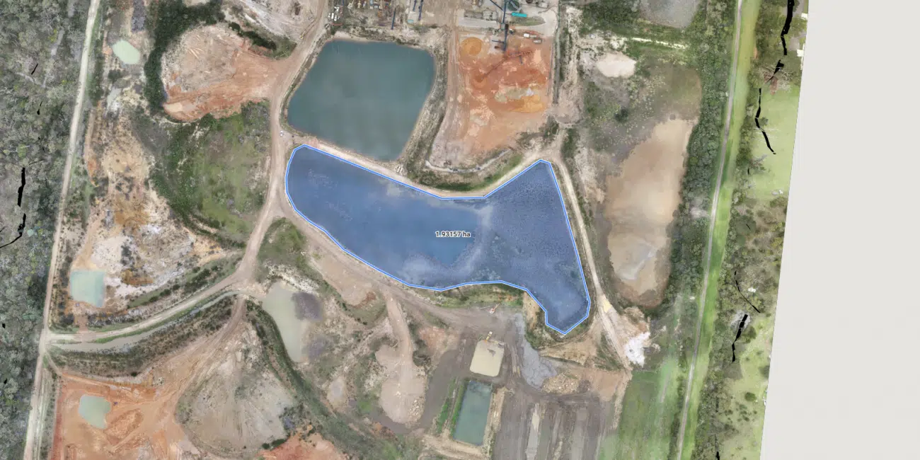
Ideal for: Engineering, Civil Construction, Road and Rail Projects, Infrastructure Managers and Urban Planners
Key Industries: Road/Rail Infrastructure, Transportation, Environmental Management, Pipelines, Energy Utilities
Benefits:
– Get a detailed topographical assessment of any corridor or linear project.
– Utilise planimetric feature extraction, precision contours, and decimated TIN mesh.
– Experience superior digital terrain mapping and modelling.
– Seamlessly integrate with CAD, BIM, and GIS platforms.
– Avoid duplication of effort across multiple sub-contractors
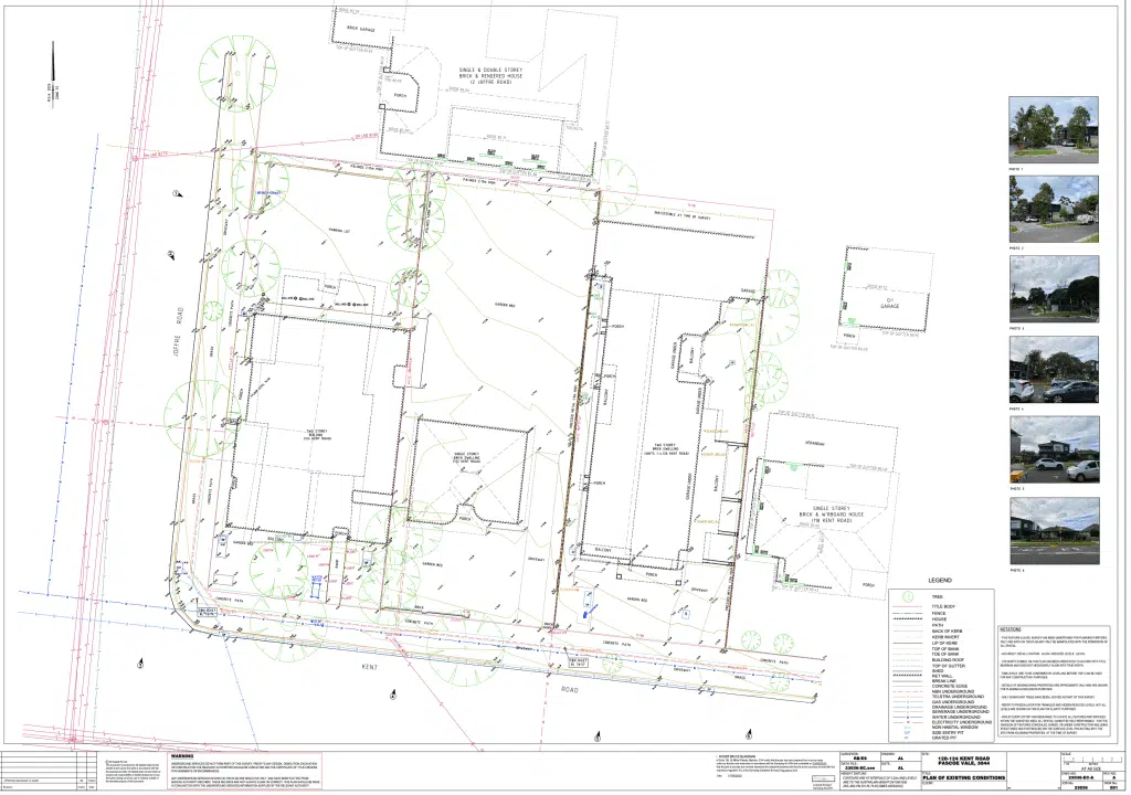
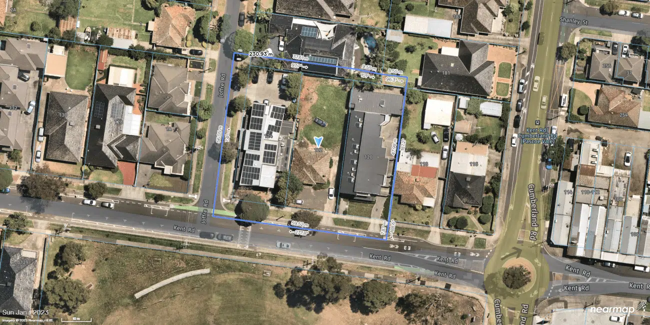
Feature Surveys for Commercial Premises
Ideal for: Commercial Property Managers, Commercial Business, Property Developers,
Key Industries: Real Estate, Environmental Planning, Developers
Benefits:
– Comprehensive site coverage to capture every angle and site feature, including adjoining properties.
– Detailed topographical and site analysis ensures clarity and clear decision making.
– Improve your project’s context with our enhanced site information.
– As always, expect a swift project turnaround.
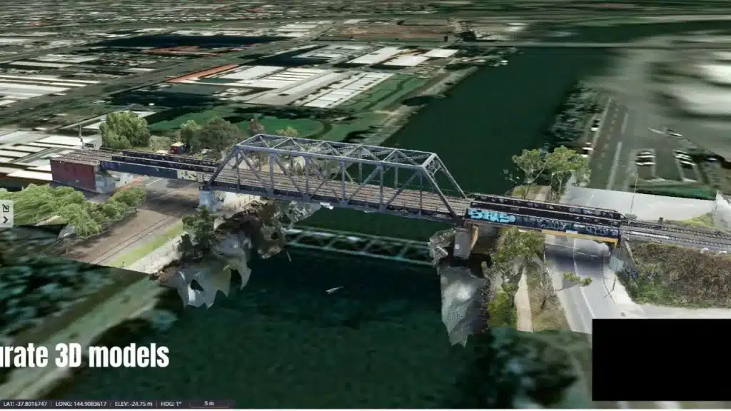
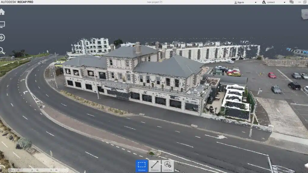
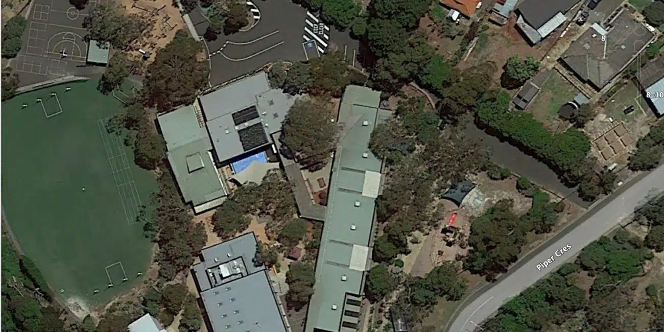
Point Clouds & 3D Models
Ideal for: The AEC Community, Civl Construction, Property Developers,
Benefits:
– Comprehensive asset coverage, leaving no stone unturned.
– Dive deep with our detailed analysis capabilities.
– Enhanced site context information to put every piece into perspective.
– Efficiently measure up complex assets and buildings with accurate geometry
One Partner, Multiple Services: Comprehensive Drone Survey Services and More
We have worked with hundreds of clients to undertake quality drone surveys in Australia, but our services extend well beyond just surveying.
Our team of experienced and licensed drone operators, surveyors, 3D artists and more allows us to provide end-to-end services across Melbourne and Australia, including drone photography services and building defects inspections.
From environmental planning and design to construction and sales and marketing, we are your go-to aerial surveying, mapping and drone inspection service company.
Why Make Avian Your Chosen Drone Surveying Company?
Whether you’re an environmental planner, town planner, engineer, or a part of the vast AEC community, our cutting-edge drone surveying and mapping services deliver faster, more comprehensive results tailored to your specific project needs.
Dive into a world where data collection meets innovation.
Join the revolution and transform the way you analyze and visualize your projects. Drone mapping isn’t just the future; it’s optimising the present. Let’s map out success together.
Experience the distinctive precision that sets us apart in the realm of aerial mapping companies
FAQs about Drones Surveys & Aerial Mapping in Australia
We have answered some common questions that clients have about aerial surveying and mapping.
The cost of drone surveying varies depending on several factors such as the size of the area to be mapped, the complexity of the terrain, and specific client deliverables. However, our drone surveys start from $1250 for areas within a 30km radius of major CBDs (central business districts).
Please note that this starting price includes the expertise of a land surveyor and drone operator, quality assurance and the delivery of data via a secure cloud link. Additionally, we offer various services such as digital terrain models, contours, drainage analysis, 3D site maps, point clouds, title and feature surveys, and web-hosted portals for 3D visualization and team collaboration. The cost of these additional services is available on request.
For more accurate pricing information based on your specific project requirements, I recommend contacting us directly through our contact page at www.avian.net.au/contact-us. Our team will be able to provide you with a tailored quote based on your needs and project scope.
Our drone mapping service excels in the industry for its precision, efficiency, and comprehensive offering:
- High Accuracy: We prioritise accurate survey-grade data collection, measurements and spatial data, essential for design and planning, using advanced surveying technology and workflows for confidence and precision.
- Updated Plans and Drawings: We provide updated plans and site drawings, efficiently and eliminating the need for manual additions.
- Quick Turnaround: Our efficient workflows and shorter fieldwork times ensure faster delivery, aiding in keeping your projects on schedule.
- Extensive Services: Beyond mapping, we offer inspections, laser scanning, and photogrammetry, catering to diverse project needs.
- Expert Team: With over 15 years of experience and full certifications, our skilled team guarantees and delivers exceptional results.
In brief, our standout factors include our commitment to accuracy, timely updates, quick project completion, a broad range of services, and an experienced team, all ensuring superior quality and customer satisfaction.
Yes, our drone surveying and mapping services can be customized for different industries and deliverables.
We have experience working with diverse industries, including construction, engineering, agriculture, mining, environmental monitoring, and more. We understand that each industry has unique requirements and specific mapping needs. Therefore, we tailor our drone surveying services to meet the demands of each client, whether it’s aerial surveying, land surveying, asset inspection, terrain mapping, or drone LiDAR scanning. Our team will consult and collaborate with you to understand your project requirements and deliver a customized solution aligned with your industry’s standards and objectives.
Our drone surveying technology is designed for easy integration with your existing construction data management systems, enhancing workflow efficiency. It’s compatible with various project management, design, and asset management software, allowing for effortless inclusion in your project workflow, reports and stakeholder updates.
This integration not only streamlines your operations but also improves accuracy and decision-making, potentially leading to cost savings. For any specific software needs, our team offers support to ensure smooth compatibility and effective use of our mapping data.
LiDAR costs in Australia can vary depending on various factors such as project size, complexity, and specific requirements. As mentioned in the provided context, LiDAR surveys can range from $1200 to $1500 per hour for the field crew and then additional costs for data processing and delivery. However, it’s important to contact us for a detailed consultation to discuss your specific project requirements and get an accurate cost estimate. You can reach us through our Contact Us page at www.avian.net.au/contact-us or by emailing us at info@avian.net.au.
Aerial photography involves capturing images from an elevated position, like via aircraft or drones, for purposes such as marketing or inspection. It focuses on high-quality visual representation. Mapping, however, is about creating detailed maps from geographic data, including measuring distances and elevations, and interpreting features on the ground. Essentially, aerial photography is about capturing images, while mapping is about creating detailed, data-driven maps.
Our drone surveys deliver high precision,
achieving accuracy within a few centimetres. We use advanced GPS technology combined with survey control methods, ensuring reliable data suitable for engineering, construction, and planning purposes.
We provide a range of data outputs, including orthomosaic maps, 3D terrain models, contour maps, volume calculations, feature extraction and 3D point clouds. These comprehensive datasets help with detailed analysis, planning, and decision-making across various industries.
Weather plays a crucial role in the success of drone surveying and mapping projects. Ideal conditions are clear skies with low wind to ensure stable flight and high-quality imagery. Rain, fog, or strong winds can delay projects or affect data quality, so we carefully monitor forecasts and plan flights accordingly.
While drone surveying offers faster, safer, and often more cost-effective data collection over large areas, it is typically used to complement rather than completely replace traditional ground surveys. For certain precise measurements or complex sites, ground verification remains essential.
Drone Surveying & Mapping Case Studies
Speak with the team at AVIAN to discuss your project needs. We love to solve complex problems using our combined knowledge and experience so let us know more about yours.