Services > Drone Surveying & Mapping > Expert Large Land Area Surveyor in Melbourne
Streamline Your Land Development and Planning with Our Comprehensive Drone Surveying and Mapping Solutions For Large Area
Navigating through the complexities of large area surveying requires resources, effort, time and a comprehensive job methodology. At Avian Australia, we bring to you an innovative solution that amalgamates traditional land surveying methods and advanced drone surveying service to deliver detailed terrain mapping, ensuring your projects are always a step ahead in efficiency, accuracy and client delivery.
Our drone surveying and mapping solutions cater to a diverse range of clients, solidifying our position as a trusted land surveyor Melbourne:
– Land Developers and Managers
– Environmental Managers
– Town and Urban Planners
– Surveying Firms
– Civil Engineering
– Civil Construction
– Municipal Councils
– Road & Rail Maintenance
Your Challenges, Our Solutions:
We understand the hurdles faced by professionals in the field:
– Difficult terrain makes the job time-consuming and resource intensive to survey large land areas
– Incomplete data collection or missing site information
– Limited site context on adjoining properties or roads
Avian Australia mitigates these challenges by offering key benefits:
– Faster Data Collection: Minimize your project timelines with rapid and accurate data acquisition to surveying industry standards.
– Comprehensive Site Coverage: Ensure no detail is overlooked with our drones that cover every inch of your site.
– Detailed Topographical Analysis: Dive deep into the nuances of the land with intricate topographical data with natural surface levels.
– Improved Site Context Information: Gain enhanced insights into the subject property and surrounding site context to make informed decisions.
– Swift Turnaround: Propel your projects forward with our expedited data delivery in agreed CAD title block format and DXF/DWG file delivery.

Services Tailored to Your Needs
Site Planning
Initiating the project with detailed planning, using drone data to ensure optimal land use and adherence to local regulations.
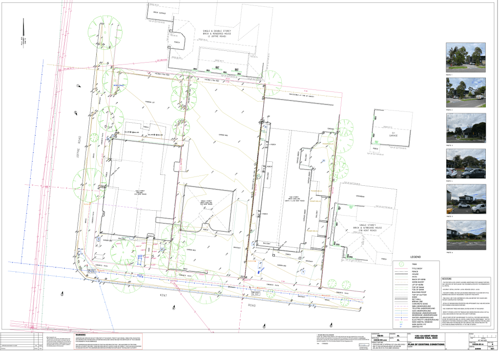
Digital Terrain Models
Developing a comprehensive understanding of the land’s physical characteristics to inform subsequent planning and development stages.
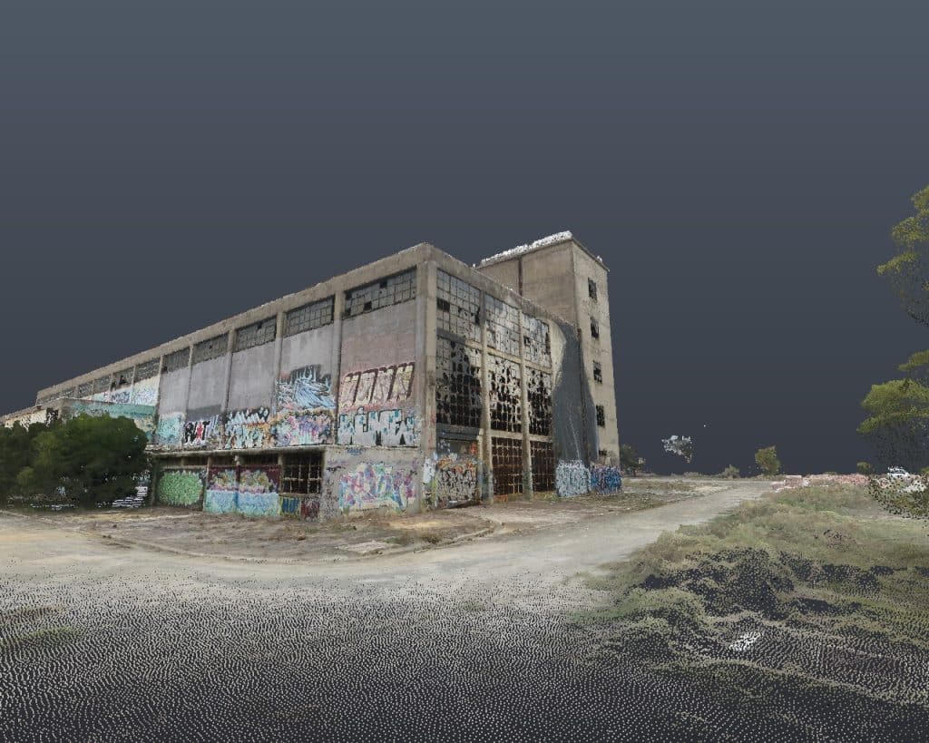
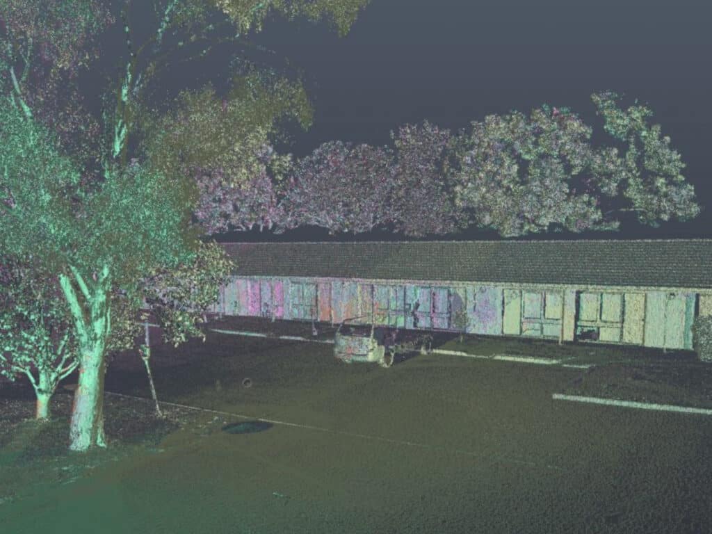
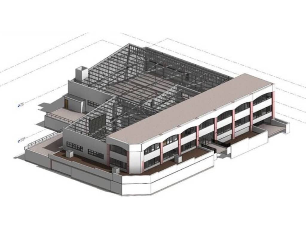
3D Site Maps and Models
Utilizing 3D visualizations to further refine planning and communicate spatial contexts effectively to stakeholders.
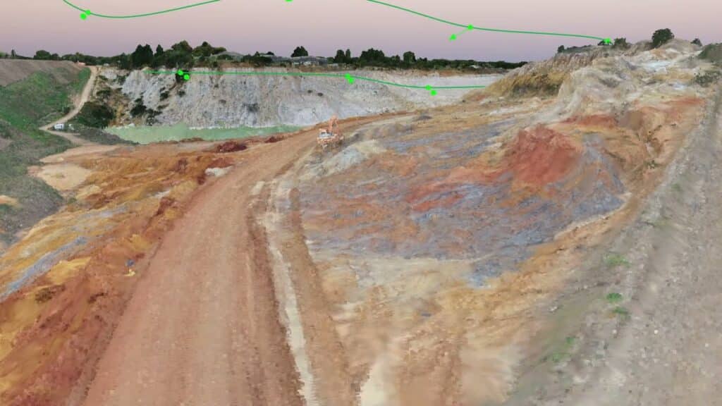
LiDAR Surveying and Mapping
Employing high-resolution, detailed mapping to inform engineering and environmental analyses, ensuring all aspects of the land are understood.
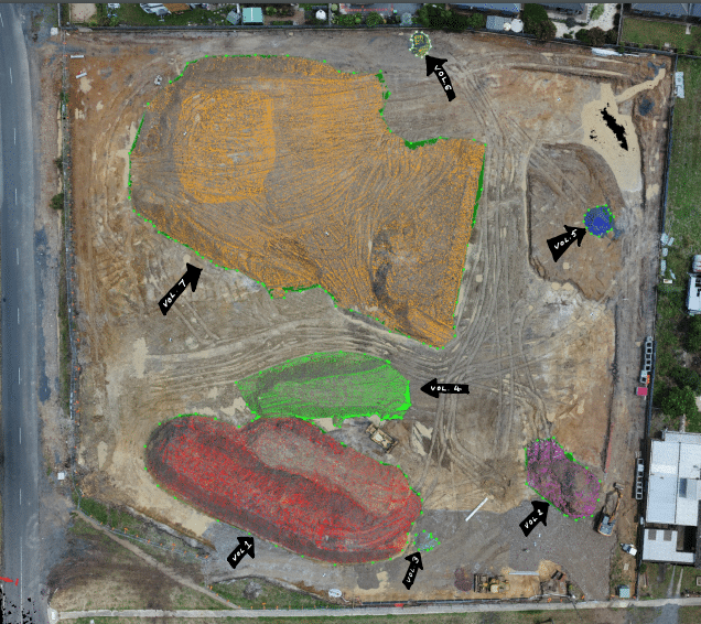
Cut and Fill Estimates
Utilizing the detailed mapping data to inform grading plans, ensuring efficient and cost-effective land preparation for development.
Quantity Surveys
Managing and estimating construction materials and costs, ensuring that the project adheres to budgetary constraints and optimizes resource allocation.
Why Choose Avian Australia for Large Land Area Surveying?
Choose Avian Australia for your large land area surveying to benefit from our drone-powered efficient data collection, thorough land analysis, precise development planning, and access to detailed, real-time site conditions surpassing conventional online mapping platforms.

FAQs about Large Land Area Survey using Drones
✓ Efficient Data Collection
Harness the power of our drone surveying and mapping solutions to collect data efficiently, accurately and effectively.
✓ Comprehensive Land Analysis
Benefit from a thorough site analysis that leaves no stone unturned. Gather insights unavailable using conventional methods.
✓ Informed Land Development & Planning
Leverage our data to plan and execute your development projects with precision and information that gives you the advantage.
✓ Real-Time Conditions
Access more detailed, higher resolution and updated site data than Google Maps, Nearmaps, or Metromap.
We have answered some common questions that clients have about Large Land Area Survey.
As a leading land surveyor Melbourne, Avian Australia’s drone surveying services offer several advantages over traditional methods, including:
- Faster Data Collection: Drones capture data more quickly, reducing project timelines.
- Comprehensive Site Coverage: Drones cover every part of the site, ensuring no detail is missed.
- Enhanced Topographical Data: High-resolution images provide detailed topographical insights, aiding in more accurate land analysis and planning.
- Improved Site Context: Our drones offer better context for adjoining properties and roads, providing a complete view of the area.
As a top land surveyor Melbourne, Avian Australia’s drones utilize advanced imaging and LiDAR technology to capture high-resolution data with pinpoint accuracy. This technology provides:
- Detailed Surface Analysis: Captures intricate terrain details, including natural surface levels.
- Precise Measurements: Ensures accurate distance and area measurements essential for land development and planning.
- Reduced Human Error: Automates data collection, minimizing the risk of errors commonly associated with manual surveying methods.
Our drone surveying services, as a premier land surveyor in Melbourne, are beneficial for a wide range of projects, including:
- Land Development: Providing detailed mapping and analysis for large land areas to inform development plans.
- Environmental Management: Monitoring and assessing land for environmental impact studies.
- Urban Planning: Aiding in the design and planning of urban and town infrastructure.
- Civil Engineering and Construction: Offering precise data for engineering designs, construction planning, and site management.
As a trusted land surveyor in Melbourne, Avian Australia prioritizes data security and privacy by:
- Secure Data Storage: Storing all collected data on secure servers with restricted access.
- Compliance with Regulations: Adhering to industry standards and local regulations regarding data collection and privacy.
- Confidentiality Agreements: Ensuring all project data is handled confidentially and only shared with authorized personnel.
The typical turnaround time for Avian Australia’s drone surveying and data delivery as a land surveyor in Melbourne varies based on the project’s complexity and size but generally includes:
- Data Collection: Rapid on-site data collection, often completed within a day for most standard projects.
- Data Processing: Processing and analyzing data typically takes a few days to a week.
- Final Delivery: Providing clients with detailed reports and data in the agreed CAD title block format and DXF/DWG files, usually within 1-2 weeks after data collection.
Speak with the team at AVIAN to discuss your project needs. We love to solve complex problems using our combined knowledge and experience so let us know more about yours.