In the dynamic realms of engineering, project management, and urban planning, the demand for precise and efficient corridor mapping is an ever-present challenge. Enter drones – the transformative force reshaping our approach to topographical modelling and understanding the immediate environment in the rapidly evolving world of modern technology. Among the diverse applications of drone technology, corridor mapping stands out as a pivotal arena, leveraging the unique advantages offered by drones and cutting-edge surveying technology.
The impact of commercial drones on corridor mapping is particularly pronounced in critical components of our transportation infrastructure, including road and rail networks, power lines, and pipelines. Drones have swiftly emerged as game-changers in this field, ushering in a host of benefits that extend beyond conventional mapping methods.
From enhancing cost-effectiveness and speed to facilitating access to challenging terrains, drones are revolutionising the mapping landscape. Their ability to quickly capture high-resolution imagery and, using photogrammetric software, generate precise 3D models not only expedites corridor mapping projects but also elevates their accuracy and efficiency.
As we delve into the world of corridor mapping with drones, we’ll explore the key advantages they bring to the table, delve into diverse applications ranging from infrastructure maintenance to environmental assessments, and examine the technological innovations propelling this transformative journey. Furthermore, we will explore advanced LiDAR techniques for corridor mapping, highlighting their advantages, data processing methods, and actual case studies.
A PwC study found that employing drones for infrastructure inspections, including corridor mapping, can save a lot of money. According to the report, drone use can reduce inspection expenses by up to 50% when compared to conventional techniques.
It has never been easy to guarantee the security, upkeep, and optimal performance of these vital linear assets. However, the development of commercial drone technology has opened up fresh perspectives in the field of corridor mapping, providing an efficient and effective method for remote management, monitoring, and inspection.
Accurate corridor mapping is now essential in the constantly evolving fields of engineering, project management, and city planning. Professionals are turning to cutting-edge solutions, like the deployment of industrial drones, to meet these needs and go beyond what was possible as extended applications, which were not possible before.
Our professional team arranges discovery calls and site visits to extract pertinent project insights. Noteworthy factors influencing construction site assessment costs encompass:
Table of Contents
Uses of Drones for Corridor Mapping with Current Technologies
The incorporation of cutting-edge technologies has significantly changed corridor mapping in recent years, with drones at the vanguard of this revolution.
Utilities corridors, transport corridors, road corridors, and rail corridors are just a few of the diverse applications that have benefited from the use of drones in corridor mapping. Here, we look at the most recent technologies that underpin these applications:
1. Identification of Infrastructure Issues
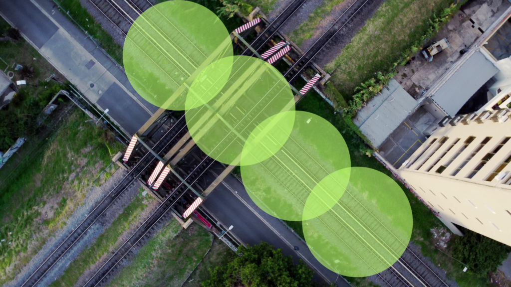
Corridor mapping using drones has proven instrumental in identifying critical infrastructure problems, ranging from loose connections and cracked insulators to issues like overgrown vegetation. Drones equipped with high-resolution cameras and advanced sensors perform thorough inspections, enhancing the efficiency of problem detection in transportation and utility corridors.
2. LiDAR (Light Detection and Ranging) for Precision Elevation Data
Employing LiDAR-equipped drones for road corridor mapping provides an unparalleled advantage in obtaining precise elevation data. These drones create highly detailed 3D representations of the topography and infrastructure, aiding in the identification of elevation changes, assessing road conditions, and facilitating effective road design and maintenance planning.
3. Thermal Imaging for Anomaly Detection
Corridor surveys leverage thermal imaging sensors on drones to detect anomalies such as hotspots on electricity lines or potential flaws in surfaces. This technology proves invaluable in pinpointing hotspots and identifying potential electrical issues during rail corridor mapping.
4. AI and Machine Learning for Advanced Data Analysis
The vast datasets accumulated during corridor mapping undergo comprehensive analysis through sophisticated algorithms powered by artificial intelligence (AI) and machine learning. AI can assist to classify assets, identify noise sources based on transport noise corridor patterns and recognize potential safety issues in utilities corridor mapping, providing invaluable insights for proactive decision-making.
5. Real-time Data Transmission
Recent strides in drone technology enable real-time data transmission and map creation to immediately assess conditions, facilitating swift responses to critical findings. This capability is particularly beneficial in planning road and rail corridors, ensuring rapid responses to enhance safety and minimise service interruptions.
6. Autonomous Flight and Path Planning
Drones are increasingly equipped with autonomous flight capabilities and intelligent flight path planning, including obstacle avoidance. This enables efficient coverage of expansive corridors without the need for constant human intervention, saving both time and resources in the mapping process.
7. Multi-Sensor Integration
The versatility of drones lies in their capacity to integrate various sensors, including multispectral cameras, thermal sensors, RGB cameras, and LiDAR. This adaptability allows drones to cater to diverse corridor mapping activities, offering comprehensive information crucial for informed decision-making.
Corridor mapping has undergone a transformative shift, evolving from a time-consuming, erroneous and costly process to a proactive, precise, and efficient strategy, all thanks to the integration of drones and evolving surveying and geospatial technologies. These advanced tools are now indispensable for managing corridors and upholding infrastructure integrity in the modern world, whether it involves assessing power line integrity, evaluating road conditions, monitoring noise pollution, or ensuring the safety of railway networks.
B. Data collection methods
The selected strategies used for drone data collection will determine how effective corridor mapping is with commercial drones. Depending on the particular corridor and its needs, several approaches, payloads or camera sensors might be used.
1. Aerial Photography
Enterprise Drones equipped with RTK (real time kinetic) and time-synced high-resolution cameras are used for aerial photography and photogrammetry. These drone cameras are calibrated to geo-tagged photos with precise positioning of the camera position, which can be assembled to produce ortho maps of the corridor. This technique using photogrammetry is often used for mapping road and railway corridors since it is very successful at efficient image capture and terrain modelling.
2. LiDAR scanning
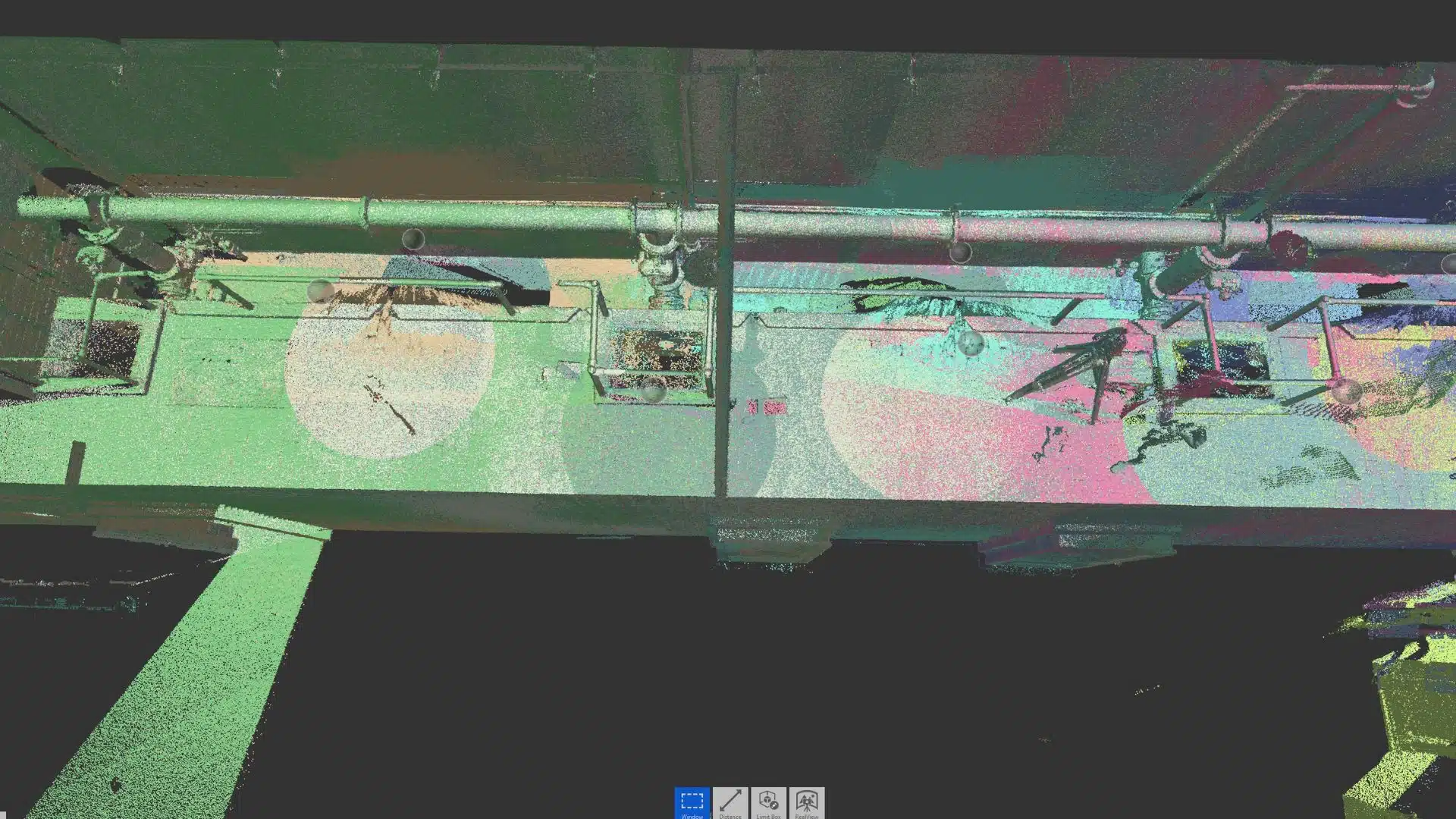
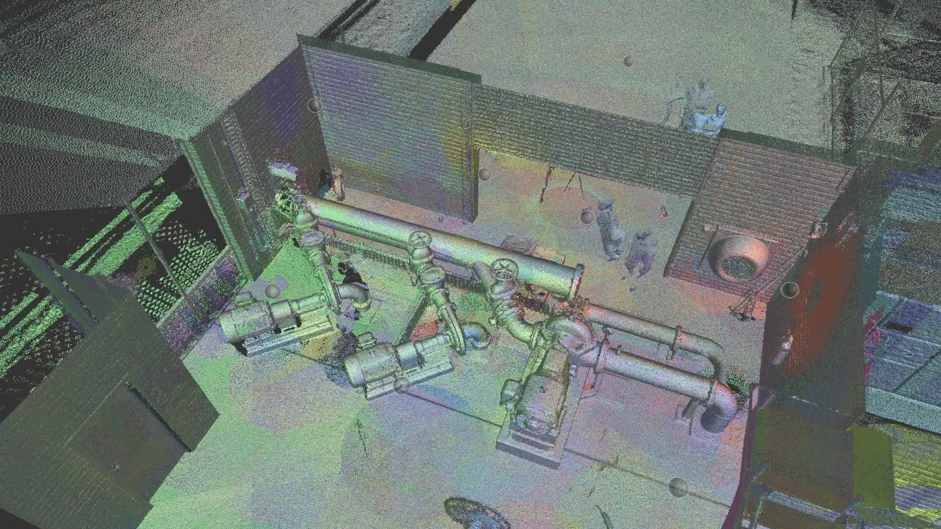
The term “LiDAR” refers to a technique that makes use of laser beams to precisely measure distances. Drones with LiDAR capabilities build 3D representations of the corridor, especially where there is a lot of tree canopy or vegetation.
Light Detection and Ranging, or LiDAR, is a cutting-edge technology used to produce incredibly accurate three-dimensional surveys of a variety of elements, such as terrain, vegetation, and electrical infrastructure. Close-range LiDAR data describes circumstances where the LiDAR sensor is placed between 50 and 150 metres from the objects or features that need to be captured. Either an aerial or terrestrial position can be used to collect data for terrain modelling purposes.
Fixed wing aircraft have traditionally been used to collect airborne LiDAR data, due to the larger land area coverage. However, with recent advancements in drone and LiDAR technologies now offer a lower cost and more efficient method of laser scanning moderate sized areas.
3. Thermography
Drones fitted with thermal cameras are used for specialised applications like power line inspection and corridor mapping. By identifying hotspots in electrical systems and detecting temperature changes, these cameras help maintain the integrity, safety, and reliability of utilities infrastructure.
4. Multispectral Imaging
Drones equipped with multispectral cameras gather data from a range of spectral wavelengths used by Agriculture. This approach is frequently used in agricultural corridor mapping to evaluate the health of crops and improve farming methods.
C. Use of Advanced LiDAR Techniques for Corridor Mapping
There are numerous advantages of using advanced LiDAR techniques for corridor mapping, including:
1. Unprecedented Precision
The combination of LiDAR and surveying practices can provide terrain data with centimetre-level accuracy, ensuring that the information gathered is comprehensive and trustworthy.
2. Detecting Obstacles
Using LiDAR, obstructions in the corridor, like overhanging foliage, constructions, or other encroachments, can be identified and mapped. For fire maintenance and safety, this is essential.
3. Real-time data gathering
Real-time data collecting is made feasible with Advanced LiDAR systems, allowing for quick analysis and immediate decision-making.
4. Enhanced Safety
Modern LiDAR methods reduce the dangers of sending workers into potentially dangerous situations. They can be used to assess the condition of the asset and determine the appropriate equipment and safety methods required.
D. Best Practices for Accurate Corridor Mapping
Harnessing the potential of commercial drones for corridor mapping demands meticulous planning and a commitment to best practices. Here are essential guidelines to ensure a successful and reliable operation:
1. Meticulous Job and Flight Planning
Before mobilising to the site, meticulous job and flight planning are indispensable. Define the objectives, risks, potential hazards, flight plans, and criteria for data gathering and processing. This comprehensive preparation phase sets the stage for a successful operation, allowing challenges to be effectively addressed in the field.
2. Choose the Appropriate Technology
The selection of sensors and cameras is a critical decision. Opt for technology that aligns with the specific requirements of the corridor being mapped. For instance, a road corridor may necessitate high-resolution photography, while a power corridor could benefit from LiDAR technology for obstacle detection.
3. Data Validation
Frequent validation and cross-referencing of gathered data are paramount. This iterative process minimises errors, ensuring the correctness and reliability of the data collected. Regular data validation enhances the overall accuracy of corridor mapping results.
4. Prioritise Security
Adhering to safety rules and regulations is non-negotiable. Given that key infrastructure routes are involved, prioritising safety is paramount. Compliance with safety procedures not only safeguards the integrity of the corridor but also ensures the well-being of individuals utilising it.
5. Choose a Qualified Service Provider
Selecting the right service provider is a pivotal step toward ensuring the success of corridor mapping projects. Opt for a provider with the appropriate experience, licences, and safe working methods. A qualified service provider brings several advantages, including:
Criteria 1 – Expertise
An experienced service provider is well-versed in the intricacies of corridor mapping data collection, understanding the unique challenges and requirements associated with different types of corridors. This can avoid costs, errors and revisits due to incorrect or inaccurate data collection.
Criteria 2 – Compliance
Ensure the service provider possesses the necessary licences and adheres to regulatory guidelines. Compliance with legal requirements not only guarantees the legality of the operation but also reflects a commitment to ethical and responsible drone use.
Criteria 3 – Safety Protocols
A reputable service provider prioritises safety, implementing rigorous safety protocols during both planning and execution phases. This commitment minimises risks to personnel, equipment, business and the surrounding environment.
Criteria 4 – Proven Track Record
Look for a service provider with a proven track record of successful corridor mapping projects. Past achievements serve as a testament to their capabilities and reliability.
Criteria 5 – Efficient Work Methods
Assess the provider’s work methods to ensure efficiency in data collection, processing, and delivery. Streamlined processes contribute to project timelines and overall success.
By adhering to these best practices, you can elevate the effectiveness and reliability of corridor mapping with commercial drones. This commitment to meticulous planning, technological suitability, data validation, and safety prioritisation contributes to the success of corridor mapping operations, making them more precise and dependable for critical infrastructure management.
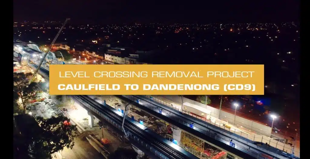
2. Real World Case study: Rail Corridor Mapping – Avian Australia
Drones were used for rail corridor mapping by Avian Australia, a leading surveying and reality capture company, to assess the track condition and overhead wires for potential issues, such as hotspots and damage. By taking a proactive stance, the rail maintenance client was able to proactively assess and identify areas to conduct track maintenance where and when it was needed, improving train safety, streamlining costs and lowering the likelihood of service interruptions.
Challenges faced in Rail Corridor Mapping
1. Safety and Inspection
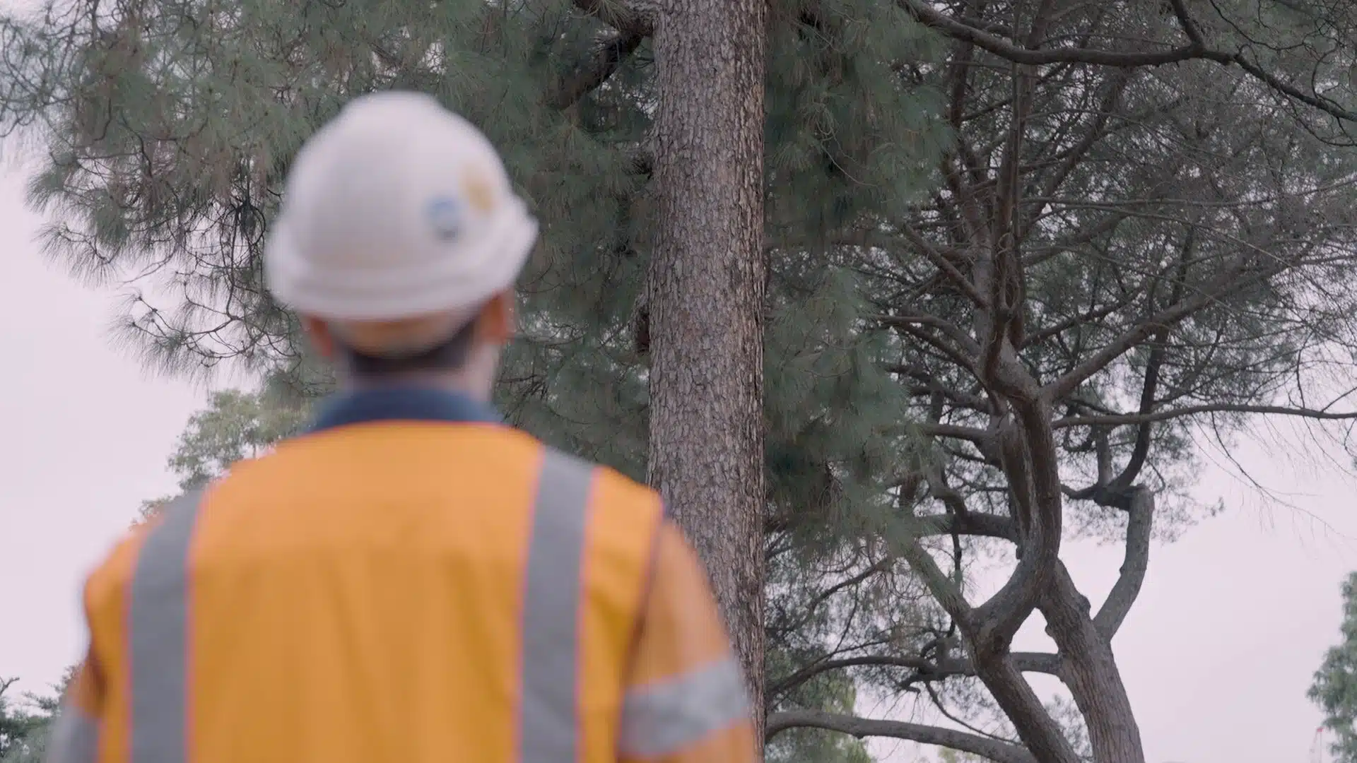
For the safety of passengers and the integrity of the rail infrastructure, frequent inspections of the rail corridors are necessary. Sending staff to inspect rails, bridges, tunnels, and embankments is costly, time-consuming and potentially dangerous undertaking.
2. Efficiency
To simplify maintenance and increase network dependability, the extensive rural rail network required effective data collection techniques.
3. Environmental Impact
A growing issue was the effect that railway activities had on the environment. It was important to lessen this impact while preserving reliability and safety.
Solutions in Rail Corridor Mapping
Commercial drones equipped with RTK positioning and LiDAR were used to collect detailed 3D data on the rail corridors. This technique assisted to detect track anomalies, clearance problems, and structural conditions.
Effective Data Gathering: In a fraction of the time and cost it would have taken conventional inspection teams, the drones traversed kilometres of rail corridor. Real-time data was gathered and quickly processed and analysed. A digital record and corridor map served to support the client with maintenance planning and repairs.
Environmental Benefits: The rail maintenance client minimised its environmental impact and complied with sustainability objectives by eliminating the need for lengthy ground inspections and maintenance procedures.
The Bottom Line
In summary, the use of commercial drones for corridor mapping is a significant development in the areas of infrastructure management, site inspection, and transport planning.
As a final point, it is crucial to recognise that in today’s fast-paced world, using drone technology for corridor mapping is not a choice but rather a need. Beyond what the human eye can see, the power of these aerial tools enables all project stakeholders to make more informed decisions based on tangible data.
We strongly advise anyone who is interested in maximising the benefits of corridor mapping using commercial drones to look into the corridor mapping service provided by Avian Australia. Learn how their knowledge may help you optimise your infrastructure and assets by visiting some of our case studies.
Don’t pass up the chance to use drone technology’s potential in your projects. Take the lead in reinventing how we manage, maintain, and plan our crucial linear assets by embracing the future of corridor mapping. The power of drones is the beginning of your next success story.