Architect
High-Precision Land Surveying in Brighton
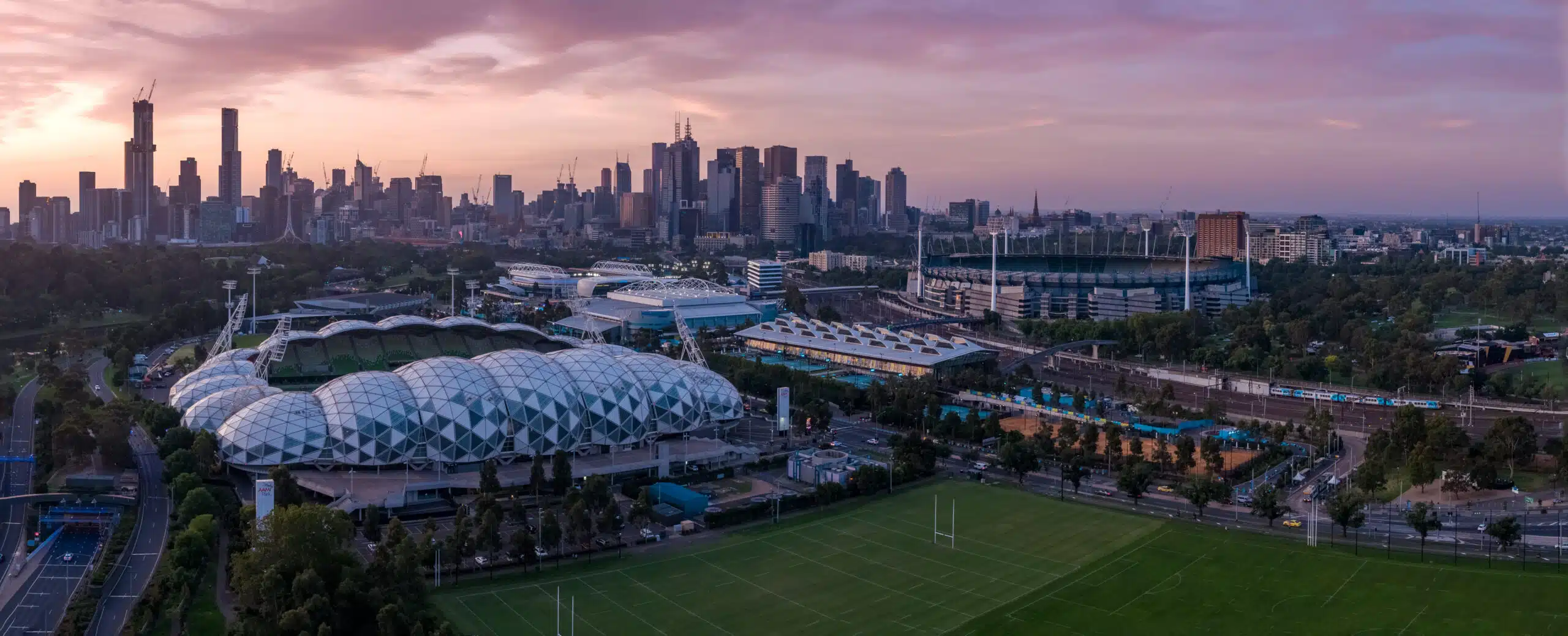
Brighton is known for its iconic bathing boxes along Dendy Street Beach, tree-lined avenues of Middle Brighton and the grandeur of Church Street’s heritage precinct.
Navigating Brighton’s Tight Corners and Laneways
Brighton’s network of narrow streets and shared driveways can make setting up tripods and total stations a logistical nightmare. Traditional ground-based methods often struggle to secure stable control points amid closely spaced buildings or limited street frontage.
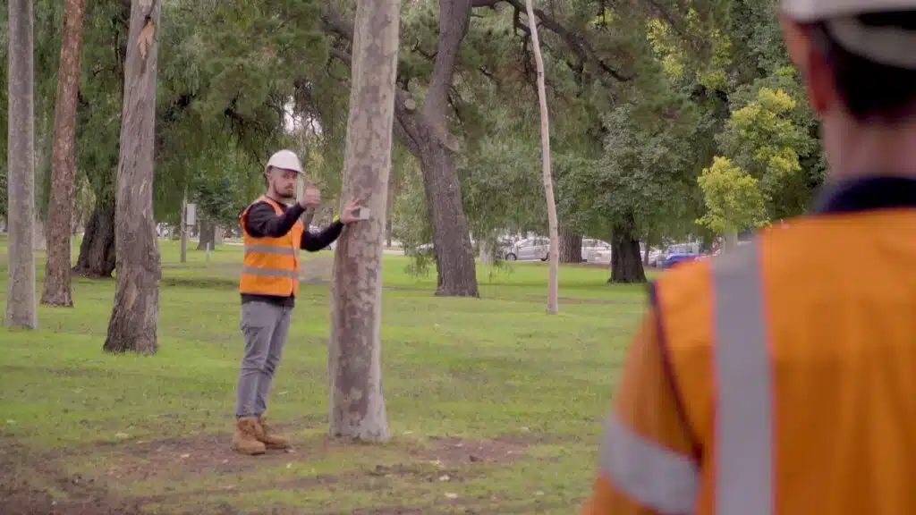
Our land surveying service Brighton solution: a bespoke combination of conventional surveys, 3D laser scanning and surveying services and aerial data capture. By deploying handheld LiDAR scanners and our drone surveying company expertise, we can map every fence line, service pit and change in elevation.
A Land Surveying Service Brighton Residents Can Trust
Each and every project we complete in Brighton carries its own character. Whether you’re subdividing a rare corner block near Brighton Grammar or preparing site plans for a waterfront apartment on the Esplanade, Avian’s process begins with a thorough review of council overlays, strata agreements and historical maps. An on-site examination follows, determining the most optimal blend of GNSS control, total-station traverses and 3D laser scanning for architecture, engineering, construction.
Certified Boundary Surveys and Subdivisions
Splitting an existing property demands precision. Our boundary surveys verify fence lines, retaining walls and buried utilities, producing certified plans that stand up to Titles Office scrutiny. With Avian’s land surveying service Brighton, you gain clarity on site extents, avoid neighbour disputes and accelerate your subdivision approvals.
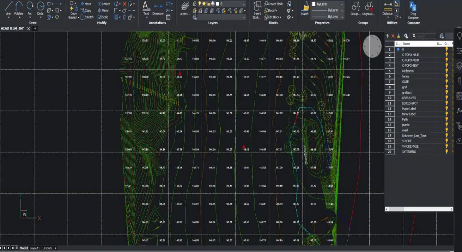
Detailed Topographical Mapping for Coastal Developments
From dune preservation near Brighton Bathing Boxes to flood resilience planning around Elster Creek, accurate topography is essential. Combining ground land surveys in Brighton with aerial mapping and LiDAR, we generate high-resolution contour maps that highlight slope gradients, cut-and-fill volumes and vegetation cover. These deliverables inform stormwater design, retaining-wall engineering and landscape architecture, keeping your project in budget and on time.
Integrating Drone Surveying and 3D Scanning
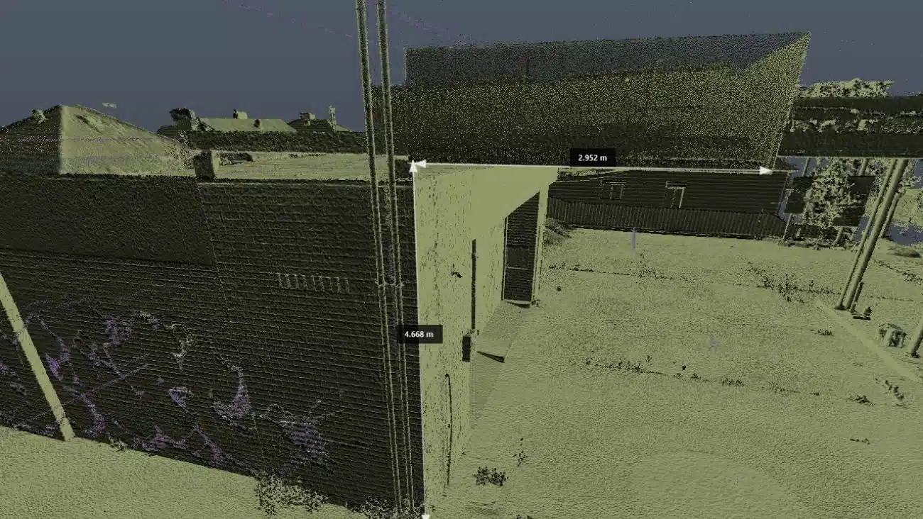
Where ground access is restricted, our drone surveying teams deliver a bird’s-eye perspective. Drones bypass fences and obstructions, capturing orthomosaics and point clouds that underpin 3D scanning Melbourne, Sydney, Brisbane workflows. For heritage façades or multi-storey sites, our terrestrial LiDAR scans produce millimetre-accurate digital twins, seamlessly bridging the gap between physical and digital.
Complying with Local Council Guidelines
Brighton falls under the jurisdiction of the Glen Eira City Council. Before any engagement we assess every site for its history, location and surrounds to assess the best methodology and equipment for our clients project needs.
Glen Eira City Council
15 Baxter Road, Bentleigh East VIC 3165
Phone: (03) 9524 3333
www.gleneira.vic.gov.au
Avian manages the entire permit process, liaising with council officers to keep your planning and permit approvals process moving forward.
Why Choose Avian’s Land Surveying Services in Brighton?
Fast and Reliable | Brighton | Professional Land Surveyors
Our Brighton-based surveyors understand local geography, history and planning regulations. We deploy within hours to Gardenvale, Hampton and Sandringham, offering fast turnaround and robust support.
Yet its high population density and closely spaced homes poses unique challenges for surveyors.
All our team members hold relevant qualifications and experience.
All land surveys are conducted in compliance with relevant Acts of Parliament and subordinate legislation relating to land surveying in Victoria and are covered by $20M public liability insurance, so you can be confident of safe and legally compliant land surveying in Brighton and surrounding suburbs.
At Avian, our land surveying Brighton based team combines their local knowledge with advanced technology, ensuring every parcel, boundary and contour is captured with absolute accuracy, whether you’re planning a townhouse infill off Bay Street or restoring a heritage villa on North Road.
")
Title Re-establishment Surveys

Feature and Levels Surveys

Large Land Area Surveys
Ready to Elevate Your Brighton Project?
Whether you need a detailed boundary survey, topographical mapping or integrated 3D laser scanning and aerial data, Avian’s land surveys team in Brighton is here to help. Contact us today to discuss your requirements and schedule a consultation. And if you’re seeking our service elsewhere, we operate across Victoria, stretching our land surveying services to Caulfield, Ballarat, Brunswick and beyond.
Let’s turn your site data into actionable insights and keep your project moving forward.
Why choose Avian?
$20M public liability insurance
Includes comprehensive Commercial coverage, Work Cover Insurance and Professional Indemnity cover.
100% Worksite Safety
Our teams all hold valid CWCs and RIWCs to work in construction and rail project worksites safely.
Qualified and Experienced Land Surveyors
Our surveyors are both Licensed and Qualified for Cadastral Land Surveying and a minimum 10 years industry experience.
Obtain more with less
We not only provide 2D plans and 3D Models but also deliver more site context and visualisation in the form of 360 virtual tours and architectural renders.
Easily integrated to existing workflows
The data we provide is compatible with your existing workflow systems like CAD, Revit, Civil3D and Microstation
Earliest Availability
Our land surveying services are available within days and across Victoria within a week of a confirmed booking.
Precision-driven land surveying in Brighton
Land Surveying is a centuries-old profession that has evolved to incorporate leading innovation and digital technologies to deliver faster and more accurate observations and measurements including the ability to provide more site information that ever before.
Our team uses a combination of geospatial, surveying and 3D laser scanning methods to capture onsite conditions faster, safer and smarter when compared to the traditional land surveying methods typically used across Melbourne and Victoria.
Here are a few key differences in the way we conduct surveys to ensure maximum value for our clients:
- Millions of data points captured onsite
- Faster onsite attendance and workflows
- Qualified and experienced surveying, laser scanning, geospatial and modelling expertise
- More onsite data supplied to clients including site analysis and neighbourhood context
- Short and long term monitoring of assets and existing conditions
- Multiple outputs available in both 2D and 3D formats including GiS applications
- Increased site context means better planning and decision making
- Improve planning and permit applications with more detailed information
- Increased client engagement from 3D visualisations and site tours
- Promote project success and improve future bids with project profile and case studies
Our Land Surveying Projects
Popular Melbourne Metropolitan Area and Inner Suburbs We Cover
| land surveyor ballarat | land surveyor daylesford | land surveyor phillip island | land surveyor pakenham |
| land surveyor bendigo | land surveyor melton | land surveyor colac | land surveyor mornington |
| land surveyor ballarat | land surveyor kyneton | land surveyor castlemaine | land surveyor greensborough |
| land surveyor werribee | land surveyor rockbank | land surveyor shepparton | land surveyor bacchus marsh |
Contact the Avian today to discuss your land surveying project
FAQs for Avian's Land Surveying in Brighton
We have answered some common questions that AEC clients have about our land surveying services in Brighton.
Brighton’s narrow laneways, shared driveways and high-density homes require creative access strategies. We blend traditional and aerial methods to ensure complete coverage for land surveys in Brighton.
Provide your site address, project brief and any existing drawings. We’ll arrange an on-site consultation to refine scope, methodology and timeline.
Yes, our building inspection services include ground-penetrating radar and laser scanning to accurately locate underground drains, pipes and conduits.
If your land survey in Brighton is within 100 m of public events or council land, Glen Eira City Council approval is mandatory. We can handle the application on your behalf.
Our local survey teams can be on-site within hours, deploying to Brighton East, North Brighton, Hampton Street and beyond.