Expert Land Surveyor Hawthorn
Hawthorn is one of Melbourne's most established and tightly held suburbs – known for its tree-lined streets, heritage homes, thriving retail precincts, and proximity to the Yarra River and CBD. From Glenferrie Road's commercial strip to historic residential pockets near Hawthorn Grove and Burwood Road, development in Hawthorn often involves working within complex urban, heritage, and planning constraints.
For property owners, architects, builders, and developers, finding a reliable land surveying company in Hawthorn can be challenging. Sites are often constrained, access can be limited, and accuracy is critical when dealing with adjoining properties, heritage overlays, or council approvals.
Avian delivers a professional, technology-led land surveying service across Hawthorn, combining licensed surveying expertise with advanced digital capture technologies. As an experienced land surveyor in Hawthorn, we support residential, commercial, and infrastructure projects with precise, compliant, and future-ready data.
Cadastral Surveys
Used to define and amend property boundaries, resolve issues concerning land titles, and subdivision of existing land titles.
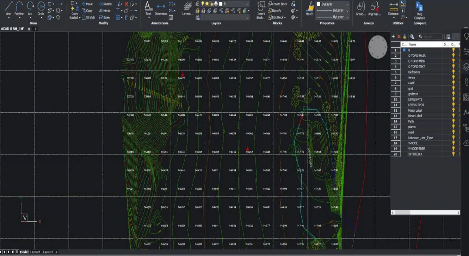
Feature and Levels Surveys
Used to help architects and builders with information of the subject site, the existing buildings, features and services including adjoining road reserves and adjoining properties.
Site Analysis Surveys
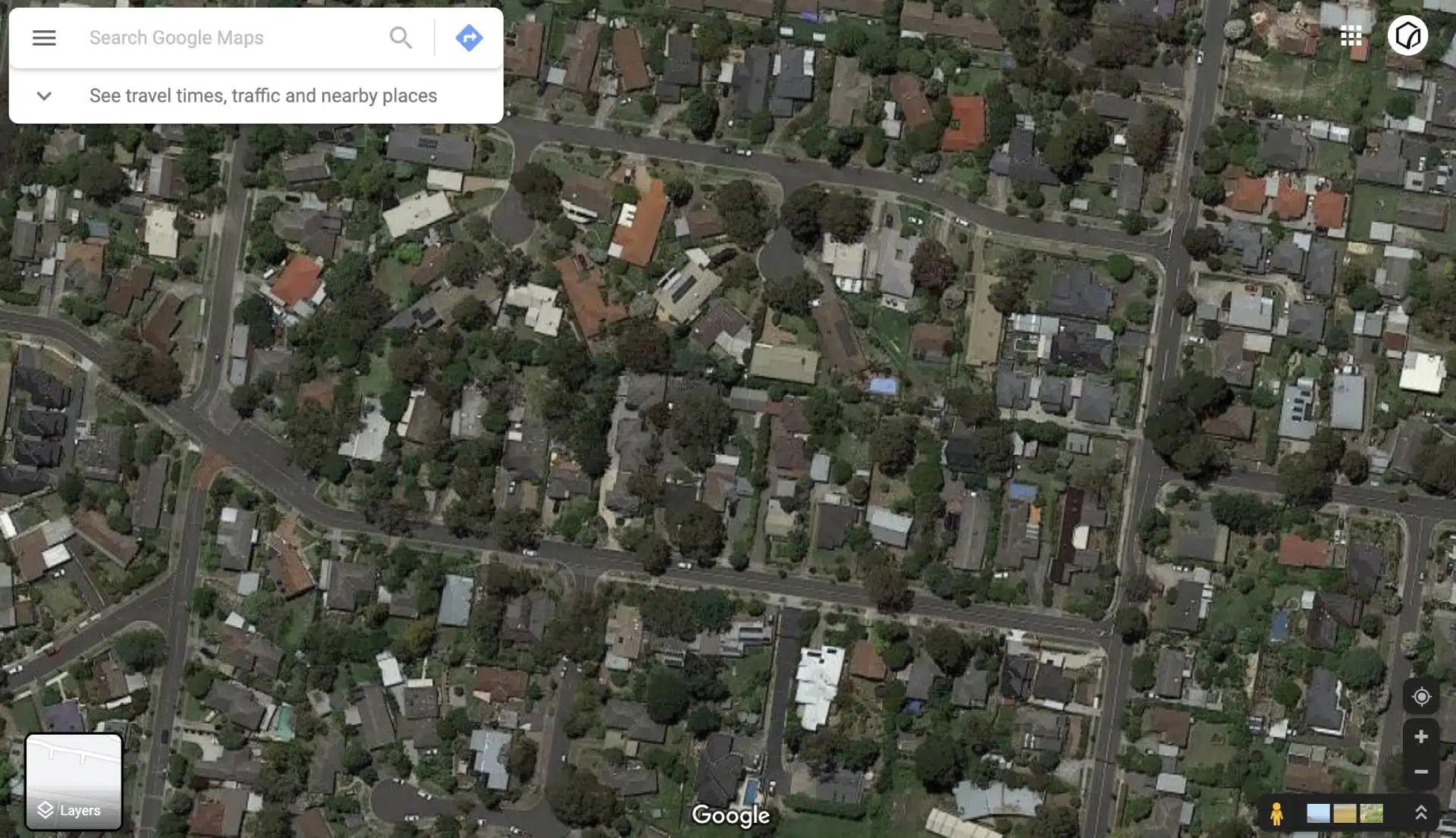
Used to capture the neighbourhood and additional areas surrounding the site usually to around 50m radius. Helps architects identify features to include in the building design and required by council for town planning and building applications.
Land Surveying Services in Hawthorn & Boroondara
As a trusted land surveying company in Hawthorn, Avian provides a full range of surveying and reality capture services designed to support planning, design, construction, and asset management across Hawthorn and the wider City of Boroondara.
Cadastral (Boundary) Surveys
Cadastral surveys define legal property boundaries and are essential for subdivisions, title re-establishment, fencing disputes, and property transactions. Our licensed land surveyors within Hawthorn ensure boundary information is accurate, compliant, and clearly documented.
Feature and Levels Surveys
A core land surveying service in Hawthorn, feature and levels surveys capture existing site conditions, including buildings, ground levels, trees, services, and adjoining infrastructure. These surveys are critical for architects and designers preparing planning or construction documentation.
Site Analysis Surveys
Site analysis surveys extend beyond the subject property to capture surrounding context, typically within a 50-metre radius. This is particularly important in Hawthorn, where neighbouring buildings, heritage streetscapes, and council requirements strongly influence design outcomes.
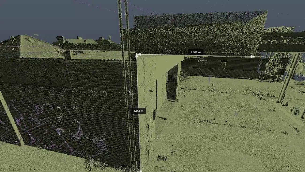
Building, Point Cloud & As-Built Surveys
For renovations, refurbishments, and leasing, Avian provides detailed interior and exterior point cloud surveys. These are often paired with 3D laser scanning to deliver millimetre-accurate floor plans, elevations, and 3D models.
Dilapidation Surveys
Our dilapidation surveys document existing structural and cosmetic conditions before and after construction. This protects property owners, builders, and asset managers by providing an independent visual record should disputes arise.
Engineering & Monitoring Surveys
We support civil and construction projects with set-out, deformation monitoring, earthworks calculations, and infrastructure surveys. These services are commonly enhanced using 3D laser scanning, delivering richer datasets in less time.
Drone Surveying & Mapping
As a certified drone surveying company, Avian captures aerial imagery, orthophotos, and volumetric data for sites that are difficult to access from ground level. Drone data is often integrated with terrestrial surveys for a complete site model.

Local Challenges of Land Surveying in Hawthorn
Land surveying in Hawthorn presents unique challenges compared to outer Melbourne suburbs. Many sites are located along narrow streets with limited parking and constant vehicle movement, particularly near Glenferrie Road, Auburn Road, and the Hawthorn Bridge corridor.
Heritage overlays are common, requiring precise documentation of existing conditions. Mature trees, fencing, and tightly spaced buildings can obstruct traditional survey lines, making advanced techniques invaluable.
Busy pedestrian areas near Swinburne University and tram corridors also mean survey work must be carefully planned to ensure public safety while maintaining efficiency. Avian’s experienced field teams are trained to work safely in these environments, often scheduling works during off-peak periods to minimise disruption.


Technology-Driven Land Surveying in Hawthorn
Avian’s approach to land surveying service in Hawthorn blends traditional surveying expertise with advanced digital capture technologies. This ensures faster turnaround, higher accuracy, and better outcomes for clients.
Our capabilities include:
- 3D laser scanning to capture millions of data points with millimetre accuracy
- 3D laser scanning for architecture, engineering, construction workflows, supporting BIM, CAD, and asset management
- Certified drone operations from an experienced drone surveying company
- Seamless integration with CAD, Revit, Civil 3D, and GIS platforms
For Hawthorn projects involving renovations, heritage buildings, or complex sites, this technology provides a level of detail that traditional methods alone cannot achieve.

")
Title Re-establishment Surveys

Feature and Levels Surveys

Large Land Area Surveys
Cost and Process of Land Surveying in Hawthorn
Every Hawthorn site is different. Before commencing works, our Hawthorn land surveying company takes the time to understand your objectives and site constraints.
We typically assess:
- The purpose of the survey (planning, construction, subdivision, or compliance)
- Site location, access limitations, and surrounding conditions
- Required outputs and file formats
- Timeframes and approval requirements
Once defined, we provide a clear scope, competitive pricing, and a realistic delivery schedule. This transparent process ensures no surprises and a smooth project experience.
Why choose Avian?
Licensed & Experienced Professionals
All our land surveyors in Hawthorn are qualified, licensed, and experienced in complex urban environments.
Future-Ready
Deliverables
Our surveys are compatible with modern design and construction workflows, from 2D plans to 3D models.
Comprehensive
Insurance Coverage
We carry $28M public liability insurance, professional indemnity cover, and full WorkCover compliance.
Local Knowledge
As a specialist land surveying service in Hawthorn, we understand council expectations, heritage constraints, and local development patterns.
Safety-First Approach
Our teams hold valid construction and rail industry credentials, ensuring safe operations on active sites.
General Guidelines for Drone Surveying in Hawthorn
Drone operations in Hawthorn must comply with the Civil Aviation Safety Authority (CASA) regulations. As responsible drone surveyors, Avian adheres strictly to these requirements.
Key guidelines include:
- Flights conducted below 120 metres and within visual line of sight
- No flying over people, busy roads, or active public areas
- Operations scheduled during low-traffic periods where possible
- Council permissions obtained for flights in public spaces
These measures ensure safety, compliance, and minimal disruption to residents and businesses.
City of Boroondara Council Information
Hawthorn falls under the jurisdiction of the City of Boroondara. Council approval is often required for developments, subdivisions, or planning-related land surveying Hawthorn projects.
Address: 8 Inglesby Road, Camberwell VIC 3124
Phone: (03) 9278 4444
Website: www.boroondara.vic.gov.au
Engaging early with council requirements can significantly streamline your project timeline.
Ready to Start Your Hawthorn Surveying Project?
Whether you’re planning a renovation, managing a construction site, or verifying property boundaries, Avian is your trusted land surveyor in Hawthorn.
With advanced technology, experienced professionals, and deep local knowledge, our land surveying company within Hawthorn delivers clarity, accuracy, and confidence at every stage.
Contact Avian today to discuss your project and see how our land surveying service in Hawthorn can support better decisions from the ground up.
Our Land Surveying Projects
Popular Melbourne Metropolitan Area and Inner Suburbs We Cover
| land surveyor ballarat | land surveyor daylesford | land surveyor phillip island | land surveyor pakenham |
| land surveyor bendigo | land surveyor melton | land surveyor colac | land surveyor mornington |
| land surveyor ballarat | land surveyor kyneton | land surveyor castlemaine | land surveyor greensborough |
| land surveyor werribee | land surveyor rockbank | land surveyor shepparton | land surveyor bacchus marsh |
Contact the Avian today to discuss your land surveying project
FAQs About Land Surveying in Hawthorn
The cost of land surveying in Hawthorn typically starts from around $1,400, depending on property size, site access, and survey type. Factors such as heritage constraints, neighbouring buildings, and traffic management can influence pricing. Avian provides transparent quotes once we assess your site and project requirements.
We can provide a detailed and accurate cost estimate once we have an address to conduct some due diligence on the property. You can book a no obligation free consultation and tell us about your land surveying requirements.
Hawthorn presents unique challenges due to narrow streets, dense housing, heritage overlays, tram corridors, and high pedestrian activity, particularly near Glenferrie Road and Auburn Road. An experienced land surveyor in Hawthorn must carefully plan equipment placement and work around traffic and public spaces while maintaining precision and safety.
Common land surveying service Hawthorn requests include cadastral (boundary) surveys, feature and levels surveys, site analysis surveys, measured building surveys, and dilapidation surveys. Many projects also require integration with 3D laser scanning for architecture, engineering, and construction, especially for renovations or heritage buildings.
Yes. Any cadastral or boundary-related work must be completed by a licensed land surveyor across Hawthorn. Using a qualified professional ensures your survey is legally compliant and accepted by council, planners, and land authorities.
Our land surveying company in Hawthorn can typically attend sites within 24-48 hours of booking confirmation, depending on project scope and access requirements. Inner-city projects are prioritised to minimise delays to planning and construction timelines.
Other than that, we also advise builders to invest in topographical surveys, sub-division surveys, dilapidation and site analysis surveys to get more information of the property for design and planning purposes.
Yes. Avian regularly collaborates with architects, builders, and engineers across Hawthorn and Boroondara. Our land surveying service in Hawthorn delivers CAD-, Revit, and BIM-ready data that integrates seamlessly into design and construction workflows.