— Aerial Feature and Conture Survey · Melbourne, VIC

Drone Feature and Contour Survey

Drone feature and contour survey is fast, accurate aerial mapping for development sites, infrastructure projects, and large or inaccessible landholdings, delivering CAD-ready deliverables referenced to AHD.

Ready to scope your project?

CASA-Certified
RePL + ReOC Compliant
$20M Public Liability
5+ Yrs Surveyor Experience
01 — Overview

What is a drone feature survey?

A drone feature land survey is the systematic aerial capture of site features, contours, and ground levels using a UAV equipped with a high-resolution camera or LiDAR sensor.

The resulting imagery and point data are processed through photogrammetric software to generate orthophotos, digital terrain models, and CAD-ready feature plans referenced to AHD — datasets your design and engineering team can rely on immediately.

Sister service

Need a known parcel measured on the ground? Our land surveys complement aerial capture for high-precision, small-site work.

02 — Core deliverables

From raw imagery to survey-grade data

Every drone feature survey is built around three technical foundations that turn aerial imagery into an AHD-referenced, survey-grade dataset.

photogrammetry-method

Photogrammetry

3D from 2D imagery

Overlapping aerial photographs are processed to derive precise three-dimensional measurements across the entire site.

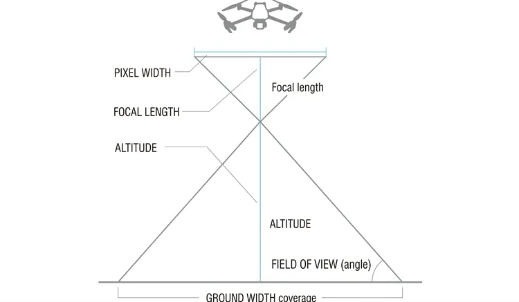
Ground sample distance (GSD)

GSD

Ground sample distance

The real-world distance represented by one image pixel — typically 10–25mm at an 80m flight altitude.

Ground control points (GCPs)

GCPs

Ground control points

Surveyed reference targets used to georeference the aerial dataset and lock it to real-world coordinates.

Standard deliverables

GeoTIFF

Orthophoto

A geometrically corrected aerial image with uniform scale.

DSM

Digital Surface Model

Elevation grid including buildings and vegetation.

DTM

Digital Terrain Model

Bare-earth elevation grid with vegetation removed.

Contours

Contour Plan

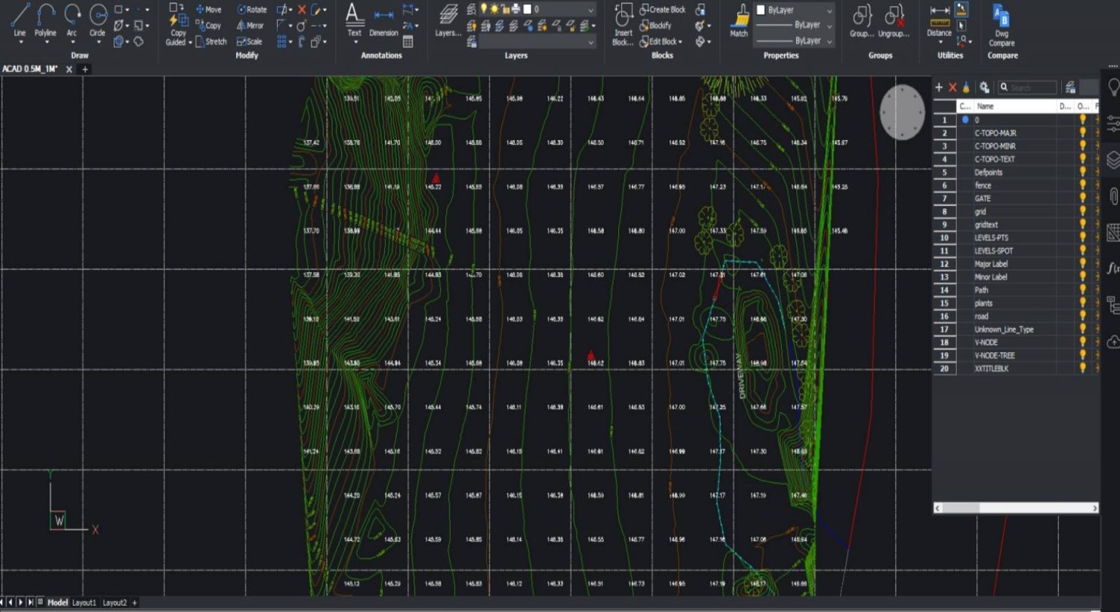
Vector contours at 0.25m, 0.5m, or 1.0m intervals.

DWG

Feature Plan

Annotated CAD plan of buildings, services, fences, and vegetation.

03 — Workflow

How Avian conducts a survey

An end-to-end, five-stage process managed by a licensed pilot and experienced survey team — designed to minimise site disruption and deliver certified, project-ready data on time.

1
1–4 hours

Pre-Flight Planning

Site review, airspace check, CASA notifications, and flight altitude and overlap calculation before any equipment reaches the ground.

2
2–4 hours

GCP Placement

Five to twelve ground control points placed and surveyed with GNSS RTK to ±20mm, with density set by site area and accuracy tier.
3
1–3 hours

UAV Flight

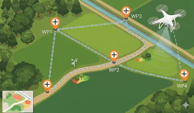
A RePL-licensed pilot flies an autonomous mission capturing 150–300 images per hectare at locked, consistent overlap and GSD.

4
4–24 hours

Processing

Structure-from-Motion processing in Pix4D, Metashape, or RealityCapture produces a dense point cloud, mesh, and orthomosaic.
5
2–7 days

Deliverables

Final outputs in DWG, GeoTIFF, LAS, OBJ, and FBX — certified by a project surveyor, most within five business days.
04 — Equipment & accuracy

A dual-platform fleet

We select the right sensor system based on site conditions, vegetation density, and accuracy requirements. All hardware is maintained to manufacturer specifications and calibrated prior to deployment.

RGB Photogrammetry Drone

RGB Photogrammetry Drones

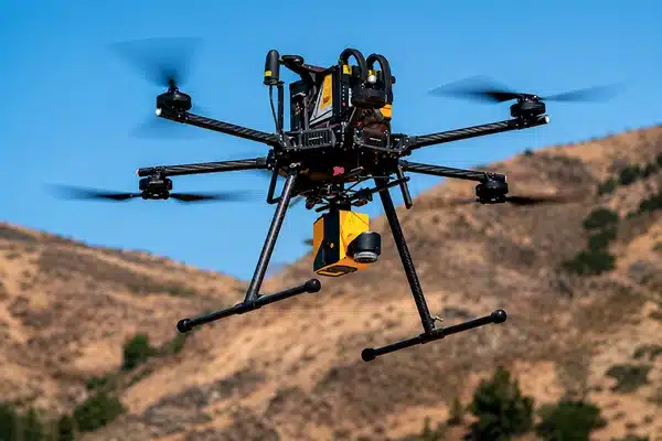
High-resolution RGB cameras purpose-built for aerial mapping. At standard flight altitudes they deliver a GSD of 10–25mm — sufficient for most commercial development, civil, and infrastructure work requiring plan and contour output at 1:500 or better.

LiDAR-Equipped UAVs

LiDAR-Equipped UAVs

For vegetated, forested, or complex terrain, LiDAR emits and records millions of laser pulses per second. Unlike photogrammetry, it penetrates vegetation canopies to return accurate ground points where imagery alone would fail.

Achievable accuracy by method

MethodAchievable accuracyCost mult.Best for
RTK + Dense GCPs (8–12)±20mm horizontal, ±30mm vertical1.5×Engineering design, BIM-grade output
Standard GCPs (5–7)±30–50mm1.0×Most commercial projects
No GCPs (RTK-only)±100mm or worse0.7×Reconnaissance only
05 — Applications

When to use a drone survey

A drone feature land survey becomes the logical choice when ground-based methods are impractical, too slow, or unable to capture the full spatial extent of a site.

01

Property Development & Feasibility

For sites of 5 hectares or more, a drone survey delivers a complete spatial picture in a fraction of the time of traditional ground methods — topography, vegetation, structures, services, and adjoining boundaries.

Common deliverables

  • Site context plan
  • Contour map
  • Volume calculation
  • 3D model
02

Sloping or Vegetated Sites

Where steep terrain or dense vegetation make ground-crew deployment slow and costly, LiDAR-equipped UAVs penetrate up to 80% of vegetation for reliable ground returns and accurate terrain models.

Common scenarios

  • Forested rural blocks
  • Riparian zones
  • Steep hillside developments
03

Restricted Ground Access

When site conditions pose a safety risk or operational disruption, aerial capture eliminates the need for personnel on the ground entirely.

Common scenarios

  • Live mining pit
  • Operational rail corridor
  • Contaminated land
  • Active construction zone
06 — Pricing

Drone feature survey cost in Melbourne

A drone feature contour survey starts at $3,500 for sites under 5 hectares using standard photogrammetry. Final cost is driven by site area, terrain complexity, accuracy tier, deliverable formats, and turnaround urgency.

Site sizePhotogrammetryLiDARTurnaround
Under 5 ha$3,500–$5,500$6,500–$9,0005–7 days
5–20 ha$5,500–$10,000$9,000–$16,0005–10 days
20–50 ha$10,000–$18,000$16,000–$28,0007–12 days
50–100 ha$18,000–$30,000$28,000–$45,00010–15 days
Over 100 ha$30,000+$45,000+Custom quote

* Pricing valid as of January 2026. Updated quarterly. Project-specific quotes within 24 hours.

07 — Compliance

CASA, RePL & ReOC compliant

All Avian drone operations are conducted in full compliance with Australian aviation law. CASA oversees civil aviation safety, including unmanned aircraft systems, regulated under Part 101 of the Civil Aviation Safety Regulations 1998 and the Part 101 Manual of Standards.

Operator Type

ReOC
Pilot Licence
RePL
Regulatory Framework
Part 101
Public Liability
$20M
Professional Indemnity
$1M

Pilot Experience

5+ years
08 — Comparison

Drone vs ground-based survey

The right method depends on site scale, the accuracy specification in your brief, and how the data will be used downstream.

AspectDrone feature surveyGround-based feature & level
MethodUAV photogrammetry or LiDARTotal station + GNSS
Site scale5+ hectares idealUnder 1 hectare ideal
Accuracy±20–50mm across hectares±5mm on individual points
Cost (typical)$3,500–$15,000+$2,000–$4,500
Turnaround5–10 days3–7 days
Common surveysDevelopment, feasibility, large sitesCouncil permits, residential design
09 — Sectors

Industries we serve

We deliver drone feature and contour surveys across the full spectrum of land development and asset management — and we understand the downstream workflows each sector relies on.

01

Property Development

Site feasibility, due diligence, and DA submission support — the topographic and contextual data development managers need to progress through approvals with confidence.

02

Civil Engineering

AHD-referenced terrain data and feature plans formatted for direct import into Civil 3D, 12D, and HECS design environments for roads, drainage, and earthworks.
03

Construction

Volume calculations, progress monitoring, and as-built capture — track cut-and-fill, verify earthwork compliance, and document conditions at key milestones.
04

Mining & Resources

Stockpile volumetrics, pit surveys, and haul-road mapping — survey-grade data without ground-crew entry into active or contaminated areas.

05

Land Management

Environmental baseline surveys, riparian mapping, and vegetation classification across large, remote, or ecologically sensitive landholdings using LiDAR.

10 — Why Avian

Why choose Avian

$20M

Public Liability Insurance

Satisfying the insurance requirements of major construction contracts, government procurement, and private development mandates.

100%

CASA-Certified Pilots

Every pilot on the Avian roster holds a current RePL and operates under the company ReOC.
2-in-1

Photogrammetry + LiDAR

We deploy both RGB photogrammetry and LiDAR UAVs, selecting the optimal sensor based on site conditions rather than availability.
5+ yrs

Pilot Experience

Our minimum pilot experience threshold is five years of commercial UAV operations.
24 hr

Quote Turnaround

Submit your brief and receive a project-specific fee proposal within one business day.
6

CAD Format Outputs

DWG, RVT, GeoTIFF, LAS, OBJ, and FBX delivered as standard — full compatibility across AEC design platforms.
Property2_ImageB_v01 (1)
Title Re-establishment Surveys
Group 9590@2x
Feature and Levels Surveys
contours
Large Land Area Surveys

Our Drone Feature and Contour Survey Projects in Melbourne

Contact the Avian today to discuss your land surveying project

FAQs about Drone Feature and Contour Survey

We have answered some common questions that AEC clients have about our land surveying services in Melbourne.

A drone feature survey in Melbourne starts at $3,500 for photogrammetry on sites under five hectares. LiDAR-equipped surveys start at $6,500 for the same site size. Final cost scales with site area, accuracy tier, terrain complexity, and required turnaround. Avian provides project-specific quotes within 24 hours.

With RTK GNSS and a dense GCP network (8–12 points), Avian achieves ±20mm horizontal and ±30mm vertical accuracy – sufficient for engineering design and BIM-grade output. Standard GCP configurations deliver ±30–50mm, which covers the majority of commercial development and civil applications. RTK-only surveys without GCPs are suitable only for reconnaissance, with accuracy typically ±100mm or worse.

Not always, but every survey requires a pre-flight airspace check regardless of approval status. Surveys in controlled airspace, near aerodromes, or above standard altitude limits require formal CASA authorisation via the AAN system. Avian manages all regulatory notifications and approvals as part of every project scope.

Use a drone feature and contour survey when your site is five hectares or larger, has significant vegetation or steep terrain, involves restricted ground access, or requires rapid data capture across a broad area. For smaller sites requiring millimetre point accuracy, our ground-based feature and level survey service is the better fit.

Standard deliverables include an orthophoto (GeoTIFF), Digital Surface Model, Digital Terrain Model, vector contour plan, and annotated CAD feature plan, delivered in DWG, GeoTIFF, LAS, OBJ, and FBX formats. All outputs are certified by a project surveyor and referenced to AHD.