Category: Drone Surveying
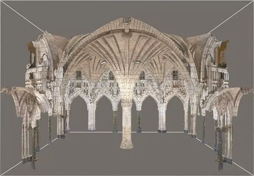
Laser Scanning for Heritage Preservation: Accurate Documentation of Historic Sites
November 28th, 2025 by avianDiscover how Avian uses point clouds to streamline project timelines, helping teams achieve smoother workflows and fewer costly delays.
Read More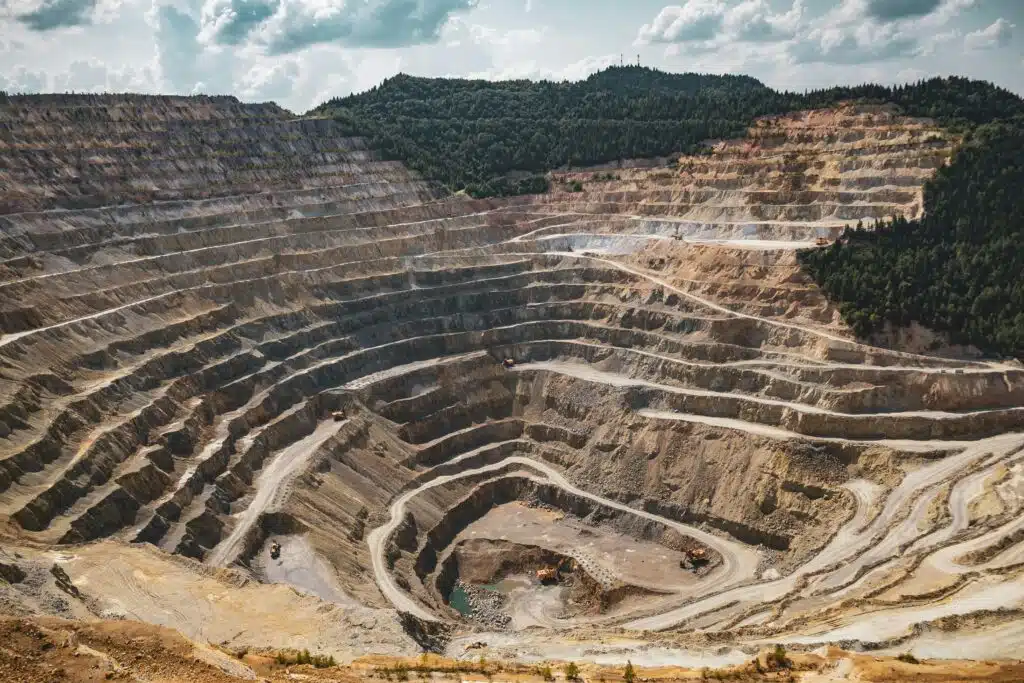
3D Laser Scanning for Mining: Accurate, Efficient, and Safer Surveys
November 25th, 2025 by avianDiscover how Avian uses point clouds to streamline project timelines, helping teams achieve smoother workflows and fewer costly delays.
Read More
How 3D Laser Scanning Streamlines Airport Terminal Renovation Projects
November 25th, 2025 by avianDiscover the top 10 uses for point cloud surveys, from heritage preservation to infrastructure projects, and explore the key benefits of this 3D technology.
Read More
Top 10 Uses for Point Cloud Surveys
September 30th, 2025 by avianDiscover the top 10 uses for point cloud surveys, from heritage preservation to infrastructure projects, and explore the key benefits of this 3D technology.
Read More
How Do Architects Use Point Clouds to Streamline Project Timelines?
September 30th, 2025 by avianDiscover how Avian uses point clouds to streamline project timelines, helping teams achieve smoother workflows and fewer costly delays.
Read More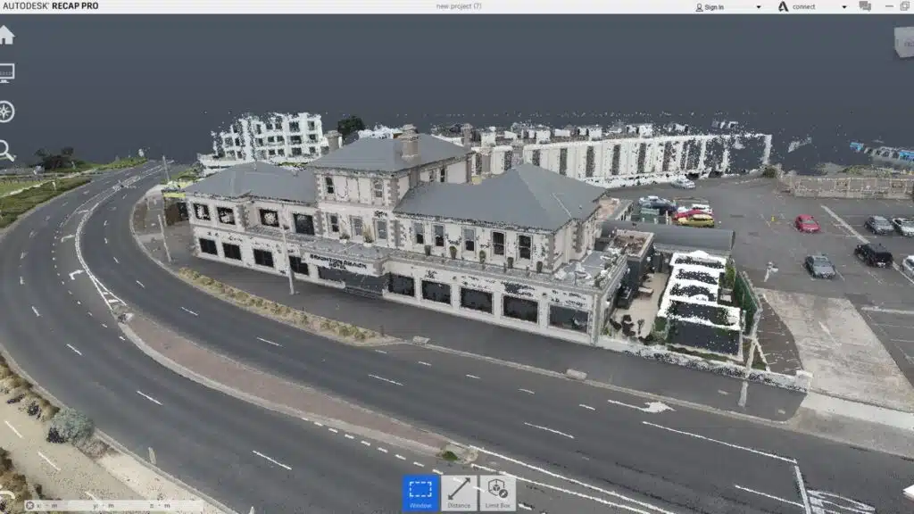
5 Uses for Point Clouds in Engineering Projects
September 30th, 2025 by avianDiscover 5 ways point clouds support engineering projects with accurate data, BIM integration, retrofitting, collaboration, and cost savings.
Read More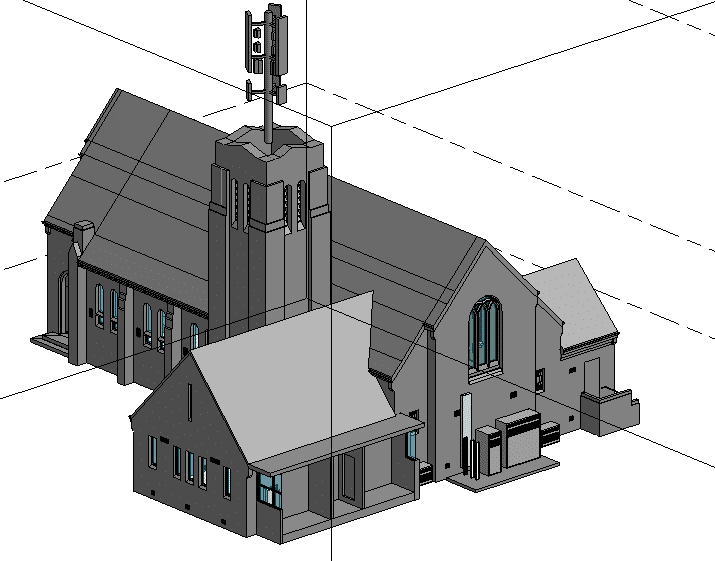
How Does 3D Laser Scanning Support Refurbishment and Fitout Projects?
September 30th, 2025 by avianCurious about 3D laser scanning in construction? Find out how it delivers accurate site data, faster timelines, and fewer costly mistakes.
Read More
Top Tips for Hiring Aerial Drone Photography in Melbourne
June 27th, 2025 by avianIn Melbourne’s fast-paced architecture, engineering and construction (AEC) sectors, aerial drone photography is a game-changer. From capturing sweeping site overviews to inspecting hard-to-reach structures, the insights gleaned from above have rapidly transformed how professionals document progress, verify data and market their work. But with so many providers vying for attention, […]
Read More
Top Uses of Drone Mapping in Melbourne’s Urban Projects
June 27th, 2025 by avianIn recent years, drone technology has revolutionised the way we capture and interpret the world around us. No longer confined to aerial photography, today’s unmanned aerial vehicles (UAVs) deliver centimetre-accurate maps and 3D models that inform critical decisions in urban planning and infrastructure development. In Melbourne, where a delicate balance […]
Read More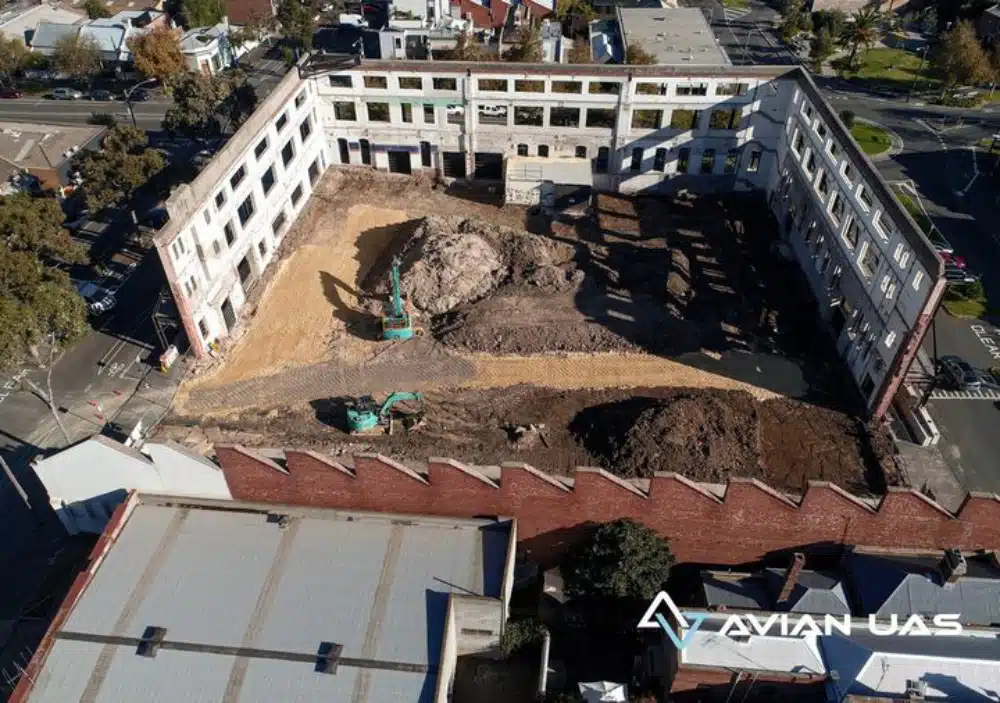
Construction and Building Set out survey Costing Guide for Melbourne
December 5th, 2022 by avianA construction set out survey gives builders, architects and site engineers the much-needed clarity and guidance on the ground to commence turning their designs into reality. Setout surveys are reference points for building and construction professionals to commence constructing a building as per the architectural plans/drawings. Set out surveys are […]
Read More