Accurate 3D Visualisation & Spatial Measurements With Drone Photogrammetry
At Avian, we offer professional drone photogrammetry in Melbourne to architects and engineers. Our team generate as-built 3D models of the complete building envelope and any built or natural asset such as roads, rail lines, towers, bridges, landscapes etc.
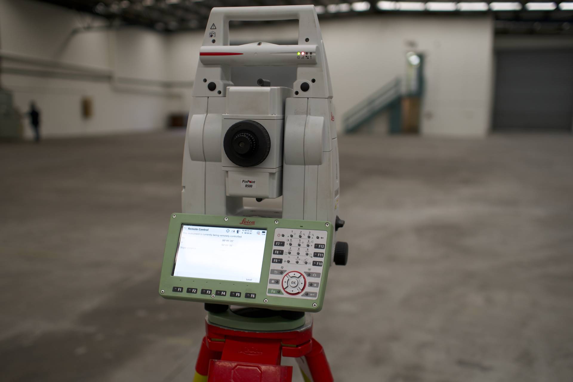
Our team is involved in every aspect of the data collection, production, processing and presentation of geospatial data. We use high tech 3D laser scanners, LiDAR, drones and specialist DSLR cameras to realistically capture the assets from all angles.
Our core photogrammetry services in Melbourne involve:
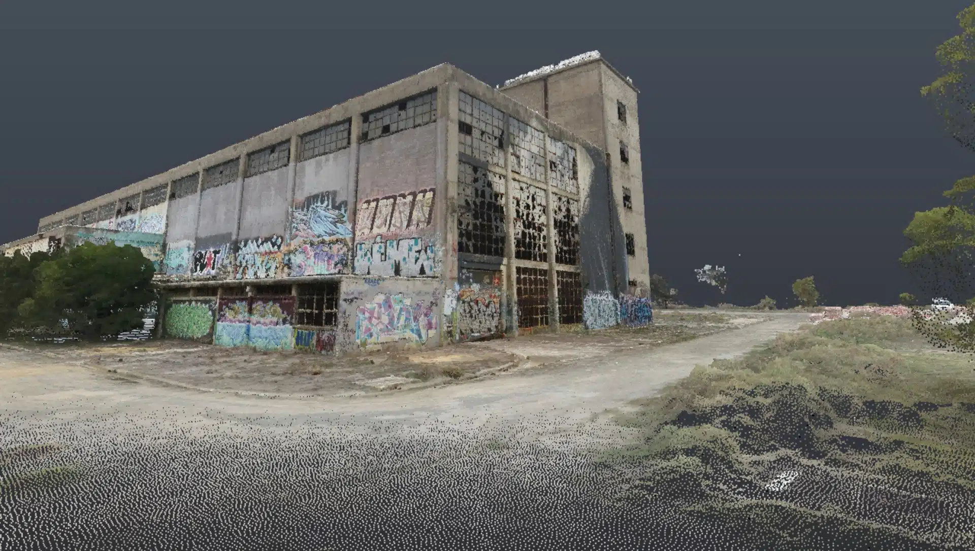
3D Drone Photogrammetry Models that Make You Go WOW!
We use powerful reality capture methods and precision survey equipment for accurate model creation, site inspection, site analysis and surveying.
Here are some tools we use to ensure accuracy with our photogrammetry solutions:
Pins: Choose from a variety of pins, icons and geotags for photogrammetry models.
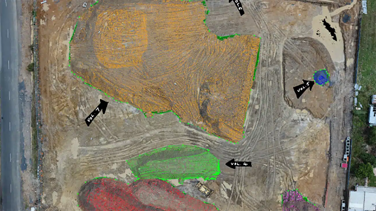
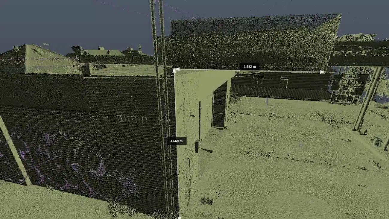
Lines: Aerial photogrammetry allows you to measure distances, heights, volumes and elevations in just a click of the mouse on the desktop, quickly and easily
Polygons: Aerial photogrammetry to measure site volume, area, tilt, and azimuth in a matter of minutes.
Linework: easily extract key site information from our photogrammetry maps and models for immediate site context and design.
All the 3D models and photogrammetry insights are annotated and geolocated. This makes it easier to identify the site location and import into spatial tools.
Lifelike 3D Models
Capture highly detailed images for photorealistic maps and models and create lifelike 3D models using advanced photogrammetry processing methods.
Informative models
We offer clients accurate and comprehensive 2D Maps and 3D models, enabling detailed site analysis based on accurate reconstruction of existing conditions.
Accessible Images
The 3D models and maps are easy to access and directly streamed to your system.
Easily shareable date
Our photogrammetry solutions are shareable across multiple phatforms. And we use industry leading photogrammetry software for compatitble file generation.
No return visits
Deploy our photogrammetry services in Metro Melbourne within hours, including the suburbs and to rural Victoria within days. Avoid repeat site visits to gather site context and information from your desktop.
Powerful. Precise. Picture Perfect !
What sets Avian apart from other drone photogrammetry in Melbourne is our dedication to deliver best quality results. Our land surveyors can achieve extremely high levels of spatial accuracy using calibrated survey quipment and specialist cameras.
We carefully position the precise focal length, principal point coordinates, and various forms of lens distortion to identify systematic distortions and correct them as required.
Collect, Collate and Classify Accessible 3D Models and Drone Images
Avian is a land surveying company that helps architects, engineers and construction (AEC) professionals gather real-time project updates and site information. Not only that, we also help clients visualise existing conditions and convert to accurate 2D terrain maps and 3D models.