Local Land Surveyors in Footscray
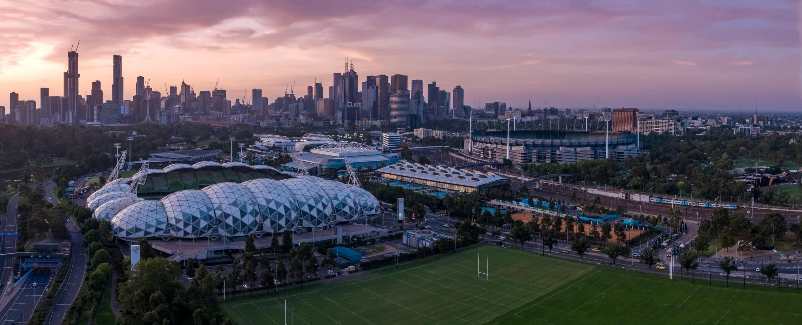
Footscray is one of Melbourne’s most diverse and fast-evolving inner-west suburbs. Known for its multicultural food scene along Barkly Street, the historic Footscray Market, riverfront paths beside the Maribyrnong River, and a growing mix of apartments, warehouses, and infrastructure projects, Footscray presents a complex environment for development and construction.
For property owners, architects, builders, and developers, finding reliable land surveying in Footscray is critical. Tight sites, ageing infrastructure, rail corridors, and constant pedestrian and vehicle traffic make accuracy and planning essential.
As an experienced land surveying company in Footscray, Avian delivers precise, efficient, and compliant surveying solutions tailored to the unique challenges of Melbourne’s inner west. We combine traditional cadastral expertise with advanced technology such as 3D laser scanning, drone mapping, and geospatial analysis to support residential, commercial, and infrastructure projects across Footscray.
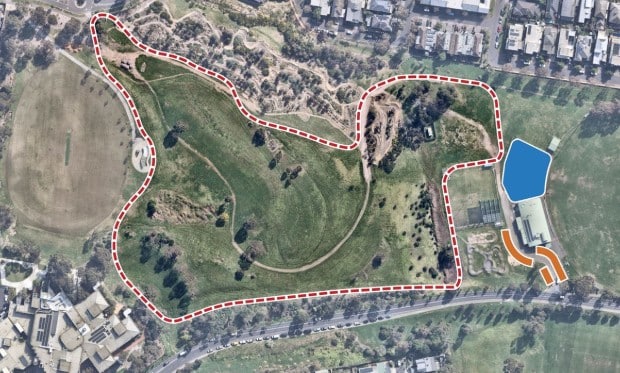
Cadastral Surveys
Used to define and amend property boundaries, resolve issues concerning land titles, and subdivision of existing land titles.
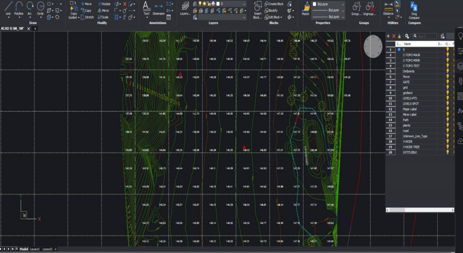
Feature and Levels Surveys
Used to help architects and builders with information of the subject site, the existing buildings, features and services including adjoining road reserves and adjoining properties.
Site Analysis Surveys
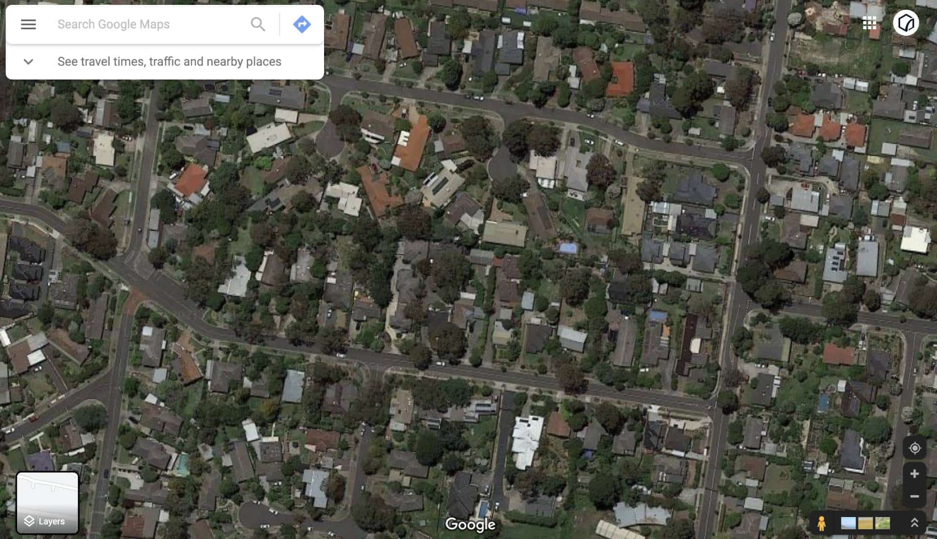
Used to capture the neighbourhood and additional areas surrounding the site usually to around 50m radius. Helps architects identify features to include in the building design and required by council for town planning and building applications.
Comprehensive Land Surveying Services in Footscray
Fast and Reliable | Footscray | Qualified Land Surveyors
Avian provides a full-suite land surveying service Footscray clients can rely on, from early planning through construction and asset management.
Cadastral Surveys
Legal boundary definition, re-establishment surveys, subdivisions, and title resolution completed by licensed professionals.
Feature and Levels Surveys
Capture of existing site features, contours, services, and surface levels for architectural design and planning approval.
Site Analysis Surveys
Contextual data covering neighbouring properties, streetscapes, and surrounding infrastructure to support town planning applications.
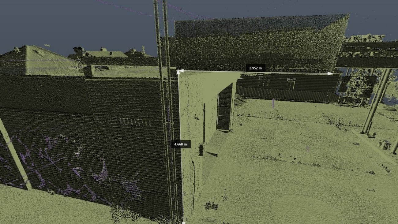
Point Cloud & As-Built Surveys
Detailed internal and external measurements for renovations, leasing, refurbishments, BIM integration, and design documentation.
Dilapidation Surveys
Condition reports recorded before and after construction to protect property owners and contractors from dispute.
Engineering & Monitoring Surveys
Set-out, deformation monitoring, earthworks measurement, and civil infrastructure mapping.
Lettable Area Surveys (NLA / GLA)
Surveys compliant with Property Council of Australia guidelines for leasing, valuation, and asset reporting.
Each land surveyor Footscray project is scoped carefully to ensure accuracy, efficiency, and compliance with local regulations.

Local Challenges of Land Surveying in Footscray
Footscray presents distinct challenges that require local knowledge and technical adaptability:
- Busy arterial roads, such as Geelong Road and Footscray Road, limit safe equipment setup
- Rail corridors and freight lines require strict safety planning
- High-density developments demand tight survey tolerances
- Older industrial buildings often lack reliable documentation
- Pedestrian-heavy areas around markets and retail strips require minimal disruption
Our Footscray land surveying team plans surveys around traffic flow, rail schedules, and access constraints, often working during off-peak hours to maintain safety and efficiency. This local experience ensures accurate outcomes without unnecessary delays.

Advanced Surveying Technology for Footscray Projects
Avian’s surveying work in Footscray is enhanced by industry-leading digital tools:
- 3D laser scanning for capturing millions of accurate data points in minutes
- 3D laser scanning for architecture, engineering, construction, enabling BIM-ready datasets
- Integration with CAD, Revit, Civil 3D, MicroStation, and GIS platforms
- Support from our certified drone surveying company for aerial data capture
These technologies allow our Footscray land surveying company clients to move beyond flat plans and gain intelligent datasets suitable for design coordination, approvals, and construction.
")
Title Re-establishment Surveys

Feature and Levels Surveys

Large Land Area Surveys
Cost and Process of Land Surveying in Footscray
Before commencing any land surveying service in Footscray, we assess:
- Survey purpose (planning, construction, subdivision, design)
- Site location, size, and access conditions
- Required deliverables and software formats
Based on this, we provide a transparent quote and clear timeframe. Our process is efficient, with most Footscray sites attended within 24 to 48 hours of confirmation.
Why choose Avian?
Licensed & Experienced Team
Qualified surveyors with extensive inner-city experience
Future-Ready Outputs
CAD, BIM, and GIS-compatible data
Fully Insured
$28M public liability, professional indemnity, and WorkCover
Enhanced Context
2D plans, 3D models, virtual tours, and photorealistic outputs
Safety-Focused
White Cards, rail safety training, and active-site protocols
General Guidelines for Drone Surveying in Footscray
When operating as a drone surveying company in Footscray, Avian complies fully with CASA regulations and local authority requirements.
Key guidelines include:
- Flights below 120m and within visual line of sight
- No flights directly over people, traffic, or rail corridors
- Operations scheduled during low-activity periods
- Council and landowner approvals obtained prior to flight
All drone operations are conducted by licensed pilots with risk assessments completed for every site.
Maribyrnong City Council – Key Information
Footscray is governed by Maribyrnong City Council.
- Address: 61 Buckley Street, Footscray VIC 3011
- Phone: (03) 9688 0200
- Website: www.maribyrnong.vic.gov.au
For developments or projects requiring planning permits, early council engagement is strongly recommended.
Precision-Driven Land Surveying in Footscray
Modern surveying demands more than traditional tools. Avian integrates geospatial intelligence, 3D laser scanning, and aerial data to deliver:
- Faster planning approvals
- Reduced construction risk
- Improved coordination between disciplines
- Long-term monitoring for infrastructure and assets
Every land surveying Footscray project is designed to support better decision-making from day one.
Ready to Get Started?
Whether you’re planning a subdivision, preparing for construction, or need accurate site data, Avian is your trusted land surveyor Footscray partner.
Contact Avian today to request a quote or speak with an experienced surveyor about your Footscray project.
Our Land Surveying Projects
Popular Melbourne Metropolitan Area and Inner Suburbs We Cover
| land surveyor ballarat | land surveyor daylesford | land surveyor phillip island | land surveyor pakenham |
| land surveyor bendigo | land surveyor melton | land surveyor colac | land surveyor mornington |
| land surveyor ballarat | land surveyor kyneton | land surveyor castlemaine | land surveyor greensborough |
| land surveyor werribee | land surveyor rockbank | land surveyor shepparton | land surveyor bacchus marsh |
Contact the Avian today to discuss your land surveying project
FAQs About Land Surveying in Footscray
We have answered some common questions that AEC clients have about our land surveying services in Footscray.
Costs typically start from around $1,400, depending on site size, complexity, and access. A tailored quote is provided after assessment.
Dense development, rail corridors, traffic, and older buildings make precision and planning essential.
Yes. Our surveys integrate 3D laser scanning and aerial data for higher accuracy and efficiency.
Most Footscray sites can be attended within 24-48 hours of booking confirmation.
Yes. As a certified drone surveying company, Avian safely integrates aerial and spatial data for accurate terrain maps.