Highly Accurate and Reliable Land Surveying in Sydney
Superior range of land surveying in Sydney
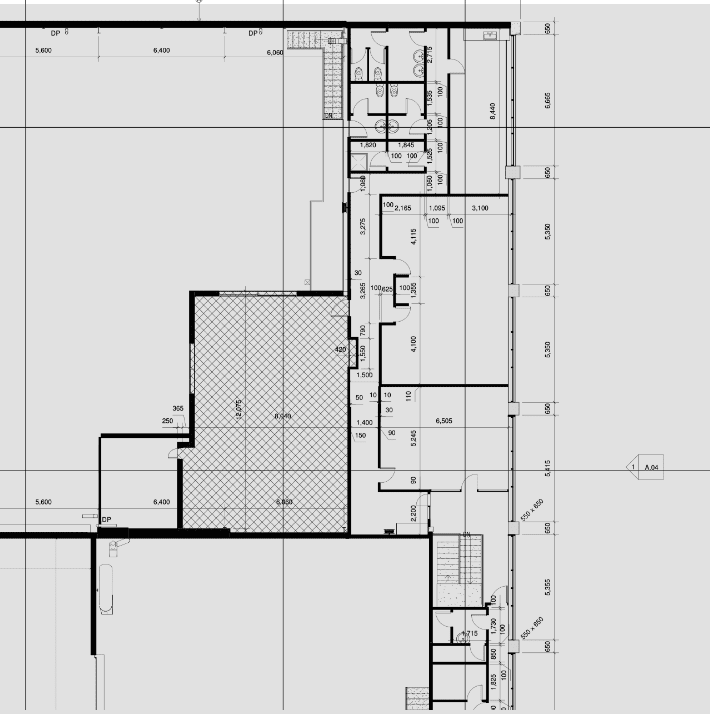
Civil Surveys
Used for construction surveys, civil engineering projects for roadways, bridges, buildings in construction, engineering and more.
Machine Guidance
Used for on-site asset management and inspecting machines, industrial equipment, heavy-duty designs and more.
Boundary Surveys
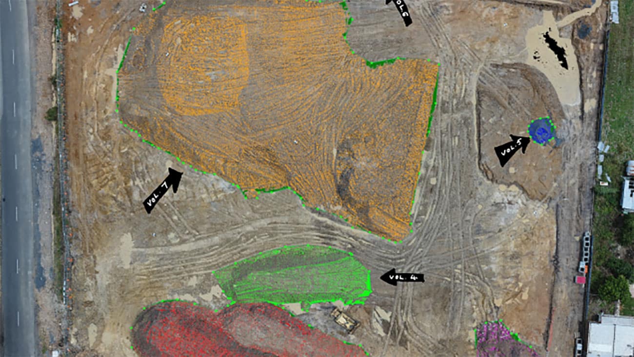
Used for volumetric measurements, fabrication checks, design checks, damage detection, 3D scanning etc.
Automated Drone Surveying To Measure Real-World Sites With Millimeter Accuracy
Precision Results | Highest Efficiency | Data Quality Assurance
With drones, you can capture high-resolution images spanning hundreds of acres in a matter of hours to inspect, measure and analyse afterwards on the desktop. These images can combined with photogrammetry, surveying and 3D laser scanning methods to produce high-accuracy, precise 2D maps and 3D models.
Typically, this would normally take weeks if done manually.
What’s more, drone surveying also helps you cut costs, track on-site productivity, monitor the progress of the project and do so much more.
Here are a few drone surveying services we offer:
- House and Building Surveys
- Industrial Land Surveys
- Detail & Level Surveys
- Boundary Surveys
- Identification Surveys
- Construction Surveys
- Lettable Area Surveys
- Strata & Community Title
- Deposited Plans
- Shadow Diagrams


Strata & Contour Surveys

Subdivisions

Residential Surveys
Cost of land surveying in Sydney
You can expect to pay anywhere between $250 – $450 p/hour for a licensed land surveyor in Sydney.
This doesn’t include any travel costs, drafting or processing services like drawing plans, models or maps of the datasets acquired whilst onsite.
Overall the scope and complexity of the job will determine the final quote as many locations require additional preparatory work, titles searching, document preparation or drafting plans/drawings.
Reach out to our team and we can get back to you with more specific cost estimates based on your unique needs.
Why choose Avian?
$20M public liability coverage
Includes WorkCover insurance and up to $1m professional indemnity.
100% Worksite Safety
Our teams all hold valid CWCs and RIWCs needed to safely work in construction and rail project worksites.
Qualified and Experienced Land Surveyors
Our surveyors are both Licensed and Qualified for Cadastral Land Surveying and have over 5 years industry experience.
3D digital visualisation
We don’t only provide you with 2D plans but give your project a unique touch with 360 virtual tours, 3D Models or Architectural Renders.
Easily integrated to existing workflows
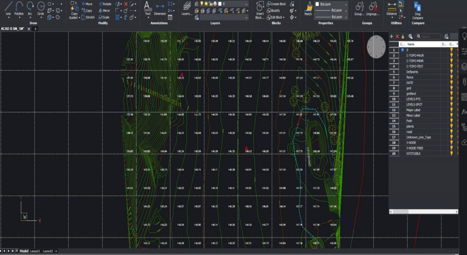
The data we provide is compatible with your existing workflow systems including applications like CAD, Revit, Civil3D and Microstation
Across Greater Sydney and NSW
Our land surveying services in greater Sydney are attended within hours or across NSW within days of a confirmed booking.
Committed to delivering accurate surveying results!
Land Surveying is a centuries-old profession that has evolved to incorporate leading-edge technologies to deliver faster and more accurate survey observations and measurements.
Our team uses a combination of geospatial, surveying and 3D laser scanning methods to capture onsite conditions faster, safer and smarter when compared to the traditional land surveying methods typically used across Sydney.
Here are a few key differences in the way we conduct surveys to ensure maximum value for our clients:
- Millions of data points captured onsite
- Faster onsite attendance and workflows
- More onsite data supplied to clients
- Short and long term monitoring of assets
- Both 2D and 3D outputs available from our surveys
- Increased site context means better planning
- Improved planning applications
- Increased client engagement from 3D visualisations
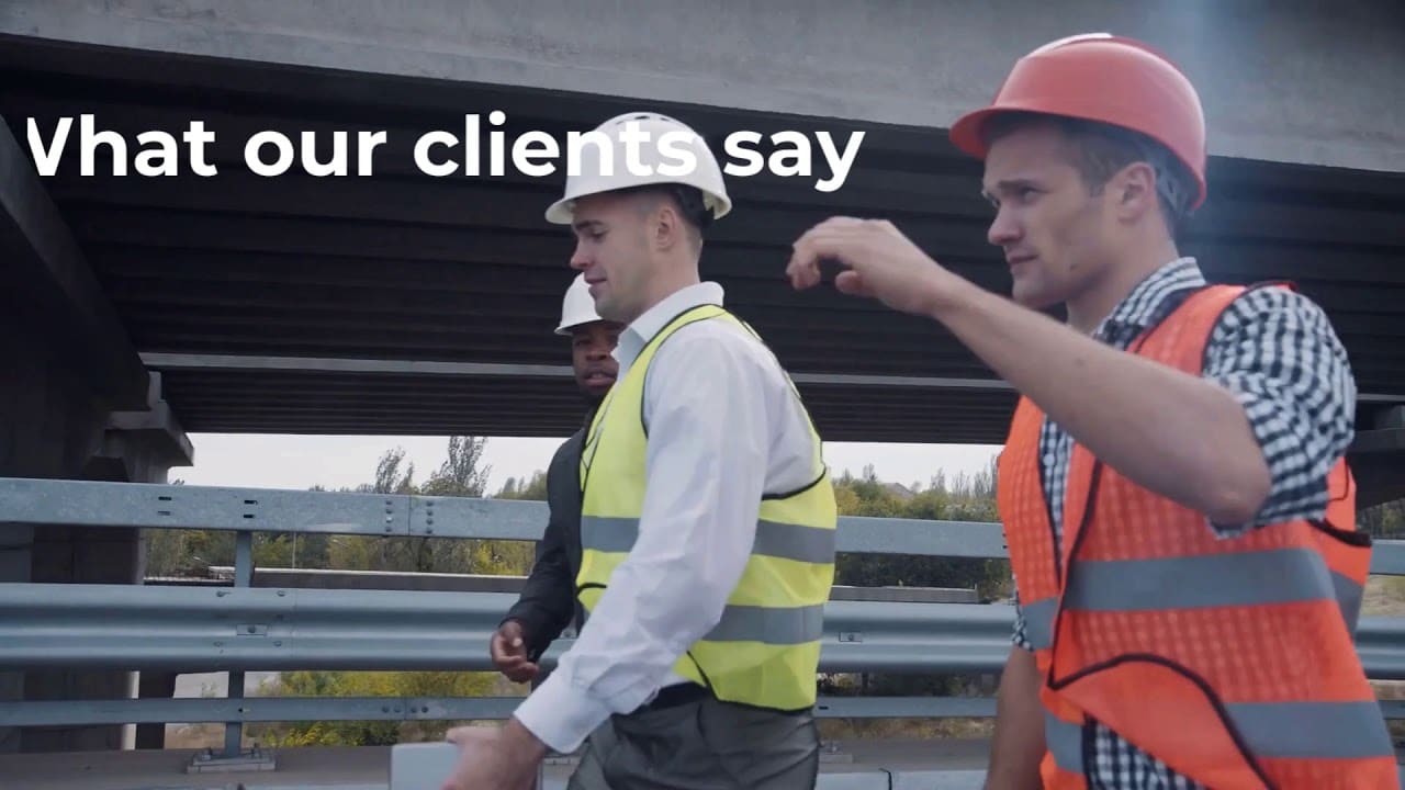
Our Land Surveying Projects
Contact the Avian today to discuss your land surveying project
FAQs about Land Surveying in Sydney
We have answered some common questions AEC clients have about land surveying in Sydney.
We have worked with hundreds of builders, contractors and project managers to have an in-depth idea of the ins and outs of construction site surveying.
We recommend you invest in an investigation or boundary survey, a detail or feature survey and a site analysis or contours survey to understand the terrain, define property boundaries, sort out land title related issues etc.
We need the client to provide us with a brief of the project and any supporting information (drawings/sketches) as to what surveys are required. We usually ask for these details from the client when they book a consultation.
We provide land surveying services across Greater Sydney and outer suburbs, including industrial sites, quarries and rural townships.
Yes, we are fully licensed by CASA to operate drones for land surveying services and have geospatial expertise in aerial surveying and terrain mapping.
The cost of land surveying in Sydney is entirely dependent on the size, shape and location of the property. Also what type of surveys are required.
You can check out our land surveying cost guide 2021 for more information.
At Avian, we have a team of land surveyors, drone operators and geospatial analysts who have worked with architects, project managers, builders etc. We hold ample experience in working on everything from road construction projects to stockpile management surveys using drones and LiDAR topographical surveys.
We don’t just conduct land surveying, we also help clients visualise data by creating 3D models and sitemaps using photogrammetry and laser scanning. This sets us apart from the other land surveyors in Sydney as we support our clients projects with sales, marketing and 3D visualisations.
Yes, at Avian we have a team of experienced laser scanner technicians and a 3D modelling team that create 3D Revit models, CAD models and digital terrain models.