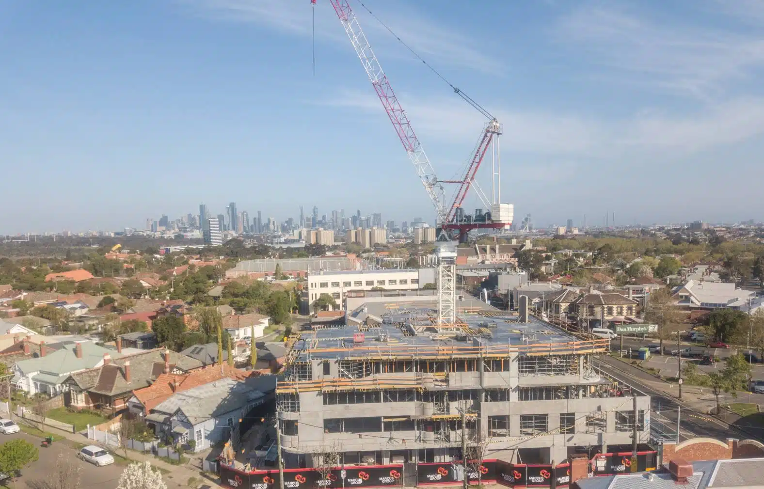
Site visualisation and topographical models are an important tool for project managers, site supervisors and engineers to understand the status and issues of any construction project.
Engineers need site data to meticulously design important features like drainage, roads, paths and signalling. Constructors need data from topographical or contour surveys to ensure everything is being built according to plan and stakeholders use terrain maps and models for presentations, construction updates as a reliable source to track the project’s progress and success.
Whatever your role in the project, you cannot deny the importance of construction sitemap and model in the overall value chain. The question therefore arises – how are you using (or not using) drones for construction inspection?
Table of Contents
Our Project Portfolio
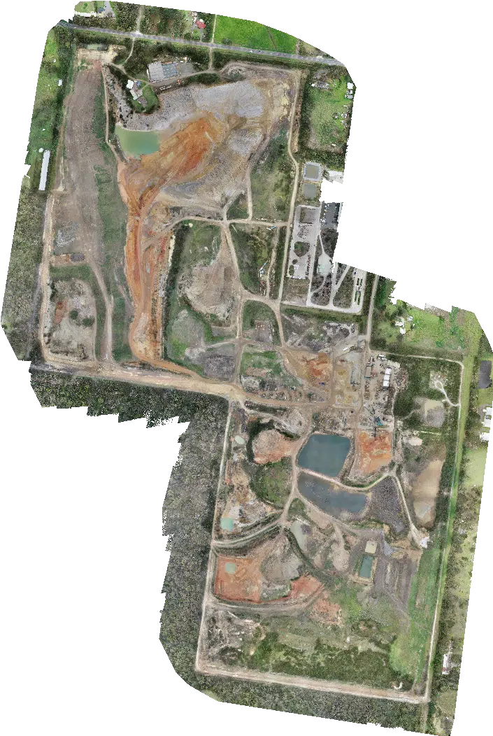
A few of our past projects from our years of experience of working with 100+ clients in AEC Industry carrying out 3D Laser Scanning, modelling, volumetric calculations, aerial inspections, mapping & contour surveys, aerial land surveying, photomontage and much more.
It’s important to note the differences between the site maps and site drawings. It’s often the case that geospatial teams will use these types of maps and models in AutoCAD or Civil 3D for site engineering, drafting and to extract planimetric features. But let’s first establish the key differences between the two.
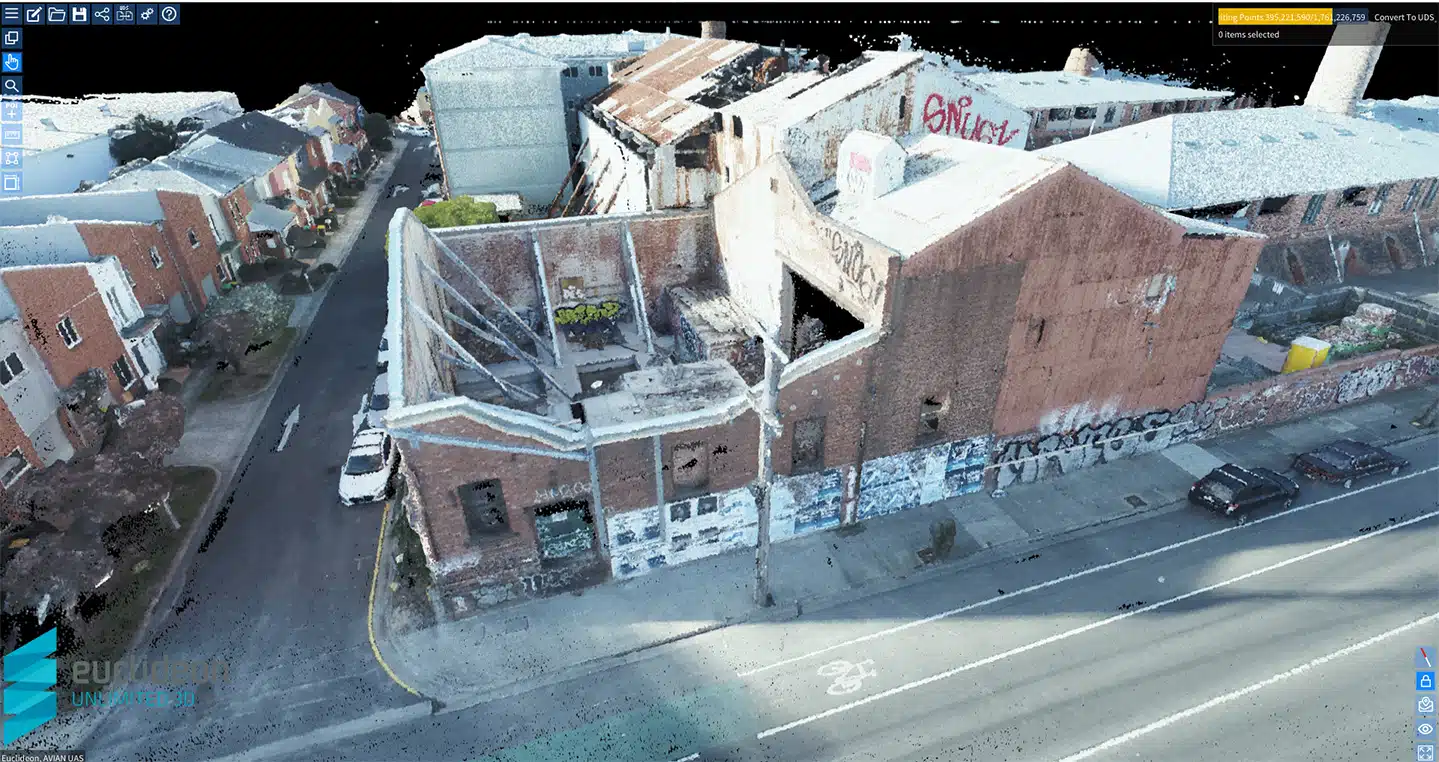
Site maps are comprised of 2D orthomosiac maps used to mark features, breaklines or contours and 3D site models are 3-dimensional models that are known as digital elevation models (DEM), digital surface models (DSM), digital terrain models (DTM) and point clouds that can be used for draining modelling, volumetric measurements, topographical / contour detailing and analysis.
The accuracy and accessibility are the two main factors that can make or break the adoption and effectiveness of a 2D site map or 3D model in construction.
This is where drone technology combined with surveying expertise comes into the picture. The drones allow larger land and project areas to be covered in shorter timeframes and the surveying expertise ensures the utmost accuracy and precision of the produced maps and models and the minimization of human errors and by delegating half the task to drones, you save on both time and resources.
Drones have only recently become popular in AEC industries and there are still a lot of companies that are apprehensive about the reliability, accuracy and effectiveness of drones for land mapping and modelling requirements.
However, considering the geo-spatial industry has widely adopted low altitude drone mapping and modelling it’s only a matter of when the construction industry in Australia realises the immense benefits of construction maps and models in the project lifecycle.
To learn more about the impact of drones in the construction industry read an article here.
Why are manual surveying methods outdated?
Manually surveying the construction site is a time consuming and labor intensive process. Not to mention the risks posed to surveyors on the ground walking on uneven, unstable or slippery ground.
There are numerous opportunities to introduce human error as the surveyor is recording hundreds of survey point observations and then manually drawing up the site plan, map or model.
Plus the drones high resolution camera captures a real-time status of the construction project at each flight that can be replicated time and time again. These maps and models can be compared to determine project status, productivity and site planning and compliance.
Pricing packages to suit your business
Plans with inclusions for Drone Inspection, Land Surveying, 3D Laser Scanning, Drone Photography & Videography. Get custom quote for your specific requirement.
The increasing development and adoption of drones in the last few years is definitely a game changer for AEC projects.
Let’s take a look at how and why drones are a better alternative to manual land surveying methods.
Increased Safety
According to the Bureau of Labor Statistics, 887 workers died due to on site accidents in construction sites in 2017.
Drones have definitely made life easier for worksite managers as now they can see the entire construction site at any point in time, without leaving the desktop. Plus, there is less risk to personnel who have to manually traverse the entire construction project over days or weeks.
It’s important to note that drone pilots and drone operators need to get licensed from CASA (Civil Aviation Safety Authority) if they are flying drones commercially in Australia. Also, adhere to the drone flying rules by CASA to reduce the risk of accidents.
Time Saving
Manual land surveying takes time, both onsite and at the back end, and can often stretch on for weeks depending on the size of the construction project. However, with drones you can cover hundreds of acres in a day and start drafting the subsequent plans and drawings the very next day!
Drones are able to deliver comparable quality in terms of survey accuracy, image quality and live insights from the site area and surrounds.
Project managers can now access all the information they need from the comfort of their office as the drone data is easily integrated and shared via secure methods into existing construction management systems.
Have a custom requirement ?
Get a quick estimate for your specific project requirements with listed inclusions/exclusions.
When incorporating drones or drone mapping into existing workflows there are cost, capability and risk factors to consider when using third party service providers or using in-house staff.
Often companies have their own staff use drones on the job site to save on costs. Only to find they have not realised the benefits because their staff are not optimising the use of the technology to its full potential. Everyone knows how to take a drone photograph but many are not able to process hundreds of photos with survey and geospatial data to deliver precision 3D terrain models and volumetric cut and fill calculations on the entire project with survey grade precision.
Also it’s common for companies to understate the potential risks of a drone incident on the construction project as in-house staff may not hold appropriate qualifications, training or be protected under existing commercial insurances and an incident could result in penalties, litigation and substantial liability for the company and individual responsible.
It is essential for AEC companies to ensure their commercial insurance policies protect the company from liability in all drone operations when hiring a drone service provider or when conducting staff led drone operations.
Drones have several advanced features and enable significant data processing that you simply cannot replace with physical on the ground site visits. Some of the possibilities when using drones in construction:
Terrain mapping
Thermal imaging
High-MP photography
Zoom cameras
4K Video
LiDAR mapping
Drones, combined with surveying methodology, use survey control in the form of GCPs or ground control points to determine the exact coordinates on the ground surface for increased data accuracy.
Also, the images are geotagged with information to ensure processing in photogrammetry, BIM or related software.
With our cutting-edge corridor mapping service, drones are setting new standards in the mapping landscape by increasing cost-effectiveness, speed, and facilitating access to difficult terrains.
Digital record and history
Drones store aerial images and videos that can be converted to digital maps, models and visualisation products like videos, virtual site tours and fly-throughs. This data is stored and archived and can be examined in future without the need to revisit the site or to determine the status of the project at a particular date or point in the past.
With 3D digital visualisation, you can convert this footage to eye-catching and immersive site tours appealing to investors, stakeholders and clients alike.
Why not trying out some construction maps and models on your project and see the difference for yourself. Contact the Avian Australia team today and we can take care of all your drone surveying and mapping needs.
Have a question for us ?
Our team is eagerly waiting to know about your queries. Please call us at the number below during business hours and our team will help you out.