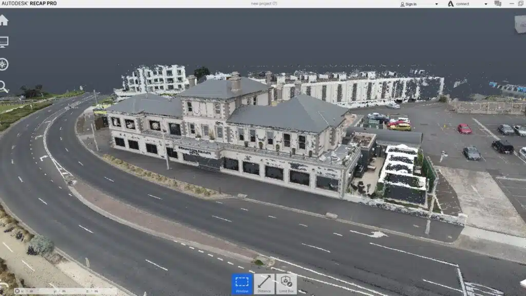
Point Cloud Surveys have emerged as the cornerstone revolutionising the industry in the dynamic arena of modern construction, where accuracy and efficiency reign supreme. Consider an exact digital replica of the real world made up of millions of points precisely collected in three-dimensional space.
This is the heart of Point Cloud Surveys, a ground breaking process that converts real-world spaces and outdoor environments into precise, data-rich virtual representations.
Civil engineers, project managers, urban planners, and infrastructure are adopting emerging technology to improve efficiency and precision in the quickly changing construction sector. Point Cloud Surveys is just one such game-changing technique.
This article examines the influence of Point Cloud Surveys on the construction industry, concentrating on its applications, advantages, and transformational developments.
Table of Contents
Pricing packages to suit your business
Plans with inclusions for Drone Inspection, Land Surveying, 3D Laser Scanning, Drone Photography & Videography. Get custom quote for your specific requirement.
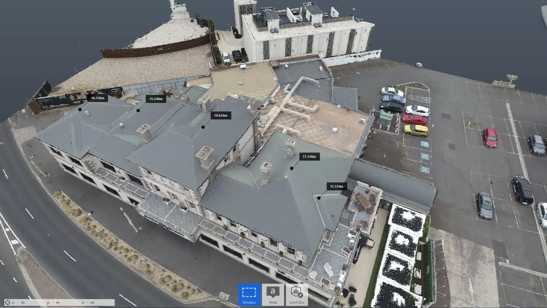
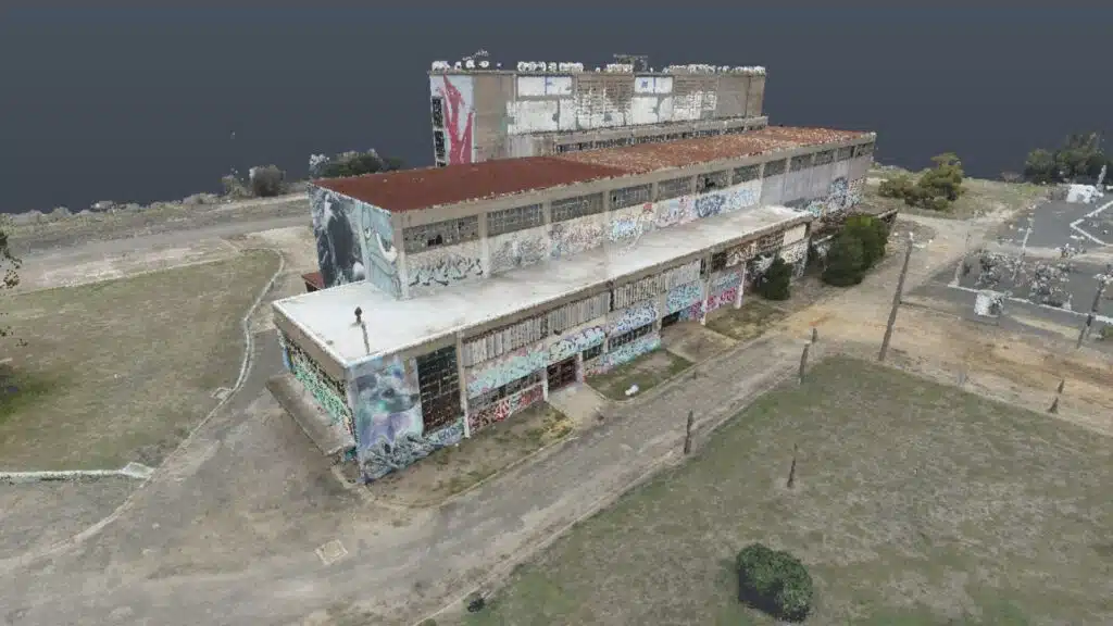
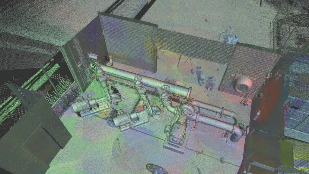
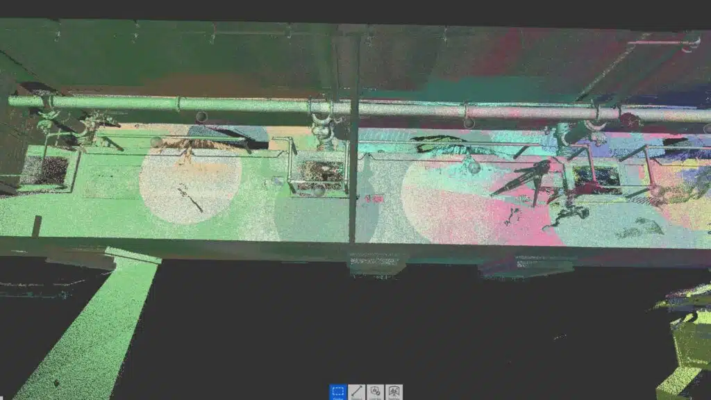
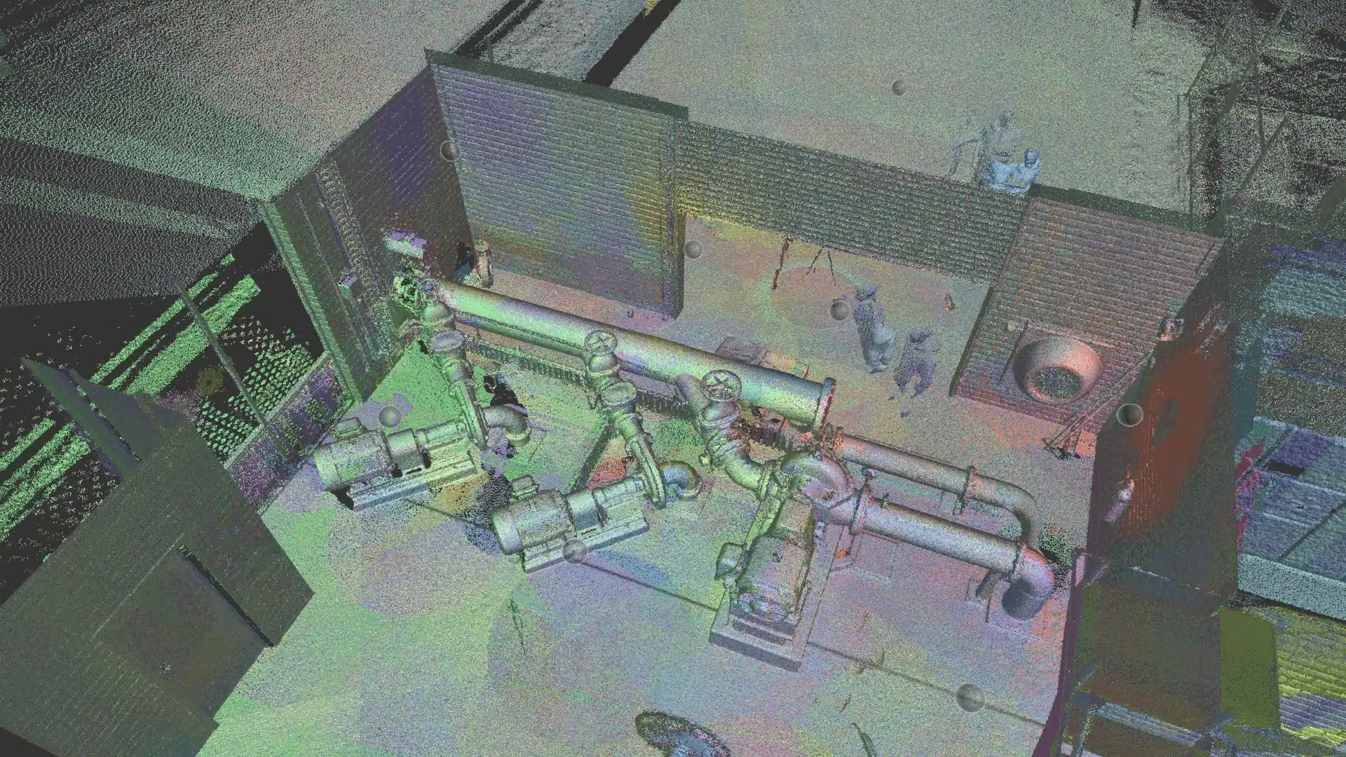
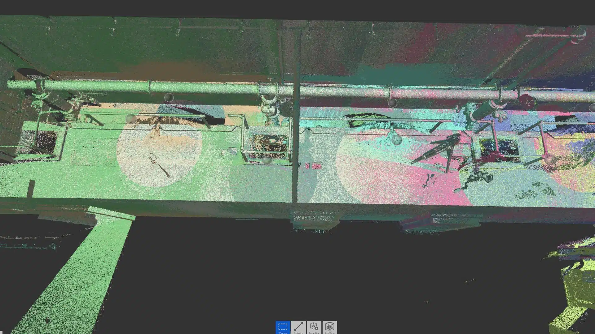
Point Cloud Surveys entail the collecting of a large number of data points in three dimensions, resulting in a digital representation of the real world. These surveys, when conducted correctly, create very precise and comprehensive spatial information by using laser scanners, total stations, and photogrammetry. This data is then processed to generate a “point cloud,” which is a virtual representation made up of millions of points that properly depicts the scanned area.
2. Point Cloud Classification
By classifying points within the point cloud data as buildings, vegetation, or infrastructure components, engineers gain a deeper understanding of the scanned environment. This classification enhances knowledge of the surveyed area, aiding in accurate planning and design.
A. Enhanced understanding
Classification enables a deep dissection of the surveyed area, providing a nuanced knowledge of the many features within the point cloud.
B. Data Optimisation
Categorising points streamlines subsequent analysis and reduces computing strain.
3. Methods of Point Cloud Classification
Point cloud classification involves the application of algorithms to assign points to specific classes or categories. Various methods are employed, each tailored to the characteristics of the surveyed environment.
A. Supervised Classification
Involves training machine learning algorithms using labelled data to classify points based on predefined classes. This can be cumbersome as a large dataset is required to adequately train the algorithms.
B. Unsupervised Classification
Algorithms autonomously identify patterns and group points into clusters without predefined classes. This may result in misclassified groups or clusters.
C. Geometric Classification
Classifies points based on geometric properties such as shape and size, aiding in the identification of features like buildings, powerlines or trees.
Our Project Portfolio
A few of our past projects from our years of experience of working with 100+ clients in AEC Industry carrying out 3D Laser Scanning, modelling, volumetric calculations, aerial inspections, mapping & contour surveys, aerial land surveying, photomontage and much more.
Point Cloud Surveys provide accurate site and terrain data for analysis, allowing for informed decision-making during the planning and design phases.
B. Construction Inspection
The use of point clouds allows for real-time monitoring of building progress. Project managers can detect differences between planned and actual construction, allowing for appropriate modifications.
C. Quality Assurance
The complete 3D depiction enables for extensive quality control, assisting in the early detection of errors or deviations throughout the construction process.
5. Gathering insights via point cloud processing
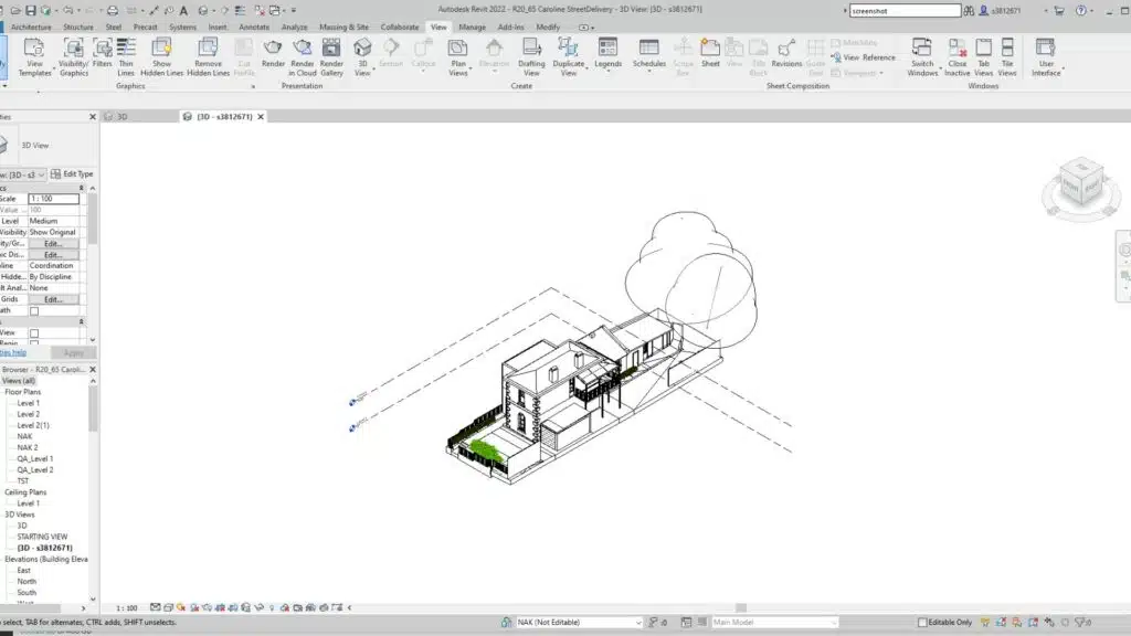
Point cloud processing is a vital component in efficiently leveraging this technology. Engineers can extract relevant insights from huge information acquired during surveys using modern software technologies like Autodesk. This comprises categorisation, segmentation, and 3D visualisation of point clouds.
A. Point Cloud Processing Efficiency
Point cloud processing is a crucial element in maximising the potential of this technology. It enables engineers to efficiently extract valuable insights from vast amounts of survey data using cutting-edge software tools and methodologies.
B. Advanced Insights Extraction
Modern software technologies empower engineers to extract relevant insights from the extensive data gathered during surveys. This includes sophisticated processes such as categorisation, segmentation, and 3D visualisation of point clouds, allowing for comprehensive analysis and decision-making.
C. Classification of Point Clouds
By classifying points within the point cloud processing data as buildings, vegetation, or infrastructure components, engineers gain a deeper understanding of the scanned environment. This classification enhances knowledge of the surveyed area, aiding in accurate planning and design.
D. Point Cloud Segmentation
Dividing the method of point cloud processing into discrete segments enables engineers to isolate specific features or characteristics within the scanned environment. This segmentation facilitates targeted investigation and analysis, leading to more informed decision-making and efficient project management.
6. Point Cloud Standards
Standardisation is essential for maintaining interoperability and consistency in the use of point cloud processing data across projects. Industry-wide standards allow for easy collaboration among many stakeholders.
The accuracy of point cloud data is critical for its use in building projects. The surveying equipment utilised, data processing processes, and the density of collected points are all factors that influence accuracy.
A. High-Resolution Scanning
Using high-resolution laser scanners guarantees that detailed and accurate point cloud data is captured.
B. Survey Control Points
The use of surveying control improves accuracy and data quality by providing reference points for data calibration and quality assurance.
8. Benefits of Point Cloud Surveys
There are many benefits to incorporating point cloud surveys intro your construction project here are just a few:
A. Streamlined Workflow
Incorporating point clouds into the construction workflow streamlines processes and reduces manual labour. By digitising the environment with point cloud data, engineers can collaborate more effectively, identify potential conflicts early on, and optimise project timelines.
B. Cost and Time Savings
Utilising point clouds in construction projects can result in significant cost and time savings. By leveraging accurate 3D representations of the site, project teams can identify clashes, plan logistics, and optimise resources more efficiently, ultimately reducing project delays and budget overruns.
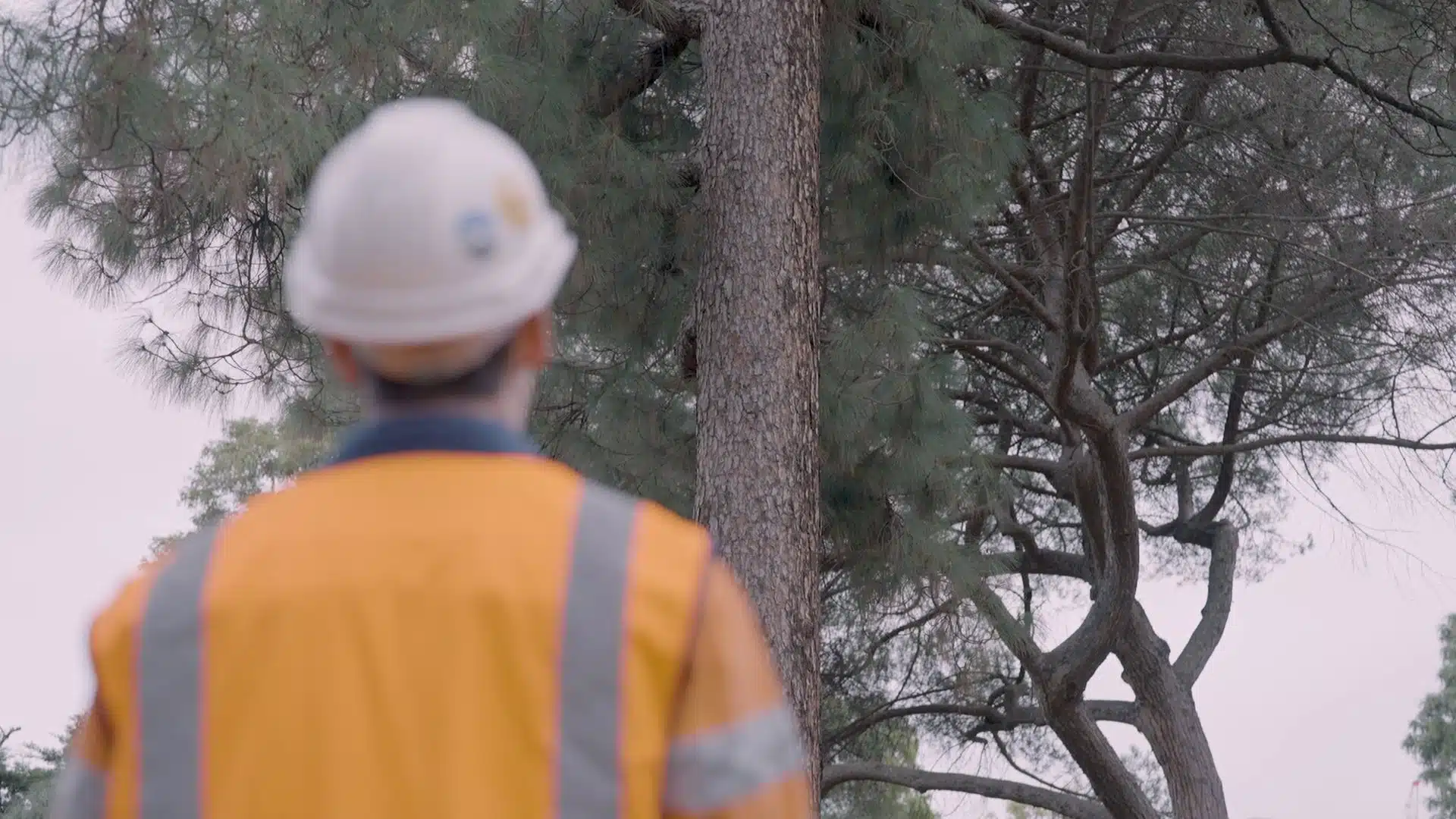
C. Enhanced Safety Measures
Point cloud technology allows for remote data collection, reducing the need for personnel to be physically present in hazardous environments. This enhances safety measures on construction sites and minimises the risk of accidents or injuries associated with traditional surveying methods.
9. Integration with other Technologies
Point Cloud Surveys have the greatest impact when combined with complementing technology, which expands their capabilities and applications.
A. Building Information Modelling (BIM)
Point cloud data serves as a foundational element for Building Information Modelling (BIM), enabling the creation of detailed digital representations of physical structures. This integration enhances collaboration, coordination, and communication among project stakeholders throughout the entire construction lifecycle.
B. Augmented Reality (AR) and Virtual Reality (VR)
Integrating point cloud data with AR and VR technologies allows for immersive visualisation, which aids in design validation and stakeholder communication.
10. Future Trends and Innovations
Incorporating point cloud technology future-proofs construction projects by providing a rich dataset that can be leveraged for various purposes beyond initial planning and construction. From design and engineering to asset monitoring and beyond, point cloud data continues to add value throughout the lifecycle of built assets.
A. Machine Learning Integration: Advancements in machine learning algorithms are enhancing the accuracy and speed of point cloud classification.
B. Real-time Classification: The industry is moving towards real-time classification, enabling on-the-fly decision-making during construction projects.
As construction projects become increasingly complex, the adoption of Point Cloud Surveys emerges as a game-changer for professionals in the industry. From precise data collection to informed decision-making, the applications of this technology are reshaping the future of construction.
The Bottom Line
Embracing Point Cloud Surveys is not just a technological upgrade; it’s a strategic move towards building a more efficient, accurate, and sustainable future for the construction sector.
At Avian, we specialise in point cloud surveys, laser scanning and 3D modelling for a variety of industries, focusing on architecture, engineering and construction. We help you to create quality-assured digital data for your projects.
Contact Avian to get a point cloud survey and 3D visualisation carried out for your project in Australia. Our team will be more than happy to help you through your queries.
Have a custom requirement ?
Get a quick estimate for your specific project requirements with listed inclusions/exclusions.