Architects are constantly balancing creativity with deadlines. Projects need to be designed, approved, and delivered faster than ever, yet the pressure to get every detail right has never been higher. Relying on manual surveys and paper plans often slows things down, leaving room for errors and costly rework.
That’s where point cloud technology comes in. By capturing sites in rich 3D detail, point clouds give architects an accurate foundation to build on. They make it easier to design, collaborate, and problem-solve without the bottlenecks that usually drag out timelines.
Across Australia, more practices are turning to architectural 3D scanning services to keep projects moving smoothly. Whether it’s a new build, a renovation, or a complex heritage restoration, point clouds are becoming the go-to tool for architects who want to save time without cutting corners.
This shift isn’t just about staying on trend. Architects are finding that point cloud technology solves very real problems that have long plagued project schedules. From incomplete site data to misaligned drawings and last-minute design changes, traditional processes often leave teams reacting instead of planning. Point clouds flip that script by giving everyone an accurate, detailed starting point right from day one.
Before exploring how they streamline workflows, it’s helpful to understand what point cloud data is, how it’s captured, and why it’s so much more than a 3D picture.
Table of Contents
Pricing packages to suit your business
Plans with inclusions for Drone Inspection, Land Surveying, 3D Laser Scanning, Drone Photography & Videography. Get custom quote for your specific requirement.
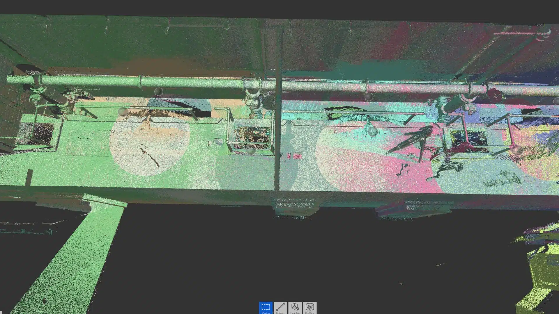
At its simplest, a point cloud is a digital collection of millions of points in a three-dimensional coordinate system. Each point represents an exact location in space, captured through laser scanning or photogrammetry. When combined, these points form a detailed and measurable 3D representation of a building, site, or object.
Point clouds are typically created using LiDAR (Light Detection and Ranging) scanners or drones equipped with advanced cameras. These tools capture the geometry of physical spaces with millimetre-level precision. The resulting dataset is then imported into modelling software, where it can be analysed, refined, or converted into CAD or BIM models.
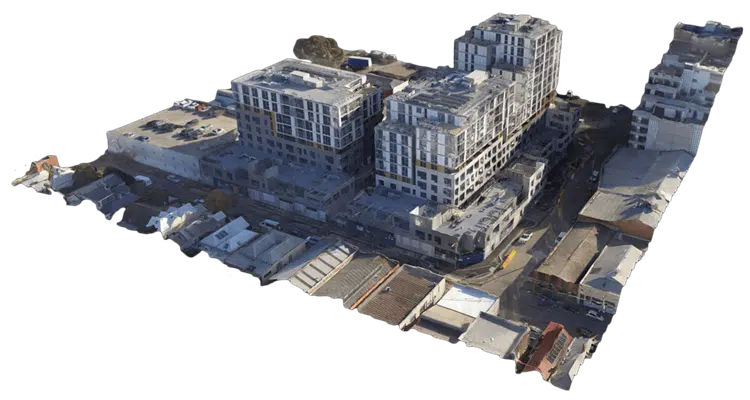
For architects, point clouds offer more than just impressive visuals. They provide accurate, data-rich canvases that eliminate guesswork and deliver a true-to-life digital twin of real-world environments. From 3D point cloud survey Sydney initiatives to large-scale infrastructure, projects across Australia use point clouds to form the foundation for efficient design, construction, and collaboration.
By starting with a detailed and accurate baseline, architects can make better decisions earlier, reducing the risk of errors and costly surprises later.
The Benefits of Point Clouds for Architects
1. Faster and More Accurate Site Surveys
Traditional surveying methods often require repeated site visits, manual measurements, and painstaking record-keeping. Even small errors can lead to design clashes or construction delays.
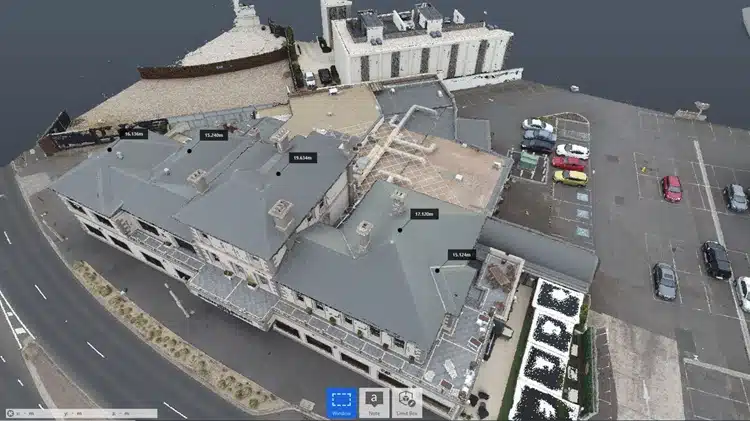
Point clouds, however, condense weeks of survey work into days. With advanced 3D scanners, an entire site can be captured in a fraction of the time, producing millions of data points that create a complete digital replica. This speed allows architects to begin design work earlier and with greater confidence.
For construction projects, it ensures that measurements are not only accurate but also consistently available for reference. This reduces rework, saves time, and ensures that all stakeholders are working from the same data set. In short, architects use point clouds to streamline project timelines by eliminating the inefficiencies of manual surveying.
2. Seamless Integration with BIM and CAD
One of the most powerful advantages of point cloud data is its compatibility with modern design platforms like Building Information Modelling (BIM) and CAD software. Architects can import point clouds directly into their workflows, overlaying them onto proposed designs for comparison and validation.
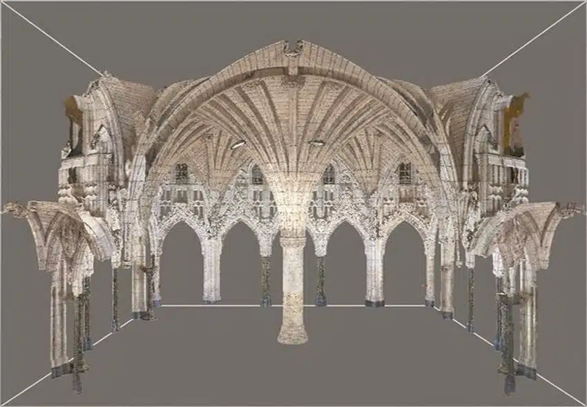
This integration enables accurate clash detection, ensuring that new plans align with existing structures. For example, when renovating a heritage building, point clouds reveal every curve, corner, and structural nuance, helping architects design with precision while preserving the original character.
By embedding point cloud data into BIM environments, project teams can visualise and plan every detail before construction begins. This reduces costly revisions, speeds up approvals, and enhances overall efficiency. We have article to explain how point clouds can be used in engineering projects.
3. Improved Collaboration Across Teams
Architecture is rarely a solo effort. Projects require seamless collaboration between architects, engineers, contractors, and clients. Point cloud data makes this possible by serving as a shared digital reference point.
Through point cloud management platforms, datasets can be uploaded to the cloud, giving every team member instant access from anywhere. This removes the dependency on outdated drawings or incomplete site photos. Instead, stakeholders work together in real time using the same up-to-date data.
This level of transparency fosters stronger collaboration, reduces miscommunication, and accelerates decision-making. The result? Projects move forward faster and with fewer roadblocks.
4. Enhanced Accuracy in Design and Renovation Projects
Renovations and refurbishments present unique challenges. Unlike new builds, architects must account for existing structures, hidden conditions, and irregular geometries. Inaccurate data can cause significant setbacks when unexpected conditions surface mid-project.
Point clouds solve this issue by providing a complete and precise record of the “as-built” environment. Whether capturing the intricacies of a century-old heritage property or the structural details of a modern commercial building, point clouds ensure that architects have the information they need to design confidently.
This accuracy directly contributes to streamlined project timelines, as fewer adjustments are required during construction. The result is smoother project delivery, reduced costs, and greater client satisfaction. For completed application list of using point cloud, we have detailed article.
5. Better Client Communication and Stakeholder Buy-In
Clients often struggle to interpret 2D drawings or technical blueprints. Point clouds bridge this gap by allowing stakeholders to visualise projects in realistic 3D environments. Architects can walk clients through virtual replicas of proposed designs, providing an intuitive understanding of scale, layout, and spatial relationships. This clarity helps secure approvals faster, reduces design revisions, and boosts confidence in the project’s direction.
By using these immersive tools, architects streamline project timelines with point clouds by avoiding lengthy back-and-forth discussions and securing buy-in earlier in the process.
6. Supporting Sustainable and Cost-Efficient Practices
Efficiency is as much about saving time as it is about conserving resources. Point clouds help lower material waste by reducing errors and minimising the need for rework.
Additionally, point clouds can be used in energy modelling and sustainability assessments, giving architects insights into how a building will perform before construction even begins. This forward-thinking approach not only supports environmental goals but also reduces long-term operating costs for clients.
Practical Workflows and Common Pitfalls
While the benefits of point cloud data are clear, the way architects apply the technology often determines how much time they actually save. To truly use point clouds to streamline project timelines, it helps to adopt some best practices that keep projects efficient from start to finish.
1. Commission scanning early
Engaging scanning services at the very beginning of a project ensures that everyone is working from the same “as-is” conditions. Waiting until later can mean wasted design effort if existing drawings prove inaccurate.
2. Model only what you need
Point clouds are dense and data-heavy, but that doesn’t mean every pipe or cable needs modelling in detail. Focus on the areas and features most critical to your design and coordination, and you’ll save time without losing accuracy.
3. Keep datasets organised
Large point cloud files can become overwhelming if not managed correctly. Consistent file naming, version control, and cloud hosting make collaboration smoother and reduce the risk of confusion.
4. Validate registration and accuracy
Not all point clouds are created equal. Checking tolerances and accuracy reports ensures the data is reliable before it feeds into design decisions. Skipping this step can introduce errors that ripple through the entire project.
5. Refresh data when conditions change
On active construction sites, the “as-is” environment is constantly evolving. Commissioning targeted rescans after demolition or structural changes keeps the dataset current and avoids reliance on outdated information.
Streamline Project Timelines with Point Clouds with Avian
By transforming raw data into actionable insights, Avian Australia helps architects use point clouds to streamline project timelines while maintaining the highest standards of quality and precision. Their expertise empowers professionals to streamline project timelines with point clouds, innovate with confidence, reduce risks, and deliver projects faster.
From initial 3D scanning to providing reliable point cloud for constructions and ongoing point cloud management, Avian Australia ensures that architects have the tools and support needed to achieve project success.
If you’re looking to integrate point cloud technology into your architectural practice, Avian Australia is the partner that can help you turn vision into reality.
Have a custom requirement ?
Get a quick estimate for your specific project requirements with listed inclusions/exclusions.