Every engineering project relies on one thing above all else: accurate information. Whether you’re planning a new build, upgrading old infrastructure, or navigating complex site conditions, having reliable data makes all the difference. That’s exactly where point cloud solutions excel.
From construction and architecture to manufacturing and land surveying, the use of point clouds has transformed how projects are documented, planned, and executed. Here are five powerful ways they’re being put to work.
Table of Contents
Pricing packages to suit your business
Plans with inclusions for Drone Inspection, Land Surveying, 3D Laser Scanning, Drone Photography & Videography. Get custom quote for your specific requirement.
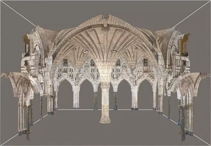
A point cloud is a set of data points in a three-dimensional coordinate system, typically generated through 3D scanning for engineering or photogrammetry. Each point represents a precise location on a surface, such as a wall, floor, or piece of machinery. Collectively, these points form a detailed digital representation of a real-world environment.
To put it simply: imagine a high-resolution 3D photograph where every pixel has a location in space. That’s a point cloud. It can be used as a base for creating drafting service outputs like CAD drawings, Building Information Models (BIM), or detailed design documents.
What Can You Do with a Point Cloud?
Point clouds aren’t just pretty digital images. With the right point cloud management processes in place, this raw data can be organised, analysed, and converted into actionable insights for engineering teams. More importantly, they provide a flexible foundation that can be adapted to different types of projects, regardless of size or complexity.
From construction and architecture to manufacturing and land surveying, point clouds are proving to be powerful tools across multiple industries, such as:
Construction and Architecture
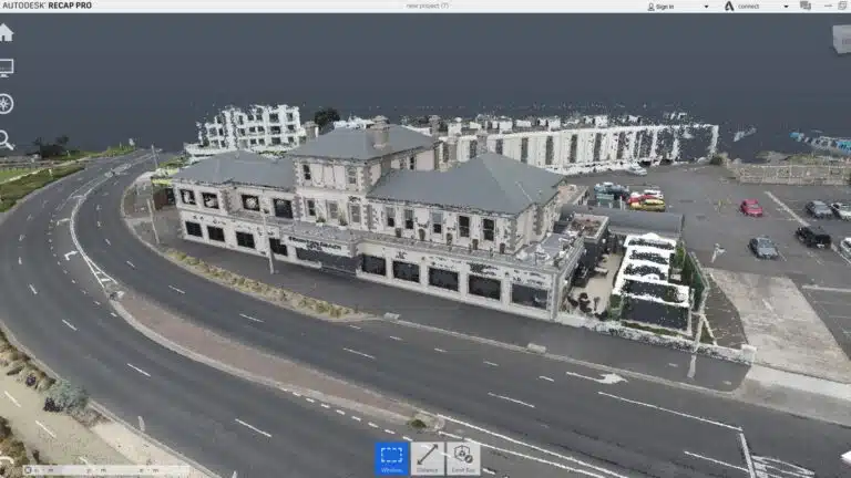
In construction and architectural projects, point clouds provide a reliable snapshot of as-built conditions. Instead of relying on outdated drawings or manual measurements, teams can scan a building or site and create a complete 3D model. This is especially useful for clash detection, measuring distances, or planning extensions where precision matters.
For example, imagine an architect tasked with renovating a commercial office block. A quick point cloud survey captures every wall, column, and ceiling detail, giving the team the confidence to design within the constraints of the existing structure. This kind of data not only speeds up the design process but also reduces the likelihood of costly surprises during construction.
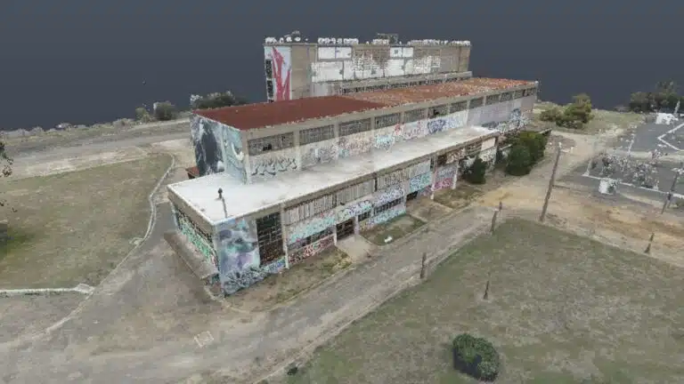
Land Surveying and Mapping
Surveyors have long relied on traditional tools for mapping terrain, but point clouds bring a new level of detail and efficiency to the process. High-resolution scans can generate topographic maps, calculate volumes for earthworks, and provide accurate data for road or infrastructure planning.
Take the case of preparing a site for a new highway extension. A point cloud survey can quickly capture the natural contours of the land, including steep slopes, vegetation, and drainage paths. With this information, engineers can design alignments and drainage systems that match the landscape, reducing risk and ensuring safer construction.
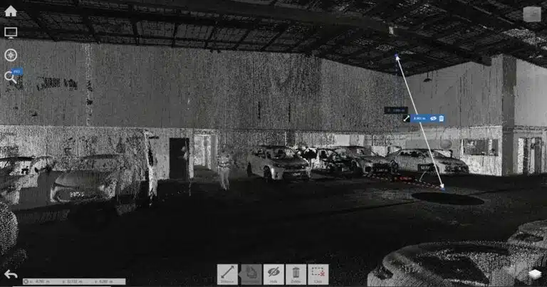
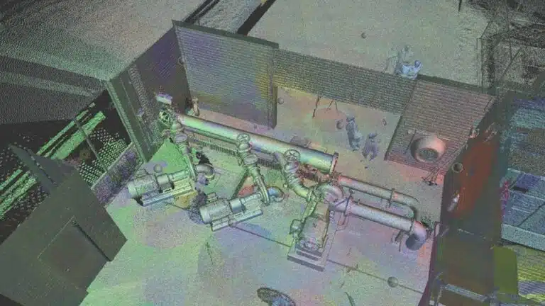
Manufacturing and Engineering
Manufacturing plants and engineering projects often involve complex machinery or facilities that must be maintained, upgraded, or reverse-engineered. Point clouds make this process more efficient by capturing exact dimensions and conditions of equipment. Engineers can then use this data to design replacement parts, improve layouts, or assess wear and tear.
A practical example would be retrofitting an older factory with new production lines. Rather than shutting down operations for weeks to take manual measurements, a point cloud scan of the factory floor captures every pipe, conveyor, and machine footprint. Engineers then use this digital model to plan where new equipment or infrastructure will go, ensuring minimal disruption to production and reducing costly errors and rework.
Why Point Clouds Are Changing the Way Engineers Work
Engineering projects have always relied on accurate measurements, but the way those measurements are captured has evolved dramatically. In the past, surveyors might spend days on site collecting data with tape measures, total stations, or even hand-drawn sketches. While useful, these methods often left gaps that made it harder to model a site or structure with complete confidence.
Point clouds change that. Instead of relying on selective measurements, they capture everything in a space at once.
The Advantages of Point Clouds in Engineering Projects
So, how does all this play out on real engineering projects? Beyond just capturing site conditions, point clouds bring a whole new level of precision and flexibility to the way engineers, architects, and surveyors work.
Here are five of the most important ways point clouds support engineering projects and help deliver better outcomes.
1. Accurate Documentation
Every engineering project starts with understanding the site or object in question. That’s why point cloud surveys and construction have become such a reliable method, replacing many time-consuming manual measurements with fast, highly accurate digital data. The advantage lies in the level of detail they provide, such as:
Millimetre-level precision ensures engineers are working with the most accurate baseline data.
As-built records, perfect for documenting existing structures before construction, renovation, or maintenance.
Comprehensive capture, where no detail is too small. From surface textures to structural nuances, point clouds provide a complete picture.
2. Perfect Integration with BIM
One of the most powerful uses of point clouds is their ability to integrate seamlessly with Building Information Modelling (BIM).
By overlaying point cloud data onto a BIM model, engineers and architects can:
Compare design intent with real-world conditions.
Detect discrepancies between the planned and actual build.
Reduce rework by identifying clashes early in the design process.
3. Streamlined Retrofitting and Renovation
Accurate as-built data is crucial when dealing with older buildings or infrastructure. Many older structures lack proper documentation, which can complicate renovation or retrofitting projects. Point clouds bridge this gap by providing detailed digital replicas of existing conditions. For heritage restorations, architectural 3D scanning services can be especially valuable, ensuring every detail of the original structure is captured before work begins.
This level of detail helps reduce guesswork, giving engineers and architects a clear understanding of what they’re working with. It also allows for more efficient planning, as proposed renovations can be modelled and tested virtually before any on-site work begins. Just as importantly, it improves safety by making it easier to identify potential risks or challenges in advance, long before construction crews set foot on-site.
4. Better Collaboration, Clearer Communication, and Smarter Visualisation
Point clouds act as a powerful bridge between everyone involved in a project. Because the data can be shared across multiple teams, collaboration becomes much easier. Engineers, architects, and contractors can all work from the same source of truth, minimising misunderstandings and reducing the risk of errors.
They also transform the way technical information is communicated. Instead of relying on complex drawings or lengthy explanations, point clouds allow project teams to create clear, intuitive visualisations. This makes it much easier to explain ideas to clients, investors, or other non-technical stakeholders who need to understand how a project is progressing.
The ability to generate interactive 3D models adds another layer of value. These visualisations bring designs to life, giving everyone involved a chance to see how the project will evolve before construction begins.
Finally, point clouds provide an effective way to verify progress throughout the build. By scanning at regular intervals, teams can confirm that work matches the design, quickly catching issues before they turn into costly rework. This combination of collaboration, communication, visualisation, and verification ensures projects stay aligned and on track from start to finish.
5. Keeps Projects on Time and on Budget
Ultimately, the value of point clouds comes down to efficiency. By capturing accurate data upfront and enabling seamless integration into engineering workflows, teams can avoid costly mistakes and delays.
Key savings include:
Reduced rework, as accurate data means fewer errors and corrections.
Faster turnaround, with large sites scanned in hours instead of days.
Labour costs are lowered because teams spend less time on manual measurements and fieldwork.
Take the Guesswork Out of Your Next Engineering Project with Avian Australia
At Avian Australia, we specialise in providing point clouds for engineering projects, designed to meet the unique needs of construction, architecture, and engineering professionals. With expertise in point cloud management and seamless integration with BIM and CAD workflows, we ensure your projects run efficiently from start to finish.
Whether you’re planning a retrofit, designing a new structure, or managing large-scale land surveys, our services give you the clarity and confidence to move forward.
If you’re ready to take your engineering project to the next level, partner with Avian Australia. With our expertise, you’ll experience the difference that precise data and innovative technology can make.
Have a custom requirement ?
Get a quick estimate for your specific project requirements with listed inclusions/exclusions.