Navigating land surveying in Preston requires precision, local knowledge, and the right technology. With its early-to-mid-20th-century subdivisions, Preston presents unique challenges for surveyors: boundary markers may be missing or inconsistent, streets are lined with established homes, and access can sometimes be difficult. From the bustling High Street to the Merri Creek corridor, understanding the local landscape is key to delivering accurate results.
At Avian, we combine advanced surveying techniques with 3D laser scanning and surveying services, drone technology, and expert analysis to provide reliable, efficient, and accurate land surveying.
Whether you’re a homeowner, developer, or construction professional, our land surveying service in Preston ensures your project is built on a solid foundation.
Land Surveying Services in Preston
Cadastral Surveys
Used to define and amend property boundaries, resolve issues concerning land titles, and subdivision of existing land titles.
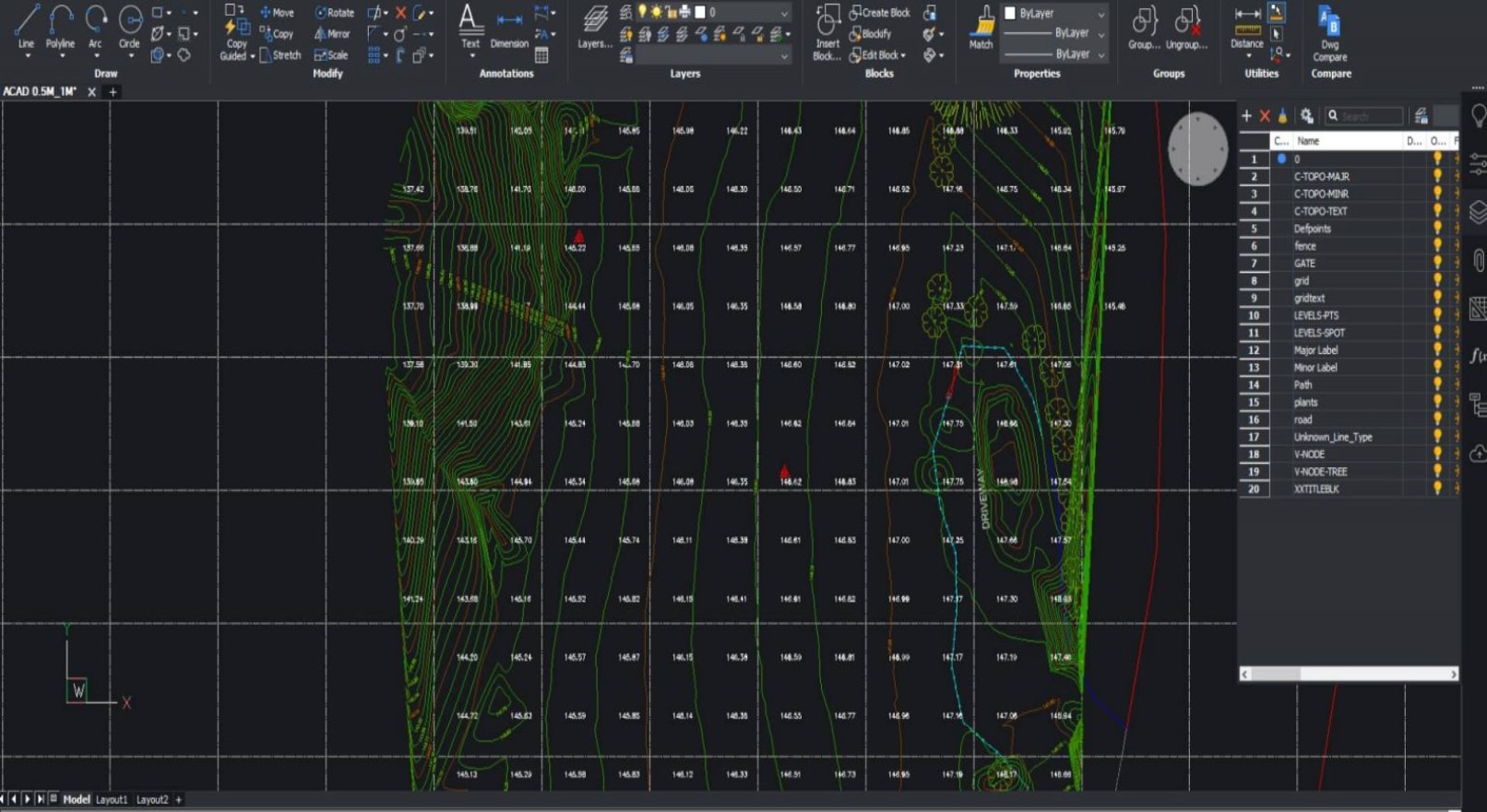
Feature and Levels Surveys
Used to help architects and builders with information of the subject site, the existing buildings, features and services including adjoining road reserves and adjoining properties.
Site Analysis Surveys
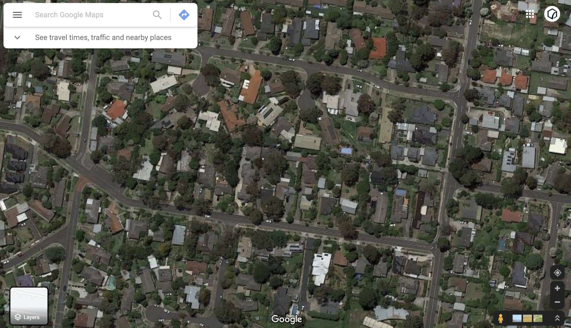
Used to capture the neighbourhood and additional areas surrounding the site usually to around 50m radius. Helps architects identify features to include in the building design and required by council for town planning and building applications.
Why Preston is Unique for Land Surveying
Preston’s urban layout and historic subdivisions bring certain survey challenges:
- Missing or inconsistent boundary markers in older subdivisions.
- Dense residential blocks with closely spaced buildings require careful access planning.
- Narrow streets and laneways can limit the setup of equipment for traditional ground surveys.
- Environmental considerations along Merri Creek and local parks.
Despite these challenges, Preston offers landmarks and streets that help guide survey planning: High Street, Gilbert Road, and the Preston Market precinct are notable points of reference for our teams during site inspections.
General guidelines for drone surveying in Preston include adhering to CASA drone rules, ensuring safety near high-traffic areas, and obtaining permits where necessary. As a trusted drone surveying company, Avian ensures all flights are compliant, safe, and provide high-accuracy results for your project.

")
Title Re-establishment Surveys

Feature and Levels Surveys

Large Land Area Surveys
Our Land Surveying Services in Preston
Avian provides a comprehensive range of land surveying services in Preston, blending traditional expertise with modern technology:
Cadastral Surveys
Feature and Levels Surveys
Site Analysis Surveys
Dilapidation Surveys
Measured Building & As-Built Surveys
Building & Construction Setout Surveys
Monitoring & Engineering Surveys
Why Choose Avian for Land Surveying in Preston
We combine experience, technology, and safety to provide unmatched surveying services. Here’s why clients choose Avian:
Qualified Land Surveyors
Licensed professionals with a minimum of five years’ experience in cadastral and engineering surveying.
Enhanced Site Context
More data means better planning, more accurate permits, and higher project success.
$20M Public Liability Insurance
Covers worksite safety, including construction and rail environments.
Flexible Deliverables
2D plans, 3D models, or architectural BIM integration for complete workflow compatibility.
Advanced Technology
Incorporating 3D scan Melbourne, Sydney, Brisbane capabilities, laser scanning, and drone services.
Rapid Response Across Victoria
On-site within hours in Preston and across Victoria within days.
Precision-driven land surveying in Preston
Land survey services in Melbourne have evolved, and so have our methods. Our approach provides:
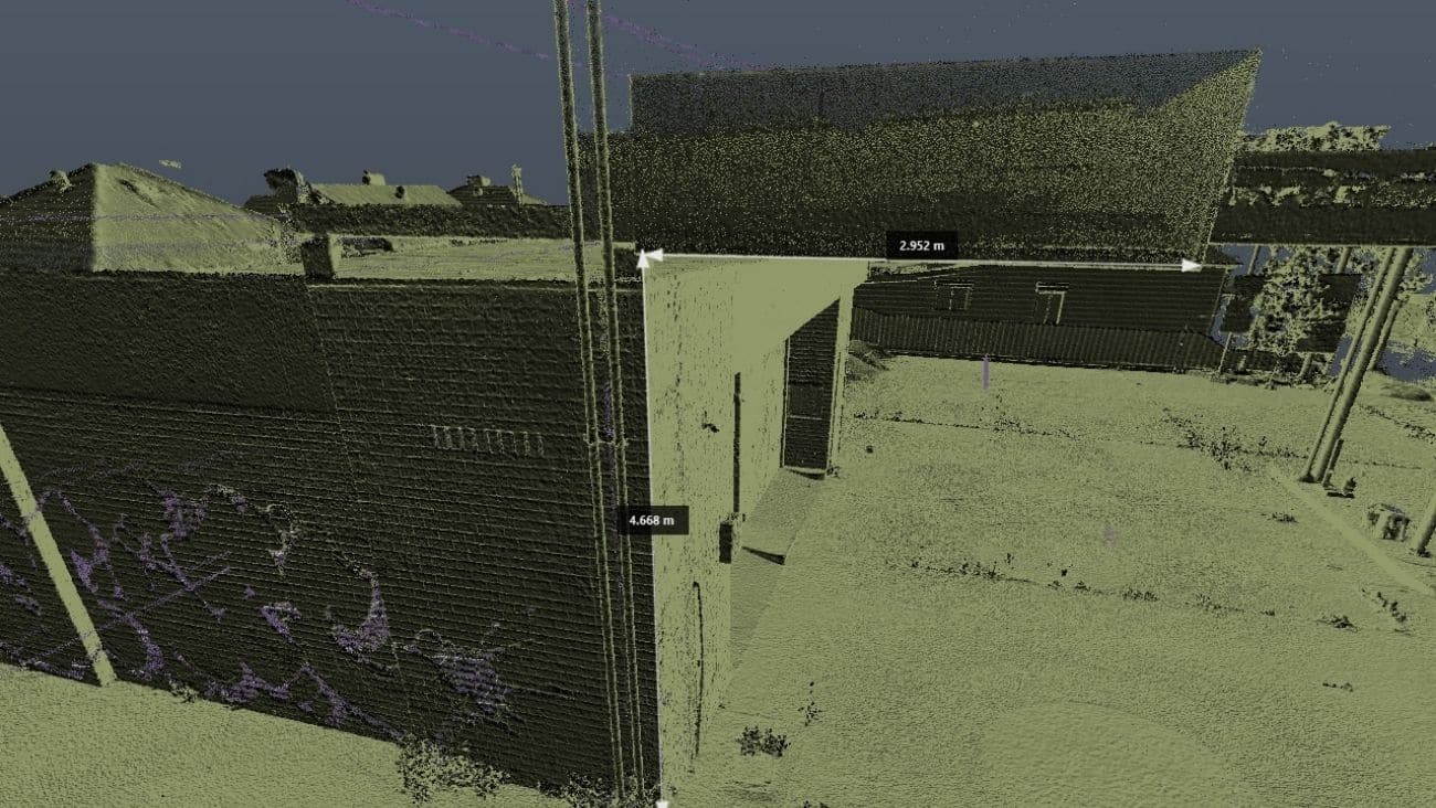
- Millions of data points captured onsite for precise analysis.
- Short and long-term monitoring of assets and existing conditions.
- Multiple outputs in 2D and 3D formats for GIS, CAD, or Revit integration.
- Increased site context for improved planning and stakeholder communication.
By combining traditional Preston land surveying with drone services and 3D laser scanning for architecture, engineering, and construction, Avian delivers richer insights than standard surveys.
Darebin City Council – Preston Jurisdiction
Preston falls under the Darebin City Council, which oversees planning and development requirements:
- Address: 274 Gower Street, Preston VIC 3072
- Website: https://www.darebin.vic.gov.au
- Phone: (03) 8470 8888
Land surveyors working in Preston should coordinate with the council to ensure compliance with local regulations and planning guidelines.
Ready to Start Your Land Surveying Service in Preston?
Accurate, reliable land surveying is the foundation of every successful project. Whether you need feature & level surveys, cadastral mapping, or drone surveying expertise, Avian delivers precise data, fast turnaround, and expert guidance.
Contact our land surveying company in Preston today to discuss your project requirements and get a competitive quote. Let Avian help you transform site data into actionable insights.
Our Land Surveying Projects
Popular Melbourne Metropolitan Area and Inner Suburbs We Cover
| land surveyor ballarat | land surveyor daylesford | land surveyor phillip island | land surveyor pakenham |
| land surveyor bendigo | land surveyor melton | land surveyor colac | land surveyor mornington |
| land surveyor ballarat | land surveyor kyneton | land surveyor castlemaine | land surveyor greensborough |
| land surveyor werribee | land surveyor rockbank | land surveyor shepparton | land surveyor bacchus marsh |

Contact the Avian today to discuss your land surveying project
FAQs About Land Surveying in Preston
How much does a land surveyor in Preston cost?
What does a site inspection involve?
What can go wrong during a land survey?
Access issues, weather, or dense vegetation can complicate surveys. Our priority is the safety of our team and the accuracy of results, so we plan accordingly to minimise risks.
Which survey types are recommended for builders?
We advise cadastral and feature & levels surveys before construction. Topographical, dilapidation, and site analysis surveys can also provide valuable data for design, planning, and council approvals.
How do drone surveys complement land surveying in Preston?
Drone services enable high-resolution aerial imagery, topographical mapping, and precise measurements of hard-to-access sites. Combined with 3D laser scanning services, this enhances accuracy, efficiency, and safety.
Can Avian handle large or complex Preston projects?
Yes. With advanced equipment, licensed land surveyors in Preston, and experience across Melbourne and regional Victoria, we manage projects of any scale, delivering accurate, actionable data on time.
Do you offer BIM or 3D modelling integration?
Absolutely. Our surveys can be integrated into your CAD, Revit, or Civil3D workflows, providing enhanced planning and architectural BIM services for Preston projects.
Can Avian help with surveying older Preston properties where boundary markers are missing?
Yes. Preston has many early-to-mid-20th-century subdivisions where boundary markers can be inconsistent. Our Preston-based land surveyor team uses a combination of historical records, precise measurements, and 3D laser scanning and surveying services to accurately re-establish property boundaries.
How do drone surveys improve land surveying projects in Preston?
Our drone surveying company services provide aerial imagery, topographical maps, and measurements of hard-to-access areas, handy for dense streets like High Street or around Merri Creek. Drone data integrates seamlessly with our surveys, improving accuracy and reducing onsite time.
Do you provide land surveying services in the Melbourne suburbs surrounding Preston?
Absolutely. In addition to land surveying in Preston, Avian offers professional services across Melbourne, covering nearby suburbs such as Thornbury, Reservoir, and Northcote. We deliver the same high-quality, precise surveying solutions, combining 3D scan technology with traditional surveying expertise.