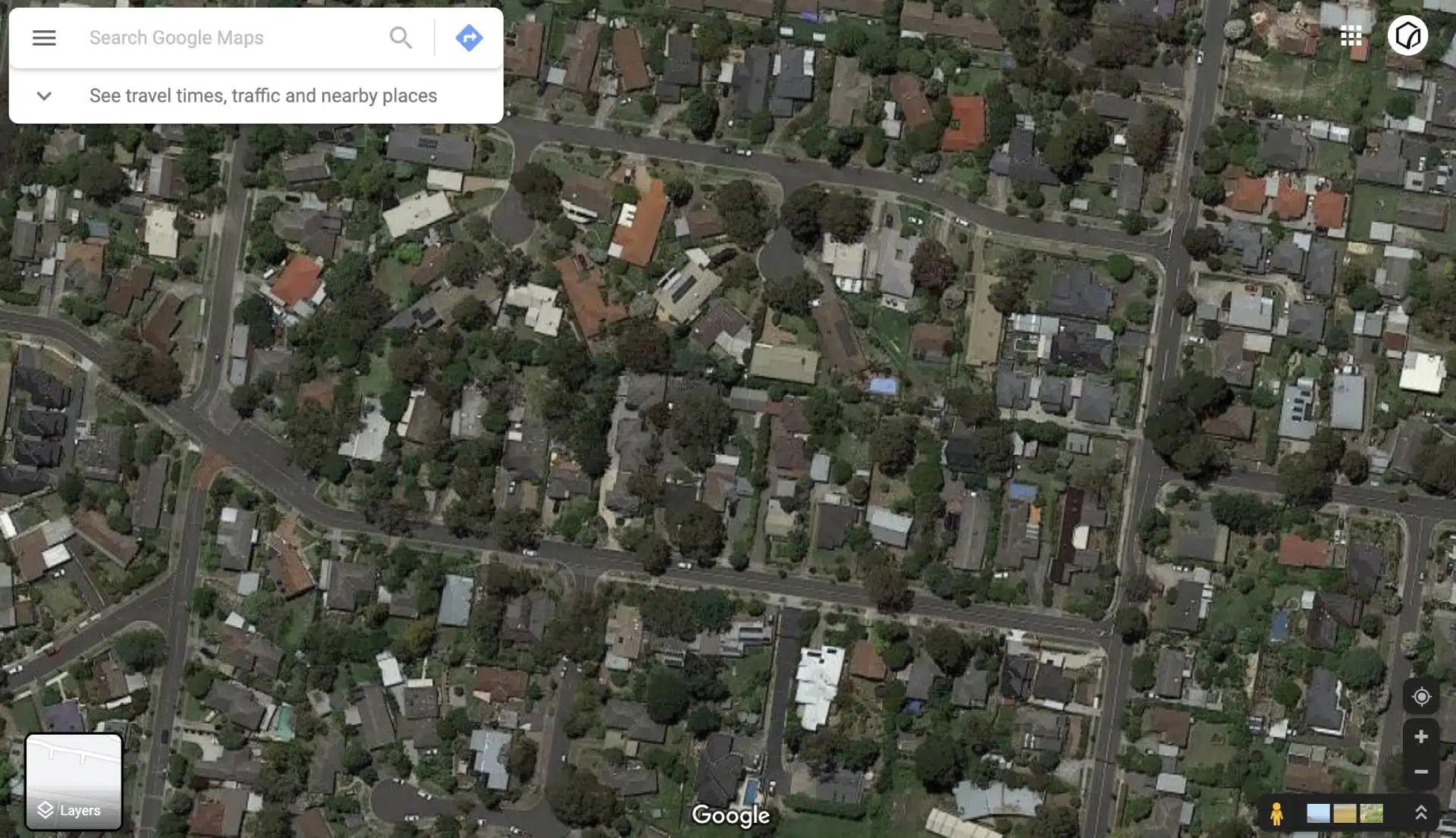
Richmond is one of Melbourne’s most dynamic suburbs – a blend of bustling cafés down Swan Street, heritage buildings, modern townhouses, and tram-lined roads that connect Richmond to other suburbs at the CBD.
For land surveyors, it’s also one of the most technically challenging areas to work in. With constant traffic, narrow streets, and busy pedestrian zones, setting up land surveying equipment in Richmond safely and efficiently can be complex.
At Avian, our team of experienced professionals brings precision and adaptability to every project. We combine traditional land surveying expertise in Richmond with the latest technology, including 3D laser scanning services, drone mapping, and geospatial data, to deliver high-quality, fast, and reliable results for residential, commercial, and infrastructure projects.
Land Surveying Services in Richmond
Cadastral Surveys
Used to define and amend property boundaries, resolve issues concerning land titles, and subdivision of existing land titles.
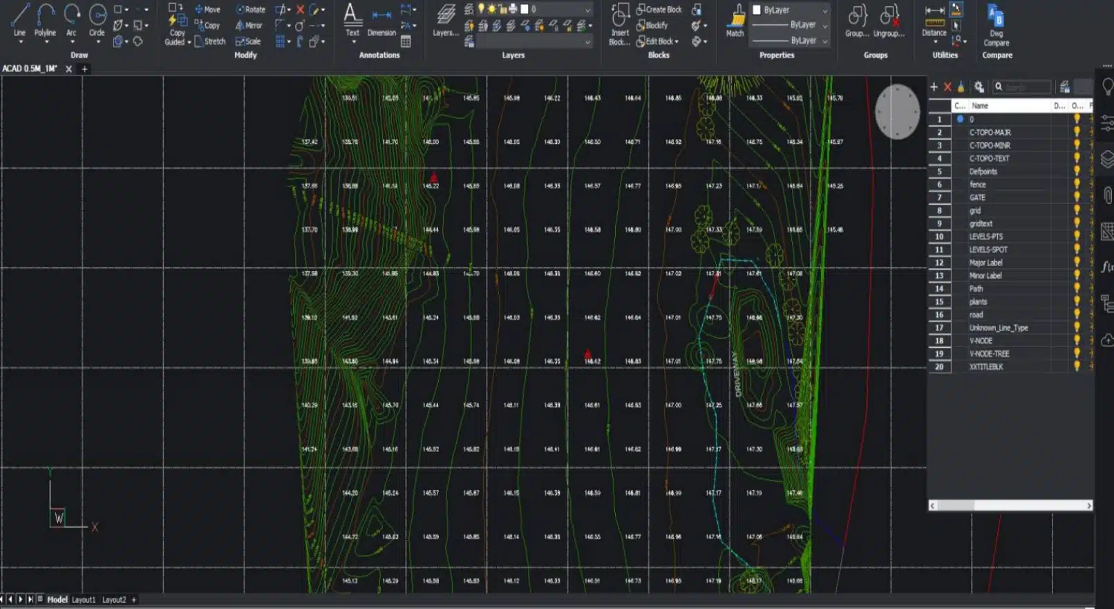
Feature and Levels Surveys
Used to help architects and builders with information of the subject site, the existing buildings, features and services including adjoining road reserves and adjoining properties.
Site Analysis Surveys
Used to capture the neighbourhood and additional areas surrounding the site usually to around 50m radius. Helps architects identify features to include in the building design and required by council for town planning and building applications.
Comprehensive Land Surveying Services in Richmond
Fast and Reliable | Richmond | Qualified Land Surveyors
Our core services include
- Cadastral Surveys: Establish or amend property boundaries, resolve title discrepancies, or subdivide existing land parcels.
- Feature and Levels Surveys: Essential for architects and builders, capturing existing features, topography, and service locations across your site.
- Site Analysis Surveys: Gather contextual data on the surrounding neighbourhood (usually within a 50m radius) to support town planning applications.
- Measured Building and As-Built Surveys: Detailed interior and exterior measurements for renovations, leasing, or design integration.
- Dilapidation Surveys: Visual documentation of existing conditions before and after construction to identify structural or cosmetic changes.
- Engineering and Monitoring Surveys: Detect surface movement, measure earthworks, or map utilities and civil infrastructure for construction and maintenance projects.
- Lettable Area Surveys (NLA/GLA): Conducted in accordance with the Property Council of Australia’s Method of Measurement Guidelines for lease and valuation purposes.

")
Title Re-establishment Surveys

Feature and Levels Surveys

Large Land Area Surveys
Local Challenges of Land Surveying in Richmond
Unlike outer Melbourne suburbs, Richmond presents unique challenges for land surveyors. The combination of busy arterial roads, tram routes, and heritage architecture means that every site requires careful planning. Accessing or closing off areas for survey work must be done safely, and this is often best achieved during off-peak hours.
Our field teams are trained to operate safely around traffic and pedestrians, ensuring minimal disruption to businesses and residents. Whether working near Bridge Road’s retail strips, Church Street’s commercial hubs, or the Yarra Boulevard residential pockets, our team ensures every land surveying service in Richmond meets both safety and accuracy standards.
Why choose Avian?
$20M public liability insurance
Includes comprehensive Commercial Coverage including Work Cover Insurance and to $1m professional indemnity cover.
100% Worksite Safety
Our teams all hold valid CWCs and RIWCs needed to safely work in construction and rail project worksites.
Qualified and Experienced Land Surveyors
Our surveyors used are both Licensed and Qualified for Cadastral Land Surveying and a minimum 5 years industry experience in land surveying.
Obtain more with less
We don’t only provide you with 2D plans but can deliver more site context and value add in the form of 360 virtual tours, 3D Models or Architectural Renders.
Easily integrated to existing workflows
The data we provide is compatible with your existing workflow systems including applications like CAD, Revit, Civil3D and Microstation
Across Melbourne and country Victoria
Our land surveying services are attended within hours and across Victoria within a week of a confirmed booking.
Land Surveying Technology That Elevates Our Work in Richmond
As part of our commitment to innovation, Avian uses a suite of advanced digital tools to make every survey more precise:
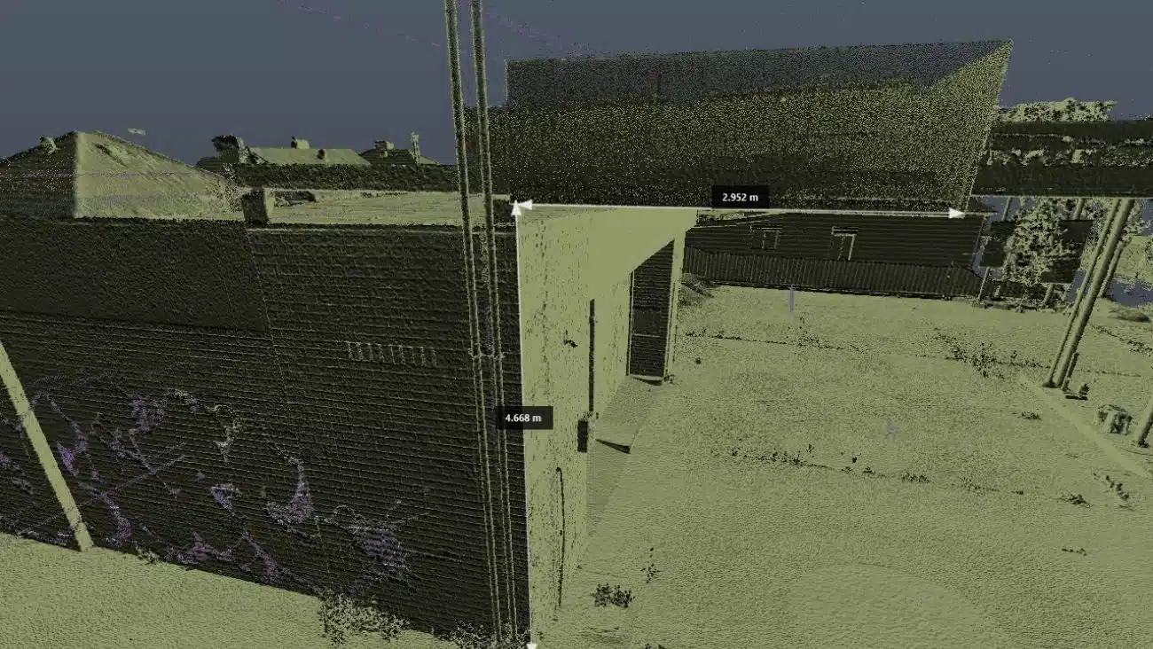
- 3D laser scanning for architecture, engineering, construction: Capture millions of data points in minutes for high-resolution 3D modelling.
- Our drone surveying company technology: Collect aerial imagery, elevation data, and volumetric information quickly and safely.
- 3D scans in Melbourne, Sydney, Brisbane: Seamless data integration for clients managing multi-site projects.
Our land surveying services in Richmond aren’t just accurate; they’re intelligent datasets ready for BIM integration, GIS applications, or planning documentation.
Our Land Surveying Projects
Cost and Process of Land Surveying in Richmond
Before starting, we assess your site and objectives to determine the most efficient and cost-effective approach.
We’ll typically ask:
- What is the purpose of your survey (e.g. subdivision, design, construction)?
- Where is your site located, and what are the access conditions?
- What file formats or software integrations are required (e.g. CAD, Revit, Civil3D)?
Once our land surveying company in Richmond has these details, we’ll provide a transparent, competitive quote and a clear timeline for completion.
Why Choose Avian as Your Land Surveyor in Richmond?
- Licensed and Experienced Surveyors: All our land surveyors in Richmond are qualified and licensed for cadastral work, with a minimum of five years’ field experience.
- Full Insurance Coverage: $20M public liability, professional indemnity, and Work Cover protection.
- Safety First: All staff hold valid Construction and Rail Industry Worker Cards, ensuring total compliance on active sites.
- Future-Ready Data: Our surveys are compatible with CAD, Revit, MicroStation, and other design software.
- Enhanced Site Context: Beyond 2D plans, we can provide 3D models, 360° virtual tours, or photorealistic renders to enhance your documentation.
Precision-Driven Land Surveying Service in Richmond
Land surveying has evolved beyond tripods and tape measures. Today, Avian’s integrated approach combines geospatial intelligence, 3D laser scanning services, and drone imaging to capture more data in less time, improving accuracy, workflow speed, and decision-making.
We provide:
- Real-time digital data for improved planning approvals.
- Extensive site and neighbourhood context.
- 2D and 3D outputs for use in CAD and GIS platforms.
- Long-term monitoring for construction and infrastructure.
General Guidelines for Drone Surveying in Richmond
When conducting drone operations in Richmond, Avian complies strictly with the CASA drone guide and the regulations of the Civil Aviation Safety Authority (CASA).
Here are a few key guidelines our drone operators follow:
- Flights are conducted below 120 metres and within the visual line of sight.
- Drones are not flown directly above people, roads, or trams.
- Operations are scheduled during low-traffic periods where possible.
- Necessary council permissions are obtained before flights in public areas.
Yarra City Council – Key Information
Richmond falls under the jurisdiction of the Yarra City Council.
Address: 333 Bridge Road, Richmond VIC 3121
Phone: (03) 9205 5555
Website: www.yarracity.vic.gov.au
For developments or land surveying Melbourne projects requiring planning permits, we recommend engaging with the council early in your project timeline.
Ready to Get Started?
Whether you’re a builder preparing for construction, an architect needing detailed site analysis, or a homeowner verifying boundaries, Avian is your trusted partner for land surveying in Richmond.
Get in touch today to request a quote or discuss your project with a qualified land surveyor Richmond team member.
Our Land Surveying Projects
Popular Melbourne Metropolitan Area and Inner Suburbs We Cover
| land surveyor ballarat | land surveyor daylesford | land surveyor phillip island | land surveyor pakenham |
| land surveyor bendigo | land surveyor melton | land surveyor colac | land surveyor mornington |
| land surveyor ballarat | land surveyor kyneton | land surveyor castlemaine | land surveyor greensborough |
| land surveyor werribee | land surveyor rockbank | land surveyor shepparton | land surveyor bacchus marsh |
Contact the Avian today to discuss your land surveying project
FAQs About Land Surveying in Richmond
How much does land surveying cost in Richmond?
The cost of land surveying in Richmond typically starts from around $1,400, depending on property size, complexity, and accessibility. We can provide a tailored estimate after assessing your site and objectives.