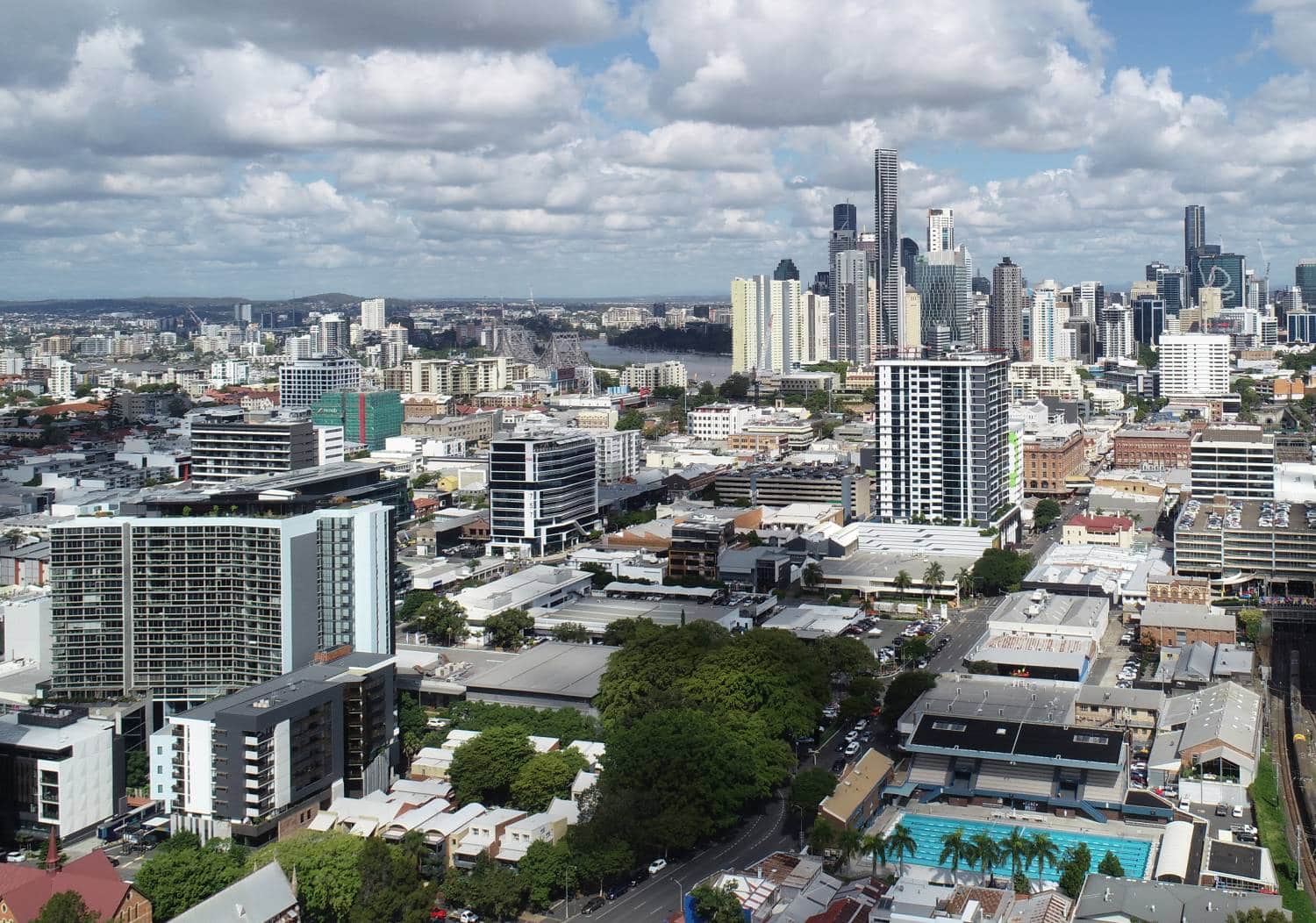
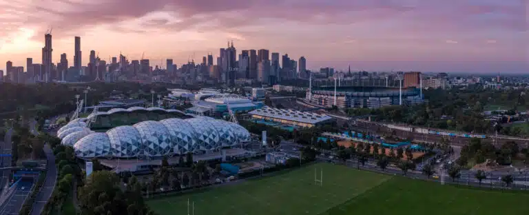
In Melbourne’s fast-paced architecture, engineering and construction (AEC) sectors, aerial drone photography is a game-changer.
From capturing sweeping site overviews to inspecting hard-to-reach structures, the insights gleaned from above have rapidly transformed how professionals document progress, verify data and market their work.
But with so many providers vying for attention, how to choose a drone photography service in Melbourne can feel overwhelming. In this guide, we will unpack everything you need to hire the right team.
Table of Contents
Pricing packages to suit your business
Plans with inclusions for Drone Inspection, Land Surveying, 3D Laser Scanning, Drone Photography & Videography. Get custom quote for your specific requirement.
Why Melbourne’s AEC Scene Demands Aerial Perspectives
As Melbourne’s skyline climbs and infrastructure projects weave through dense urban fabrics, ground-based documentation can leave gaps. Aerial views fill those voids, giving you a long list of benefits of drone photography in construction:
Holistic Project Documentation Instead of piecing together snapshots from multiple site visits, a single drone flight can capture your entire footprint, ideal for monthly progress reports or quick stakeholder updates.
Precision Inspections Faulty cladding, cracked façades or roof damage can hide from ground eyes. Paired with our building inspection services, drones get closer, capturing high-resolution stills or video for detailed analysis.
Compelling Marketing Assets Whether you’re promoting a new residential enclave in Brighton or a commercial tower near Bourke Street, sweeping aerial imagery elevates your marketing collateral, garnering attention on websites, brochures and social channels.
Beyond “Pretty Pictures”: Drone Photography in AEC
Detailed Site Documentation & Asset Monitoring
Contrary to popular belief, drone photography in construction isn’t just about scenic panoramas. At Avian, our drone services in Melbourne encompass:
Site Context Mapping
Georeferenced orthomosaics let architects overlay proposed designs onto real-world imagery, ensuring your concept respects existing terrain and sightlines.
Progress Tracking
Time-lapse sequences show cumulative work by fortnight, enabling project managers to benchmark productivity and recalibrate schedules.
Asset InspectionsInspections of bridges, chimneys or civil infrastructure become safer and faster. Our drone surveyinganddrone inspection teams access confined or elevated areas in minutes, capturing data without scaffolding or rope access.
Cutting-Edge Techniques for Tomorrow’s Projects
As AEC projects grow in complexity, so do the tools we deploy:
360° Panoramas immerse stakeholders in a virtual site walkthrough, perfect for remote teams or community consultations.
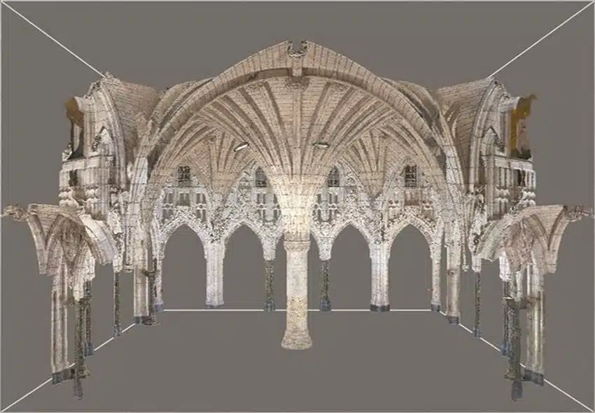
3D Modelling stitches aerial LiDAR and photogrammetry into digital twins, enabling clash detection, volume calculations and scenario testing in BIM platforms.
Virtual Tours integrate drone footage with ground-level imagery, offering a seamless navigation experience for prospective buyers or investors.
The Game-Changing Benefits of Drone Photography in Construction
Crafting skyscrapers, bridges, or multi-unit developments in Melbourne often means juggling tight timelines, safety regulations and public scrutiny. Here’s how drones give you the edge:
Accelerated Data Collection
A single flight can cover an entire construction zone in under an hour, dramatically cutting down on site visits compared to manual surveys.
Enhanced Safety
Eliminating the need for personnel on precarious scaffolds or rooftops reduces risk and insurance premiums.
Comprehensive Oversight
From excavation depth to stockpile volumes, drones integrate with analytics tools to quantify earthworks, measure material usage, and flag deviations from plans.
Choosing Wisely: How to Select Your Drone Provider
So, now you’re wondering how to choose a drone photography service in Melbourne. Finding the right partner comes down to more than price tags. Keep these factors top of mind:
Local Expertise Familiarity with Melbourne’s often complex airspace, around Essendon Airport, city-centre no-fly zones and seasonal events, is non-negotiable. Avian’s pilots hold local CASA approvals and maintain close ties with municipal authorities.
Certified Operators Verify your provider holds a current Remote Pilot License and has documented experience in building inspections or complex AEC undertakings.
Full-Spectrum Services Opt for a team that can pivot between photography, videography, mapping, 3D modelling and integration with 3D laser scanning, delivering a one-stop solution that reduces coordination headaches.
Reputation & Proof Review case studies, like our Level-View aerial photography for residential towers, and client testimonials to ensure reliability, quality and responsiveness.
What You’ll Receive: Deliverables & Integration
Aerial data is only as good as its usability. At Avian, we tailor deliverables to your workflow:
Data Formats
Choose from high-resolution JPEGs, TIFF orthomosaics, LAS/LAZ point clouds or Revit-compatible mesh exports, seamless for CAD, GIS or BIM platforms.
Turnaround Times
Most standard site documentation packages deliver within 48 hours of flight, while advanced 3D models or virtual tours may require up to five business days, ensuring your planning cycles stay on track.
Usage Rights
You get full commercial usage rights for marketing, presentations and public displays with no hidden licensing fees or restrictions.
Understanding the Cost of Drone Photography Services in Melbourne
Investing in drone photography isn’t an expense; it’s a strategic decision. Here’s how to navigate the costs of drone photography services across Melbourne:
Pricing Models Most providers offer per-flight, hourly or project-based rates. Avian’s transparent structure lets you choose the model that aligns with your budget and scale.
Cost Drivers Project complexity, site location (CBD vs. regional), required deliverables (2D photos vs. 3D models) and permit coordination all influence the final quote.
Comparative Value When you calculate the man-hours saved in inspections, the reduction in safety equipment rentals, and the marketing lift from high-impact visuals, drone services often undercut traditional methods on total cost of ownership.
Legal, Safety & Compliance in the Melbourne Skies
Operating drones in a metropolis demands strict adherence to regulations.
CASA Regulations
Your provider must comply with Part 101 (commercial operations) and hold a Remotely Piloted Aircraft Operator’s Certificate (ReOC).
Local Permits
For flights near major events, like the Australian Open at Melbourne Park, or restricted areas around Essendon and Moorabbin airports, special approvals from local councils are essential.
Rigorous Safety Protocols
Risk assessments, contingency planning and redundant systems (dual-operator mode, backup batteries) safeguard your assets and site teams.
Insurance Coverage
Confirm your provider carries at least $10 million in public liability insurance, covering any accidental damage during operations.
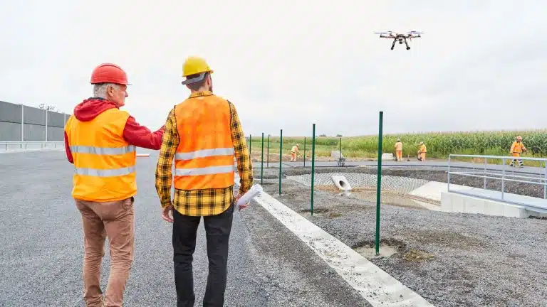
Proactive Risk Mitigation for Flawless Drone Operations
No matter how seasoned your team, a successful drone shoot hinges on anticipating potential issues before wheels leave the ground. Here’s how Avian safeguards your project from planning through flight day:
Thorough Site Reconnaissance
Before any equipment is packed, our pilots visit the site to note obstacles (overhead wires, tall trees or narrow laneways). This on-foot survey informs flight paths and ground control placement, ensuring smooth data capture.
Weather Monitoring
Sudden gusts or unexpected showers can ground drones. We track local forecasts, secure indoor backup options (like terrestrial scanners or handheld LiDAR), and schedule buffer days to accommodate meteorological delays.
Airspace & Permit Checks
From Essendon Airport’s controlled zones to council-run events at Caulfield Racecourse, we map all relevant airspace restrictions. Our in-house team secures CASA approvals and City of Glen Eira permits well in advance, avoiding last-minute hold-ups.
Equipment Redundancy
Battery depletion, SD-card failure or GPS signal loss can derail a flight. We deploy multiple sets of fully charged batteries, redundant recording media and dual-GNSS rovers, so a single fault never stops progress.
Clear Communication Protocols
We assign a dedicated safety officer and ground spotter for every flight, maintaining radio contact with the pilot. Real-time check-ins keep the entire crew informed and ready to adapt if conditions change.
Data Integrity Measures
Immediately after each flight, our team verifies that all images, video and position logs have been recorded correctly. On-site backups and checksums guarantee your deliverables remain pristine.
Real-World Wins: Case Studies in Melbourne
Level-View Residential Towers
Avian captured progressive aerial stills and time-lapse video for a twin-tower development in Docklands. By merging drone footage with ground surveys and 3D laser scanning vs. traditional surveying data, the client detected foundation deviations early, saving $ 150k in rework costs.
For a Slade Lane shopping centre near Brighton, our team delivered photorealistic aerial renders, blending drone imagery, BIM exports and virtual tour tech. The marketing campaign saw a 30% uptick in leasing inquiries within two weeks.
Aerial drone photography has transcended novelty to become an indispensable AEC tool in Melbourne.
From the benefits of drone photography in construction: accelerated inspections, safer workflows and enriched marketing, to the integration with 3D laser scanning applications, the advantages are clear.
If you’re contemplating how to choose a drone photography service in Melbourne, remember: local knowledge, certified expertise and comprehensive deliverables are non-negotiable.
And when it comes to the cost of drone photography services in Melbourne, view it as an investment that pays dividends in time saved, risks mitigated, and stakeholder confidence boosted.
Ready to Take Flight?
Partner with Avian’s experienced team for tailored drone services, from site documentation to immersive virtual tours.
Contact us today to discuss how aerial imagery can elevate your next AEC project.
Have a custom requirement ?
Get a quick estimate for your specific project requirements with listed inclusions/exclusions.