Revolutionizing Commercial Refurbishments: Avian Australia's Laser Scanning and 3D Models Success Story
Introduction
In this case study, we will delve into how Avian Australia, a leading surveying and reality-capture company, partnered with a commercial client to address a challenging problem related to refurbishing a warehouse. By utilising cutting-edge laser scanning technology and 3D drafting processes, Avian Australia revolutionized the way architects and construction professionals obtain accurate as-built drawings and 3D models for their projects.
Client Background
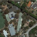
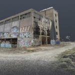
Our client, a commercial property owner, was facing a common problem in the industry. They needed to refurbish a warehouse for incoming tenants, but accurate or updated as-built drawings were unavailable. This posed a significant obstacle to the planning and design process, as architects have to resort to manual measurements, resulting in multiple site visits, transcription errors, and doubts about accuracy.
Problem Statement
The challenge was clear: how to efficiently and accurately capture the existing conditions of the warehouse to facilitate the refurbishment process. Traditional measurement methods were time-consuming, error-prone, and costly, leading to delays and potential design flaws.
Avian Australia’s Solution
Avian Australia stepped in with a groundbreaking solution. Leveraging their expertise in laser scanning, surveying, drafting, and 3D modeling, they proposed a comprehensive solution to address the client’s needs. Avian Australia’s solution included:
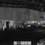
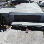
Conducting a comprehensive site scan of the warehouse, both its interior and exterior facades and rooftop assets, using state-of-the-art technologies.
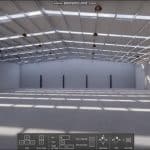
Capturing a detailed digital twin in the form of a point cloud for 3D modeling and site analysis.
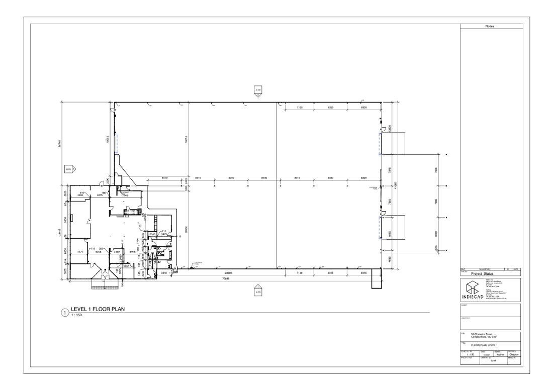
Generating a comprehensive 3D Revit model of the building envelope for client design and planning needs.
Utilising a Leica laser scanner, Leica total station for survey control and a DJI RTK drone for mapping and photogrammetry.
Implementation
Avian Australia executed their plan efficiently, scanning and surveying the entire site, both inside and out, all within a single day. They captured additional site context and rooftop assets through aerial photography and aerial mapping using the drone. This data was crucial for creating accurate as-built drawings and surveys of the building envelope both inside and out.
Results
The results were transformative:
✓ Avian Australia’s digital twin facilitated 3D Revit modeling, enabling the creation of precise as-built drawings.
✓ Additional plans and drawings could be drafted directly from the digital twin, eliminating the need for costly and time-consuming site revisits.
✓ The digital twin also provided valuable information about the rooftop services and adjoining features and buildings, ensuring a comprehensive understanding of the site and surroundings.
Choosing the right Laser Scanning Service
At Avian Australia, we offer a range of surveying and laser scanning services tailored to meet the specific needs of architects and construction managers. When choosing the right package, consider the scope of your project, the level of detail required, and your budget. Contact us today to discuss your project and receive a customised quote.
Our Mission is to empower architects and construction managers with the tools they need to execute their projects flawlessly. With the state-of-the-art technology and a dedicated team, we ensure that your designs are brought to life with unmatched precision and realism. Dive into a partnership with Avian Australia and experience the difference in quality, accuracy and project success.