High-Precision Land Surveying in Brunswick
Brunswick’s lively café scene on Sydney Road, colourful Brunswick Street Mall laneways and the serene Merri Creek corridor create a distinctive backdrop for surveying projects.
Navigating Brunswick’s Urban Maze
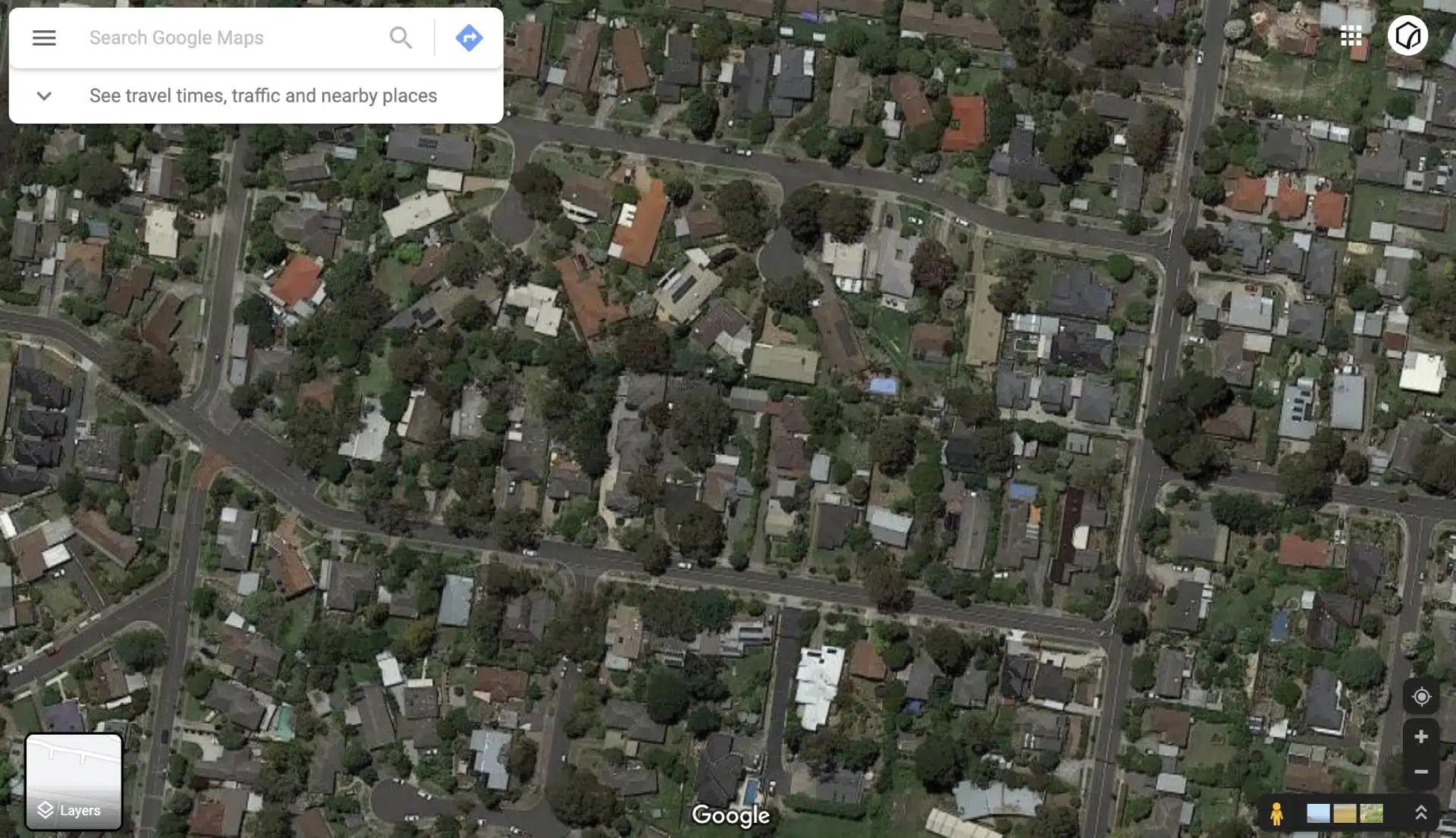
A crew completing land surveys in Brunswick can find themselves wedged between heritage terraces on Albert Street and modern apartments off Glenlyon Road. Limited kerbside space, tram tracks on Sydney Road and continuous residential occupancy force surveyors to rethink conventional methods. Avian counters these obstacles by deploying compact GNSS rovers, tripod-free handheld scanners and collaborating with our drone surveying company partners to capture aerial data where ground access is constrained. This hybrid approach ensures every boundary, feature and contour is recorded, no matter how tight the site.
A Bespoke Land Surveying Service Brunswick Trusts
Every Brunswick land surveying project is distinct. Whether you’re subdividing a Victorian cottage near Brunswick East, preparing to submit a building permit for a Merri Creek restoration, or mapping studio conversions around Lygon Street, our workflow begins with an analysis of council overlays and historical records. We then conduct an online site review to determine the optimal blend of surveying and geospatial tools and 3D laser scanning for architecture, engineering, construction.
This custom methodology guarantees that your certified boundary surveys, site feature, and subdivisions comply with the City of Melbourne regulations and fit seamlessly into your CAD, Civil3D or Revit environment.
Certified Boundary Surveys and Subdivisions
In Brunswick’s tightly packed blocks, even minor errors in fence lines or lot dimensions can lead to neighbour disputes and costly setbacks. Avian’s boundary land surveys in Brunswick verify property extents, fence alignments and buried utilities with certainty.
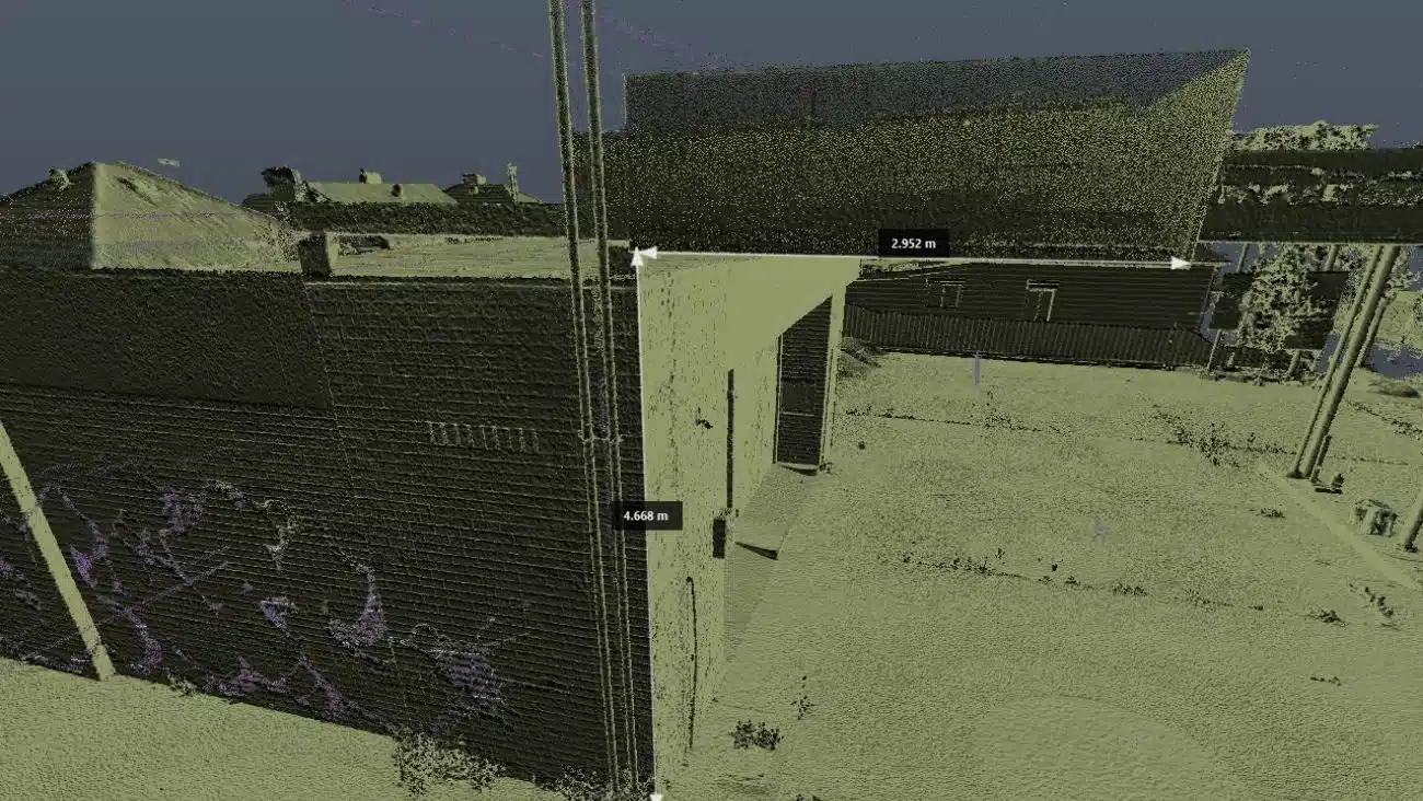
Using 3D laser scanning and surveying services, we produce legally defensible plans, essential for strata developments on Sydney Road or title adjustments near Moreland Road. Our certified deliverables streamline your lodgment with both Council and the Land Titles Office, ensuring a smooth path to approval.
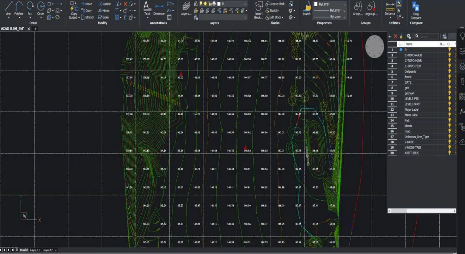
Detailed Topographical Mapping for Council Permits
Large-scale urban renewal projects, such as mixed-use precincts in Brunswick West, demand precise elevation and contour data. By combining ground surveys with LiDAR and photogrammetry, we generate high-resolution topographical maps that highlight slope gradients, cut-and-fill volumes and vegetation cover along Merri Creek’s banks.
These deliverables feed directly into stormwater design, landscape architecture and civil engineering models, keeping your project informed, on time and within budget.
The Aerial Advantage: Drone Surveying in Brunswick
Where ground access is limited, Avian brings a new vantage point. Our CASA-certified pilots capture orthomosaics and point clouds from above the rooftops of Hoffman Brickworks and between the heritage fronts on Blyth Street. These aerial surveys integrate smoothly with our capabilities for 3D laser scanning surveys across Sydney, Brisbane, Melbourne providing a comprehensive digital twin of your entire site and surrounds. Whether you’re assessing rooftop solar potential or tracking façade renovations, drone data fills in the gaps left by ground surveys.
Complying with City of Melbourne Planning Guidelines
Brunswick falls under the jurisdiction of the City of Melbourne. You need to comply with the planning and building permit process which includes pre-application steps, issuing decisions, and review processes. It’s important to comply with local laws to avoid fines.
For detailed information, you can visit the official City of Melbourne website.
City of Melbourne
Address: 120 Swanston Street, Melbourne VIC 3000
Phone: (03) 9658 9658
Website: www.melbourne.vic.gov.au
Avian’s land surveying services in Brunswick supports the planning and building permit process. By managing the permit application process end-to-end, we ensure your surveying in Brunswick is lawful, safe and aligned with local regulations.
Seamless Data Integration for Your Workflow
Fast and Reliable | Brunswick | Professional Land Surveyors
In Brunswick’s fast-paced developments data must integrate smoothly. Avian delivers survey outputs in formats that your team already uses: 2D CAD plans, Civil3D contours, Revit-compatible 3D models, point clouds and GIS-ready shapefiles. This seamless compatibility reduces rework, accelerates design iterations and keeps consultants aligned across disciplines. For clients needing land surveying services in Caulfield, Ballarat, Brighton, Avian provides the same high standard of service, data consistency and quality.
Local Expertise and Rapid Response
Our local survey crews know the local conditions, pitfalls and council processes. We deploy teams for land surveying to Brunswick East, Brunswick West, Moreland Road precincts and beyond, often with short notice. This local footprint guarantees swift mobilisation, expert insights and real-time support throughout your project lifecycle.

")
Title Re-establishment Surveys

Feature and Levels Surveys

Large Land Area Surveys
Ready to Transform Your Project with Land Surveying in Brunswick?
As a densely populated inner-city suburb, Brunswick’s narrow streets, laneways and closely spaced homes often leave little room for surveying. Between parked cars, buzzing trams and bustling footpaths, accurate data capture demands innovation, precision and local know-how. Avian’s land surveying Brunswick team brings all three, combining traditional techniques with advanced technology to deliver reliable and insightful results for every project, from small infill sites to larger mixed-use developments.
From detailed boundary validation to comprehensive topographical mapping and aerial data capture, Avian’s surveying Brunswick-based team is here to deliver precision, efficiency and peace of mind. Contact us today to discuss your requirements and arrange a tailored on-site consultation.
Let’s bring your Brunswick vision to life with data you can trust.
Why choose Avian?
$20M public liability insurance
Includes comprehensive Commercial coverage, Work Cover Insurance and Professional Indemnity cover.
100% Worksite Safety
Our teams all hold valid CWCs and RIWCs to work in construction and rail project worksites safely.
Qualified and Experienced Land Surveyors
Our surveyors are both Licensed and Qualified for Cadastral Land Surveying and a minimum 10 years industry experience.
Obtain more with less
We not only provide 2D plans and 3D Models but also deliver more site context and visualisation in the form of 360 virtual tours and architectural renders.
Easily integrated to existing workflows
The data we provide is compatible with your existing workflow systems like CAD, Revit, Civil3D and Microstation
Earliest Availability
Our land surveying services are available within days and across Victoria within a week of a confirmed booking.
Precision-driven land surveying in Brunswick
Land Surveying is a centuries-old profession that has evolved to incorporate leading innovation and digital technologies to deliver faster and more accurate observations and measurements including the ability to provide more site information that ever before.
Our team uses a combination of geospatial, surveying and 3D laser scanning methods to capture onsite conditions faster, safer and smarter when compared to the traditional land surveying methods typically used across Melbourne and Victoria.
Here are a few key differences in the way we conduct surveys to ensure maximum value for our clients:
- Millions of data points captured onsite
- Faster onsite attendance and workflows
- Qualified and experienced surveying, laser scanning, geospatial and modelling expertise
- More onsite data supplied to clients including site analysis and neighbourhood context
- Short and long term monitoring of assets and existing conditions
- Multiple outputs available in both 2D and 3D formats including GiS applications
- Increased site context means better planning and decision making
- Improve planning and permit applications with more detailed information
- Increased client engagement from 3D visualisations and site tours
- Promote project success and improve future bids with project profile and case studies
Our Land Surveying Projects
Popular Melbourne Metropolitan Area and Inner Suburbs We Cover
Contact the Avian today to discuss your land surveying project
FAQs for Avian's Land Surveying in Brunswick
We have answered some common questions that AEC clients have about our land surveying services in Brunswick.
Brunswick’s narrow streets, laneways and high-density housing require creative access strategies. We combine ground-based surveys in Brunswick, as well as 3D laser scanning and drone flights to map every detail, even when sites are hard to reach.
For a heritage conversion, start with a certified boundary survey to confirm your exact property lines, then add a feature-and-level survey to capture wall offsets and rooflines. If you’re breathing new life into your loft, a topographical site analysis will reveal slope changes and neighbouring building encroachments, vital for both design and council approvals.
For any land surveying service in Brunswick simply share your site address, project scope and any available drawings. We’ll arrange a free on-site consultation to refine deliverables, methodology and pricing.
Yes. Our building inspection services include ground-penetrating radar and laser scanning to accurately locate drains, power cables and telecoms beneath Brunswick’s footpaths.
Absolutely. Our building inspection services combine ground-penetrating radar, precision total-station setups and phased LiDAR scans to reveal every hidden drain, conduit and cable. We even schedule surveys at off-peak hours to minimise disruption to trams and traffic, ensuring we capture utilities without blocking footpaths or roads.
If your flight plans to operate within 30 metres of people, buildings or roads, City of Melbourne approval is mandatory. Avian manages the entire application process to keep your survey compliant.