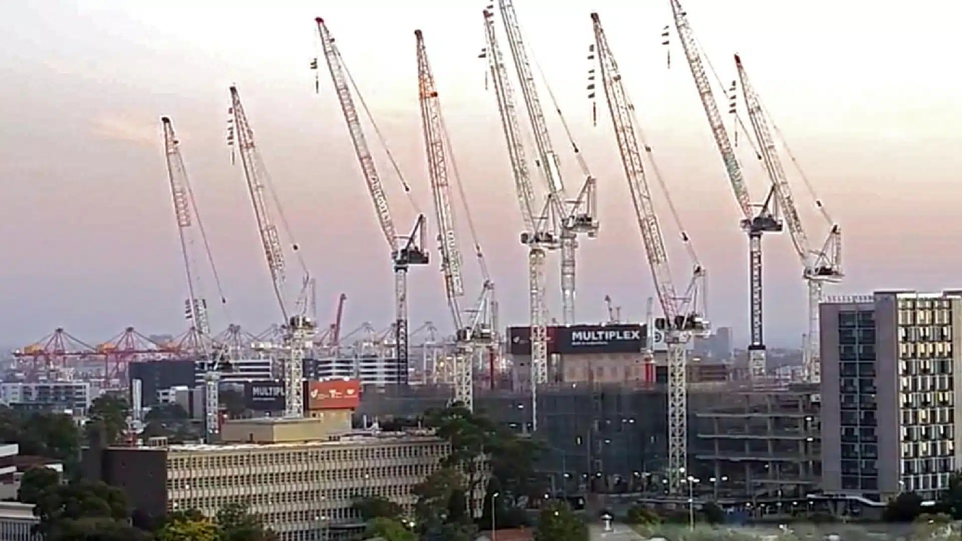
In the ever-evolving landscape of construction and surveying, technology has brought about transformative changes. The integration of advancements such as GPS, microprocessors, drones, laser scanning, and the Internet of Things (IoT) has significantly streamlined operations for project managers, builders, surveyors, and engineers within the Architecture, Engineering, and Construction (AEC) sectors.
One pivotal aspect of the construction process is the assessment and monitoring of construction sites. This critical phase provides essential insights, especially during the pre-construction stage, enabling site engineers to gain a comprehensive understanding of site topography, soil conditions, features, and terrain.
Historically, the manual and traditional methods for site assessment demanded extensive time and effort, often spanning days to collect essential data for feasibility and site condition analysis. Today, leveraging GPS technology, drones, satellite data, LiDAR, and Geographic Information Systems (GIS), this process has been accelerated to mere hours, yielding invaluable site information.
As experts in surveying and geospatial analysis, we frequently encounter queries about construction site assessments and associated costs. We recommend scheduling a consultation to gain a precise understanding of the benefits, procedure, and expenses linked to construction site assessment and monitoring. Each project possesses unique requisites and budget considerations, thus warranting a tailored consultation for accurate guidance.
Our professional team arranges discovery calls and site visits to extract pertinent project insights. Noteworthy factors influencing construction site assessment costs encompass:
Table of Contents
Pricing packages to suit your business
Plans with inclusions for Drone Inspection, Land Surveying, 3D Laser Scanning, Drone Photography & Videography. Get custom quote for your specific requirement.
What is construction site assessment and monitoring?
Construction site assessment, also referred to as site feasibility studies, encompasses the collection of site dimensions, topography, soil conditions, and more. This includes conducting feature and level surveys, yielding essential data for site and building plans, town planning applications, council permits, and architectural designs.
Construction monitoring
Throughout each construction phase, monitoring plays a pivotal role. During pre-construction, surveys offer insights into terrain, site characteristics, and elevations. Throughout construction, monitoring facilitates project oversight, resource management, and early identification of design or construction challenges, ultimately minimizing costly rework. Key functions encompass:
Tracking construction progress and milestones.
Detecting potential issues, limitations, and errors.
Ensuring adherence to project schedules.
Validating contractor work for payment.
Ensuring site safety and regulatory compliance.
Optimizing material, access, and storage planning.
Verifying asset maintenance and storage conditions.
A few of our past projects from our years of experience of working with 100+ clients in AEC Industry carrying out 3D Laser Scanning, modelling, volumetric calculations, aerial inspections, mapping & contour surveys, aerial land surveying, photomontage and much more.
With improvements in technology the way we conduct construction monitoring has completely changed and are a vast improvement on other traditional methods. Here are some benefits of using our solutions for construction assessment and monitoring.
Data accuracy
Using our surveying and reality capture equipment provides a guarantee of accuracy standards and quality control. We work with the client to meet accuracy deliverables and ensure our data is aligned with existing survey and GiS datasets.
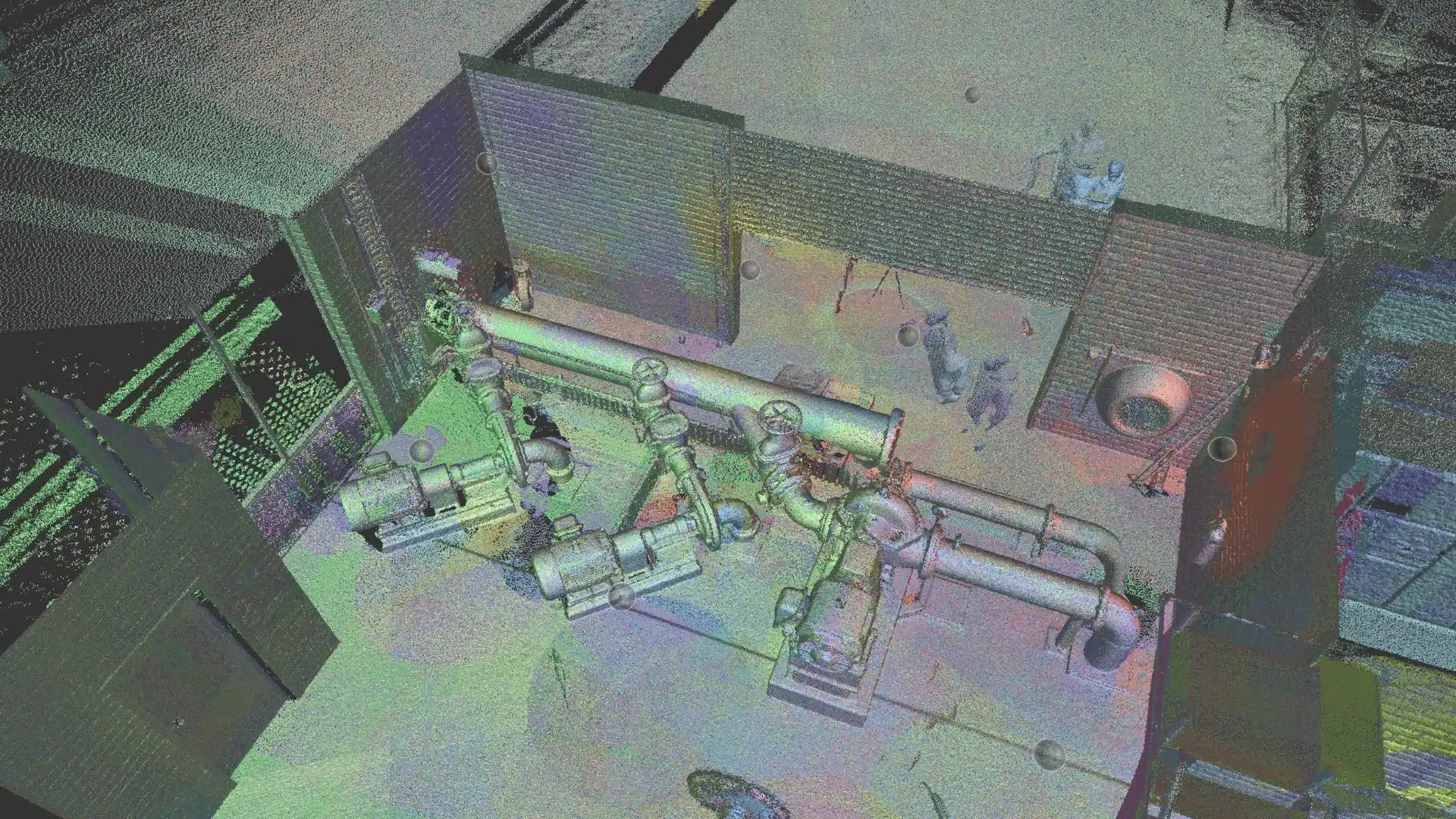
3D modelling and site visualisations
One of the biggest advantages of using our site monitoring is that our laser scanning and photogrammetric models can be converted into 3D visualisations. This can be a simple 2D map of the project or a more involved 360 virtual tour and site walk-through animation. At Avian, we help our clients generate engaging 3D sitemaps and models based on the data we gather in the field.
These 3D models can be used as crucial communications tools, safety and site inductions, communications and marketing materials or to inform potential investors, impress your clients and increase project support with interactive visual methods.
Quick results
Avian deploy a range of complementary technologies that allows us to conduct surveys of large construction projects and road/rail corridors in hours, rather than days avoiding the more traditional boots on the ground type of surveying.
This makes our surveys more efficient, safer and delivers more complete information about the construction project and it’s status. Our accuracy and data quality control are guaranteed to meet accuracy and data standards.
Have a custom requirement ?
Get a quick estimate for your specific project requirements with listed inclusions/exclusions.
Our construction monitoring is more cost effective due to the less time required onsite. You can collect all the site measurements and data in a single aerial survey and review the project in digital space to gather critical measurements and project information. This allows you to avoid the need to schedule repeated site visits to measure or assess the project or to determine the status of each component.
It is a far safer, affordable and faster way to measure aspects on the construction site than manual inspections.
Real-time data
Our construction monitoring and surveying services support project managers, engineers, project teams, and contractors by providing efficient project site assessment, project status and resource planning without requiring you to attend to multiple site visits. Furthermore, our site monitoring and progress updates enable early detection and resolution of construction or design errors. This demonstrates how Avian’s construction monitoring solutions can effectively save time and costs throughout your construction project.
Embracing modern technology, our solutions offer:
Exceptional data accuracy through advanced surveying tools.
Creation of detailed 3D models and visualizations.
Swift results, enabling efficient project monitoring.
Cost-effectiveness due to reduced onsite time.
Real-time project insights for timely decisions.
Reap the Rewards with Avian
If you’re seeking innovative, value-added construction services, contact Avian. Our team customises our solutions to your project’s specific requirements and business needs, ensuring success through advanced technology, cost savings, and streamlined operations. Experience the benefits of cutting-edge surveying and monitoring, revolutionizing the construction process.
Have a question for us ?
Our team is eagerly waiting to know about your queries. Please call us at the number below during business hours and our team will help you out.