High-Precision Land Surveying in Ballarat
Your trusted partner for land surveying in Ballarat, from Sovereign Hill to Lake Wendouree. Accurate site data is critical for every Ballarat project.
Our Comprehensive Land Surveying Services in Ballarat
Whether you need cadastral boundaries for a title transfer or a full topographical model for civil design, our land surveying service in Ballarat covers every requirement. We begin with a desktop analysis to review historical surveys and council overlays, then conduct an on-site reviewto determine the optimal mix of GNSS control, total station setups and additional survey tools. The result is a seamless workflow tailored to Ballarat’s geology, from Alfredton to Miners Rest.
Monitoring Surveys for Stability and Safety
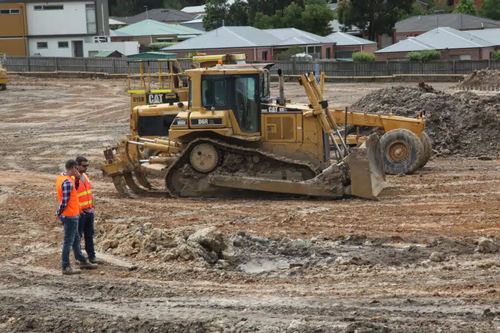
Construction sites, quarries and mines can experience settlement or ground movement over time. Our monitoring land surveys in Ballarat use repeated measurements, captured via GNSS rovers and terrestrial laser scanning, to detect millimetre-scale shifts.
Subdivision and Boundary Validation
When you subdivide rural or residential land, parcel lines are essential. In compliance with council regulations, we verify fences, adjoining properties and underground utilities, delivering certified boundary plans that stand up to legal scrutiny.
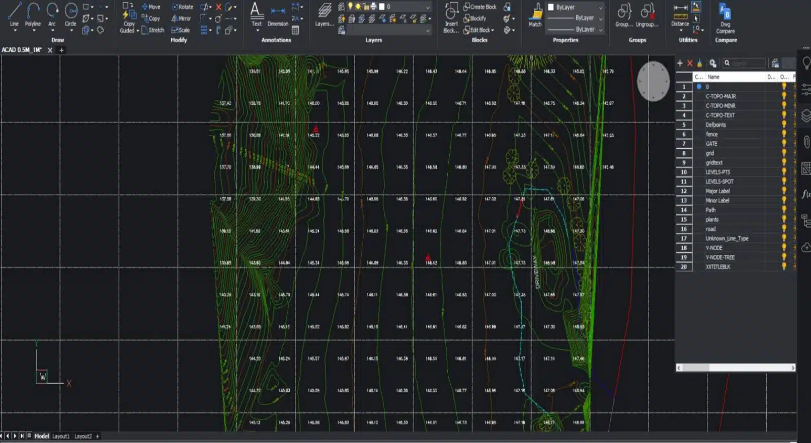
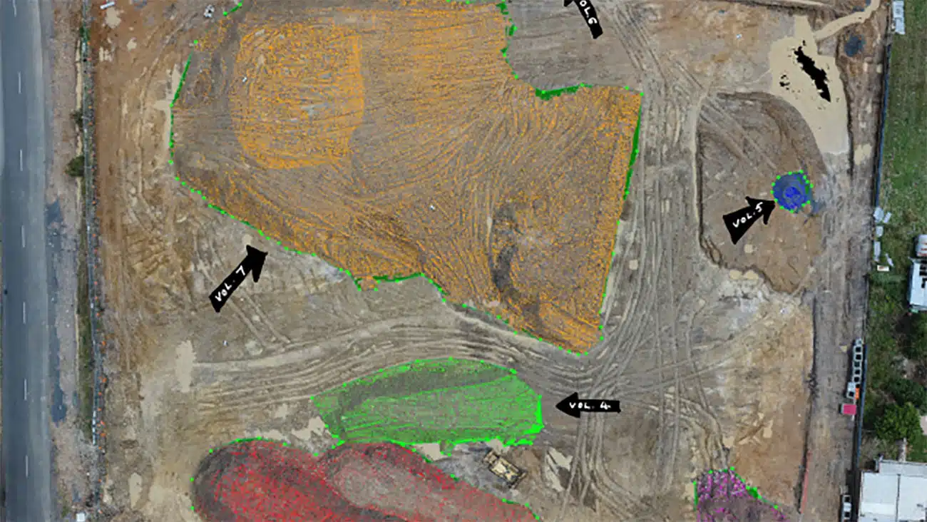
For large-scale developments, civil engineers need detailed elevation data. Using a combination of ground and drone surveying, we generate high-resolution topographical maps that highlight site volume, slope gradients and vegetation cover. These deliverables integrate directly into design platforms like CAD, Civil3D and MicroStation.
State-of-the-Art Land Surveying Techniques & Equipment in Ballarat
Cadastral Surveys | Quality Assured | Fast turnaround and reliable
We tailor our approach by considering: site access, terrain density, desired accuracy and final deliverables. Typical tools include:
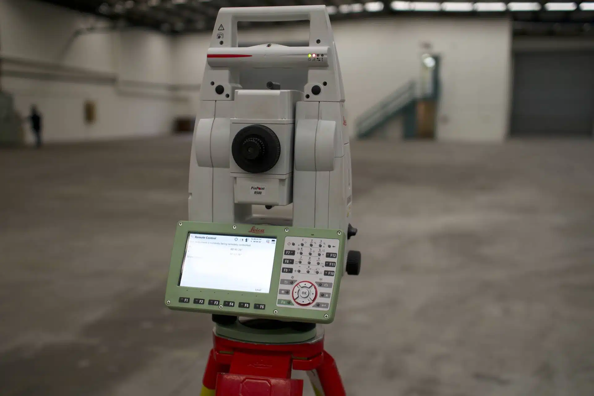
- Total Station & GNSS/RTK Rover for high-precision control points
- Enterprise Drones with LiDAR or photogrammetry cameras
- Markers, Tripods & Surveying Pegs for stable setups on sloping ground
- High-Capacity Data Storage and on-site redundancy to safeguard your data
Our process begins with a desktop review and site inspection. Then, we combine 3D laser scanning for architecture, engineering, construction with terrestrial surveys and airborne LiDAR to capture every detail.

Why Ballarat Needs Expert Land Surveyors
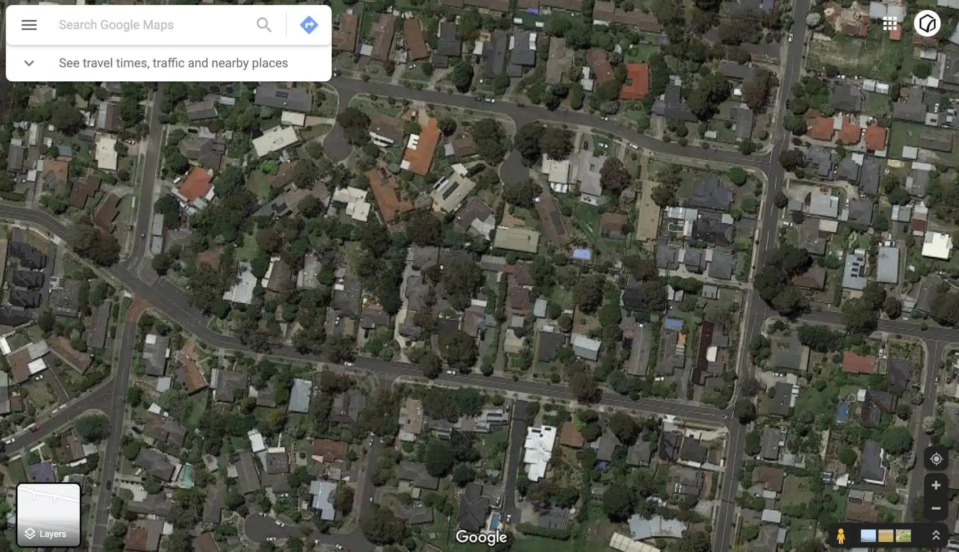
Ballarat’s rolling hills, historic streets like Sturt Street and varying elevations make precise measurements a challenge. Our local team understands these undulating landscapes and uses a blend of traditional techniques, drone surveying, and advanced 3D laser scanning to deliver reliable and repeatable results.

")

Land Surveying techniques for accurate site measurements
The land surveying equipment varies from project to project. Some other factors that affect this decision are:
- Survey accuracy levels
- Site access terrain and vegetation
- Deliverables requested and outcomes
- Where is the survey data used?
- What is the survey data used for?
A typical land surveying project would involve the following tools and platforms:
- A Surveying Total Station
- A GNSS/RTK Rover
- A drone and camera
- Markers and surveying pegs
- Tripods and stands
- High storage devices and memory cards
- Redundancy equipment
Our team of surveying experts conducts an initial site inspection to determine the workflow and methodology to apply to the area. Based on these insights, we use a combination of surveying, laser scanning and drone technology to capture the required measurements and observations efficiently while onsite.
State-of-the-Art Land Surveying Techniques & Equipment in Ballarat
Cadastral Surveys | Quality Assured | Fast turnaround and reliable
We tailor our approach by considering: site access, terrain density, desired accuracy and final deliverables. Typical tools include:
- Total Station & GNSS/RTK Rover for high-precision control points
- Compliant Enterprise Drones with LiDAR or photogrammetry cameras
- Markers, Tripods & Surveying Pegs for stable setups on sloping ground
- High-Capacity Data Storage and on-site redundancy to safeguard your data
Our process begins with a desktop review and site inspection. Then, we combine 3D laser scanning for architecture, engineering, construction with terrestrial surveys and airborne LiDAR to capture every detail.

Navigating Council Permits for Land Surveys in Ballarat
Before any construction, renovation or alteration on your property, it’s crucial to confirm local council requirements from Ballarat Council. For permit enquiries, contact the City of Ballarat:
Address: 25 Armstrong Street North, Ballarat VIC 3350
Phone: (03) 5320 5500
Website: www.ballarat.vic.gov.au
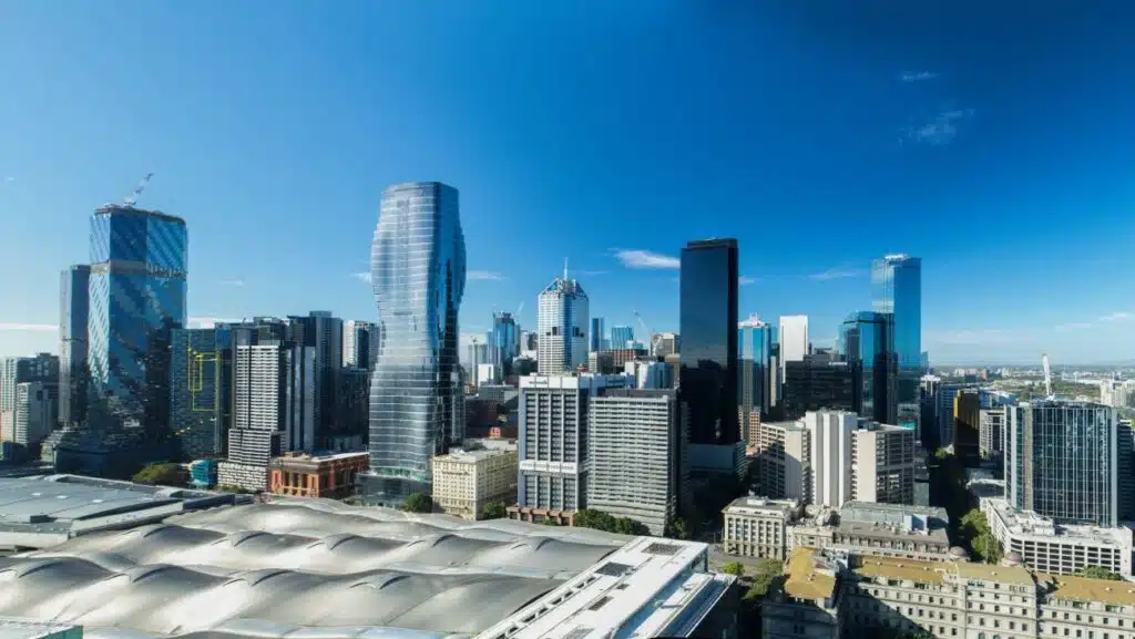
Servicing Ballarat and Beyond Across Victoria
While our core focus is land surveying in Ballarat, Avian’s reach extends throughout Victoria. From metropolitan projects in Melbourne’s inner suburbs to regional jobs, our land surveying service Ballarat team handles every assignment. Whether you need detailed land surveys in Ballarat or land surveys in Delacombe, Sebastopol and Wendouree.
Wherever your project is located, Avian delivers precision and reliability you can count on.
Ready to Elevate Your Ballarat Project?
Partner with Avian for precision land surveying across Ballarat, including our advanced 3D laser scanning services and seamless integration of point cloud scans. Whether you need a single boundary survey or a complex topographical model, our local team is here to help.
Contact Us Today to discuss your land surveying requirements and discover how our expertise can turn your site data into actionable insights.
Why Choose Avian’s Land Surveying Ballarat?
Local Expertise
Surveyors who understand regional geography, weather patterns and council processes.
Advanced Visualisation
Beyond 2D, we offer 360° virtual tours and photorealistic 3D renders for stakeholders.
Fast Turnaround
On-site teams deploy within hours to Alfredton, Cardigan Village and Soldiers Hill.
Safety & Compliance
All team members hold valid CWCs, RIWCs and are covered by $20 M public liability insurance.
Comprehensive Deliverables
2D plans, digital maps, 3D models and 3D scanning services in Melbourne, Sydney, Brisbane compatibility with CAD, Revit, Civil3D and MicroStation.
Capture, interpret and present site data with 3D visualisations
3D laser scanners, also known as LiDAR scanners save data as point clouds. These point clouds consist of millions of precise points which can be merged, manipulated, coloured and converted into different file formats.
The point cloud can be processed in CAD, BIM or visualisation applications depending on your unique project needs and outcomes.
From construction sites to warehouses and residential renovations, you can capture it all via our 3D laser scanning services in Melbourne, Sydney and Brisbane.
Here are a few advantages of 3D laser scanning:
- Quick and accurate site data capture
- Minimal disruptions onsite
- Eliminate revisits
- Easily detect issues and minimises risks
- Helps architects, engineers and designers identify design errors
- Provide accurate site conditions to contractors and fabricators
- Assists with asset management and condition
- Real-time site inspection and analysis
- Visualise real world data in 3D Space
Get in touch with our team at Avian 3D Laser Scanning and we’ll take your projects to the next level!
Our Land Surveying Projects
Popular Melbourne Metropolitan Area and Inner Suburbs We Cover
Contact the Avian today to discuss your land surveying project
FAQs for Avian's Land Surveying in Ballarat
We have answered some common questions AEC clients have about our land surveying services in Ballarat.
We recommend a cadastral survey, a feature-level survey and a topographical survey to understand boundaries, site levels and terrain.
Provide a project brief, any existing drawings and site access details. We’ll arrange an on-site consultation to refine the scope and methodology.
Yes, our building inspection services include ground-penetrating radar and laser scanning to locate buried services accurately.
We cover Ballarat Central, Ballarat North, Buninyong, Delacombe, Miners Rest, Alfredton, Soldiers Hill and beyond, plus regional quarries and farms.
Drones provide rapid terrain mapping and aerial imagery, reducing field time and increasing safety on uneven sites. They integrate seamlessly with our ground surveys for full 3D context.
Yes, if flying within 100 m of events or filming on council land. Contact the City of Ballarat at (03) 5320 5500 or visit their website for permit details.