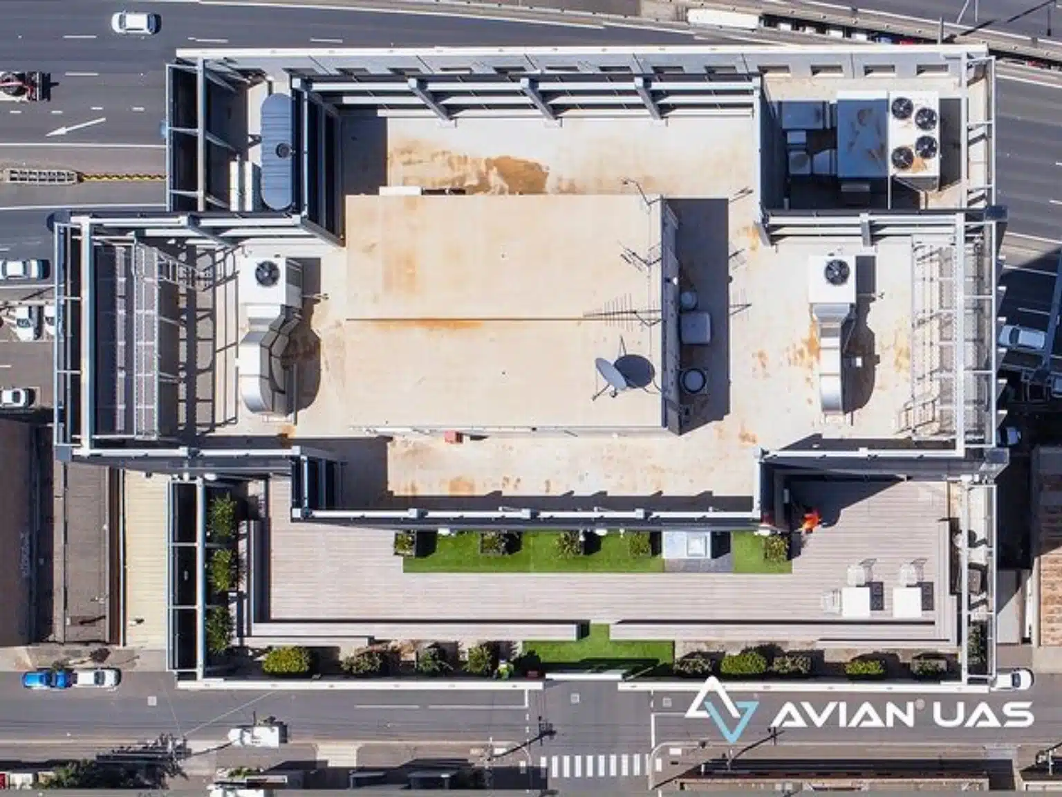
Aerial surveying using drones is a game changer for architecture, engineering and construction (AEC) companies. Every aerial survey and mapping project aims to collect site data and generate 2D or 3D maps and 3D digital models that fulfill the accuracy standards of both surveyors and engineers.
And as useful as drone technology is, there are some significant challenges and drone surveying mistakes in using UAVs for land surveying and mapping that people can get. Drone pilots and drone service companies have to overcome a range of issues that can affect the desired outcomes such as wind resistance, coordinate reference systems, datums, site accessibility, technical issues and more.
A report by ABC Australia reveals technical difficulties to be the number one cause behind drone crashes and on site accidents. The report further states that about 64% of civilian drone accidents were caused due to a technical fault and not operational errors. This data was collected by Dr. Wild from the RMIT School of Engineering using about 150 drone crash case studies that happened over the course of the past decade.
It’s quite common to hear from clients of drone incidents and crashes in Melbourne that resulted in near misses, destroyed equipment and potential serious damage.
A few of our past projects from our years of experience of working with 100+ clients in AEC Industry carrying out 3D Laser Scanning, modelling, volumetric calculations, aerial inspections, mapping & contour surveys, aerial land surveying, photomontage and much more.
So, what does technical fault exactly mean? Technical issues can be something as simple as lack of remaining battery, local radio signal or Wi-Fi interference to more serious errors like lost radio connection or failure/loss of GPS satellite connections.
A common misconception is that modern day drones are reliable and low risk. However, as any full-time drone services company will tell you, the more hours spent in the sky, the higher the chance of an incident or failure.
Either way, drone crashes can lead to some expensive and serious incidents, either on the job site, surrounding homes, roads and infrastructure causing significant damage to property and potentially loss of life. In Sydney, there has been a drone crash into a car on the busy Sydney Harbour Bridge that luckily didn’t result in a multi-vehicle crash or serious injury.
It is very important that anyone operating a drone, your employees and drone services company takes necessary precautions to prevent such incidents from happening on your project site.
Here are 5 potential causes of drone crashes and accidents that could cost AEC companies quite a fortune not to mention reputational damage!
Birds attacking drones
Drones can cover hundreds of acres in a matter of hours when compared to traditional land surveying methods that can take days or weeks for the same task. This is because drones don’t have to face the same kind of obstacles in the sky as a land surveyor would on land.
However, that doesn’t mean that drones are bird-proof. There are a lot of obstacles in the sky and at low altitudes (power lines, radio antennas, mobile towers) that the drone pilot has to smartly navigate around. Another more common type of obstacle is birds. Not only large predatory birds such as eagles, hawks and falcons don’t like drones but smaller crows, ravens and magpies also attack the drone in mid air.
This can lead to sudden crashes, loss of network connection and expensive damages to the camera equipment.
Pricing packages to suit your business
Plans with inclusions for Drone Inspection, Land Surveying, 3D Laser Scanning, Drone Photography & Videography. Get custom quote for your specific requirement.
A construction site is quite a dangerous place to fly a drone. There are many obstacles, distractions and radio interferences that can affect the drone and its radio connection. Basically, there are many places where you can crash the drone, leading to losses and embarrassment for the company.
Drone operators often try to fly the drone as close to the construction site or the building as possible. This allows them to take accurate, crystal clear images of the areas of interest.
However, a slight mistake and you could possibly endanger the life of workers or other people on site.
A recent incident (January 15th 2021) reported a commercial DJI Inspire 2 drone crashing into a high rise building in Sydney leading to one person getting insured.
The drone operator worked for Sky Monkey, a drone surveying company that has refused to comment on the situation. The investigation is still underway and it’s unclear if it was a technical fault or an operational error.
Flying the drone on a windy day
A sunny day with clear skies is the best opportunity to fly the drone. This is because clear skies offer maximum visibility and access to the drone. The drone operator can easily track the UAV in the sky and maneuver it accordingly.
Windy days or rainy days can cause loss of control leading to drone crashes, loss of crucial drone footage and even damaging expensive camera equipment. The video footage below shows a drone crash during a terrain mapping project.
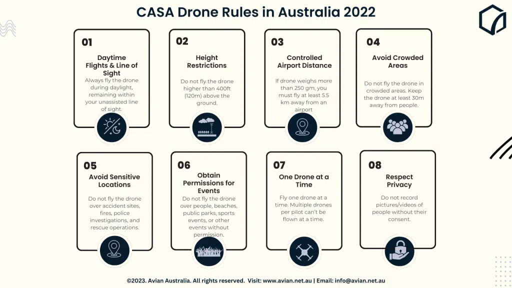
Not adhering to CASA drone rules
The Civil Aviation Safety Authority or CASA is a government body in Australia that supervises all aviation related operations in the area. This includes both commercial and recreational drone flights all across the country.
A drone pilot has to undergo mandatory training and obtain a drone pilot license from CASA before they can fly drones.
And other than that, drone pilots also have to adhere to a set of regulations to ensure flight safety and prevent any accidents.
Failure to comply with the drone regulations can lead to heavy fines or even legal hassles for the drone operator. CASA drone regulations list down some basic practices that would protect both the drone on air and the people underneath on the ground.
Drone crashes due to battery/power issues
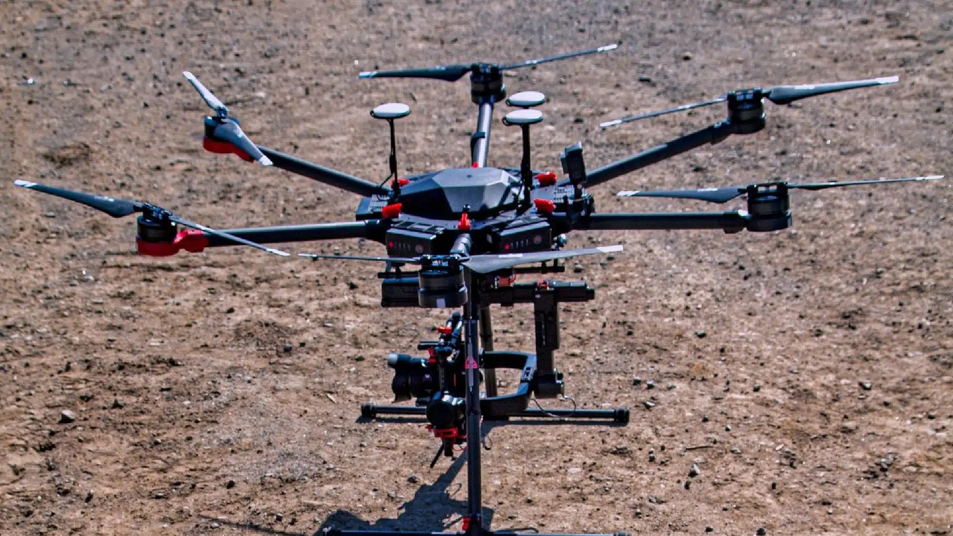
One of the biggest mistakes that drone operators commit is not checking the drones before the flight. I always recommend drone pilots to conduct a thorough inspection of the drone and camera equipment before every flight.
You can detect any battery issues or faulty connection in the drone before flight. Drone run on lithium batteries which are combustible and can lead to sparks and even a full fledged fire.
Check and recheck the drone battery to see if it shows any signs of leakage, discoloration or bulging. They’re all signs of a faulty battery that you must change immediately.
How to prevent drone crashes
Now that we have learned all about drone accidents and what causes them, let us look at some preventive measures we take in each of our drone surveying projects.
Get licensed!
Getting a CASA drone license is mandatory for anyone who wants to fly the drone in the country.
All the drone pilots and surveyors at Avian hold a CASA license and are well aware of the regular updates in CASA regulations.
Our AEC experts also have the necessary CWCs or construction white cards that permit them to work in construction sites.
Have a custom requirement ?
Get a quick estimate for your specific project requirements with listed inclusions/exclusions.
I always recommend drone pilots to conduct a test run for the drone before the actual survey. This preliminary check ensures that the drone and other camera equipment is in working condition and that there are no technical faults that need to be resolved now.
Inspect the drone and camera equipment
Our team of drone operators ensure that everything’s in order before they begin the drone survey. This includes a mandatory preliminary check of all the surveying equipment.
We check and recheck 3D laser scanning equipment, drones and other surveying apparatus for any breakage and battery leakages. Plus, we also ensure that there is ample space in the memory card to record all the drone footage.
Hire commercial drone experts with comprehensive insurance
Commercial drone insurance covers any damages done by the drone and to the drone. There are two types of drone insurance policies that you can opt for.
Public liability insurance that covers any third party claims of property damage or injuries caused by the drone. Do check if the cover is appropriate for your project site.
Hull insurance which covers damages done to the drone when it crashed on the site.
At Avian, we provide $20m workcover insurance coverage to clients. This insurance covers these damages on your behalf and also provinces compensation to workers in case they’re injured during on site drone operations
Check the weather report
We prefer to fly drones only on days when the skies are clear and there is no sign of any rain. This is because flying drones on windy and rainy days would not yield accurate results. Plus,there is a risk of damaging the camera equipment, leading to heavy losses.
At Avian, we always keep an eye on the weather forecast before planning construction drone services and projects for the day.
Obtain proper permits/permissions
At Avian, our team is not just certified to fly drones but also hold ample expertise over the AEC sector.
We can guide you to apply for any other licenses or permits you might need to fly the drone over the location. Certain areas in Australia such as private properties, military bases, naval bases etc. are off limits for drones unless you have special permission.
Avoid crowded places
CASA has certain practical drone regulations that apply to both commercial and recreational drone pilots.
One of the major regulations that CASA stresses upon is: “Avoid crowded places, public parks, beaches, concerts etc.” This reduces the risk of drone crashes and any injuries that might incur because of it.
Flying the drones too high in the air could result in loss of radio transmission.
Our drone experts ensure that the drones stay in their line of vision and fly no more than 400ft from the ground level.
Hire professional drone surveyors
One of the first things I would recommend to AEC companies is to hire a professional drone operator for all your on site land surveying and 3D visualisation activities.
Professional surveyors have years of experience dealing with any on site emergencies. Plus, they can handle drones much better than less experienced drone amateurs, reducing the scope for human errors.
Avian Australia is a reliable land surveying company that offers 3D laser scanning, aerial asset management, site inspection services to AEC companies.
Feel free to contact us in case you need professional drone surveyors for a project in the future.
Have a question for us ?
Our team is eagerly waiting to know about your queries. Please call us at the number below during business hours and our team will help you out.