High Accuracy 3D Laser Scanning services in Sydney
Are you seeking high-precision 3D scanning laser services in Sydney? Avian Australia has you covered.
Accurate 3D Scanning for Quick, High-Quality Point Cloud Data
Our 3D scanning and laser scanning services in Sydney employ cutting-edge technology for on-site scanning, ensuring quick and precise data capture for point clouds. Whether it’s exterior or interior scanning of buildings, bridges, or roads, we’re your go-to partner for 3d scanning services in Melbourne, Sydney and Brisbane.
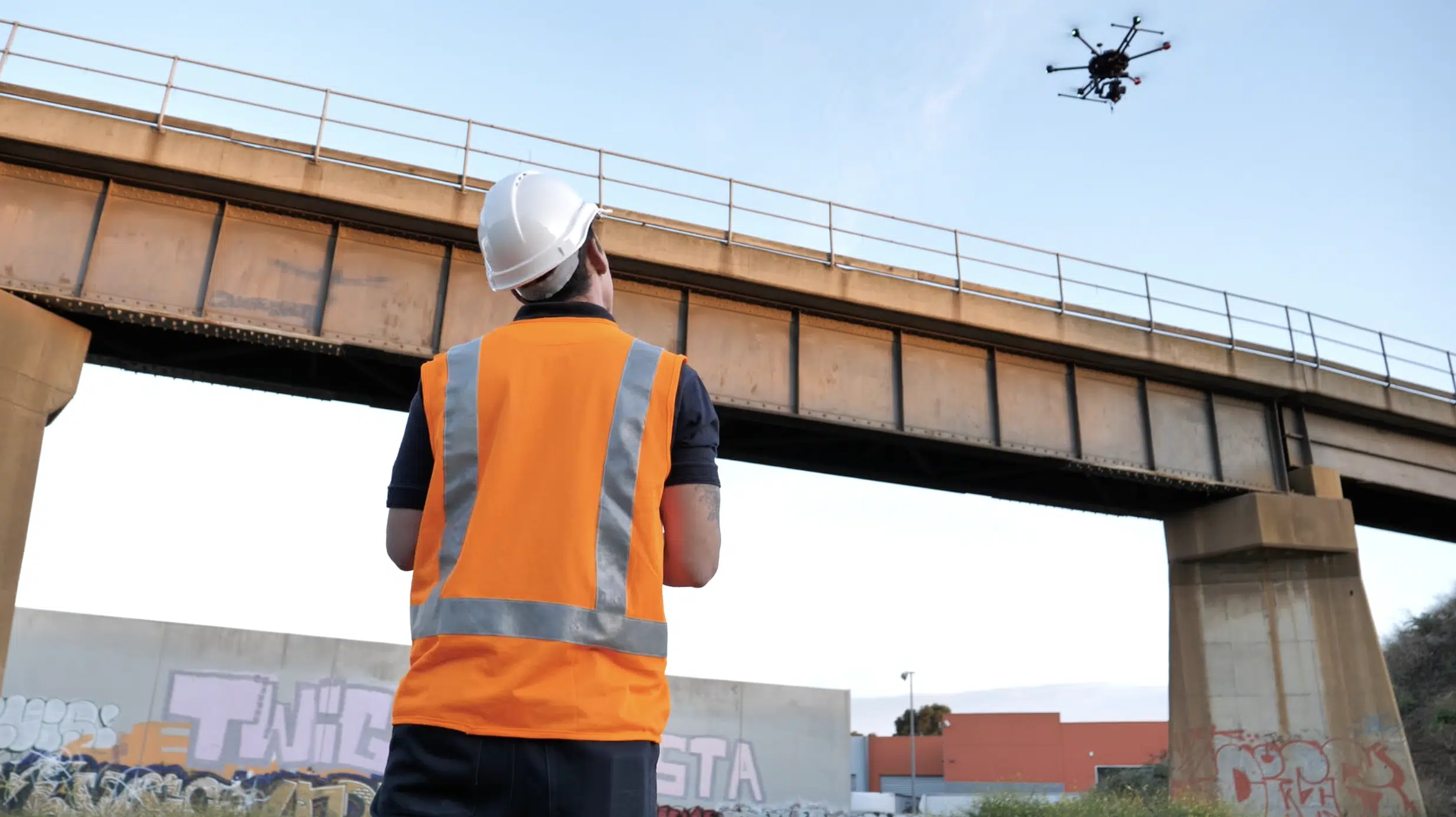
On-site scanning
We use advanced 3D laser scanning technology to record detailed spatial data on-site, capturing both internal and external features of buildings, infrastructure, and roadways with precision.
LiDAR surveying
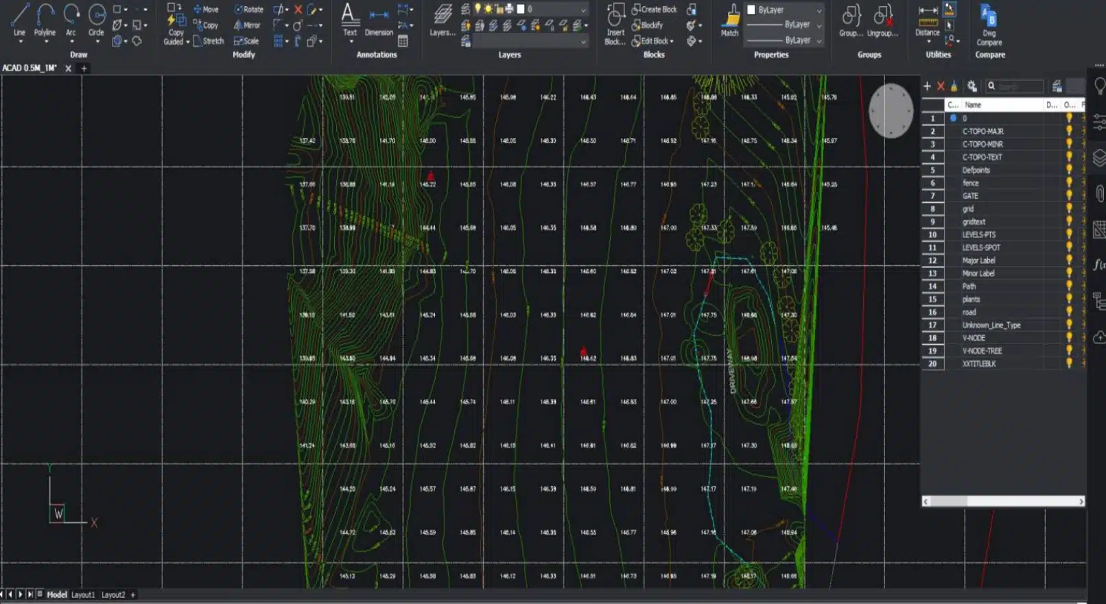
Measure site dimensions, elevation changes, and surface contours with LiDAR. We convert raw scan data into point clouds and 3D models, providing a digital representation of the physical environment.
CAD and Revit Models
Our team transforms scan data into usable CAD drawings and Revit models, ideal for planning, analysis, or project documentation. We also provide 2D site plans and elevations when required.
Delivering As-Built 3D Surveys, Existing Conditions & Structural Analysis via 3D Laser Scanning in Sydney
Need for 3D Scanning in Sydney
3D scanning involves capturing real-world structures using laser-based technology, which measures the exact dimensions, surfaces, and geometries of built environments. The data is then processed into highly accurate 3D digital models.
At Avian, we specialise in delivering reliable 3D laser scanning in Sydney to architects, engineers, and construction professionals undertaking commercial projects. Our capabilities include:
- Generating accurate and detailed 3D models
- Civil project inspections and assessments
- Evaluating plant layouts and machinery installations
- Supporting renovation and refurbishment planning
- Monitoring site conditions, elevations, and terrain
- Detecting and managing structural defects
Read more about the benefits and pitfalls of 3D laser scanning here
If you are working on a project outside of Sydney or NSW, we also offer
3D scanning (including laser scanning and surveying) in Brisbane and Melbourne.


Scan to BIM

Scan to Plan

Why Use High-Definition 3D Surveying for Sydney Projects?
LiDAR (3D laser) scanners collect millions of precise measurements, storing them as point clouds – a dense collection of spatial data points. These can be edited, colourised, and exported into various formats to suit your project requirements.
Whether you’re working in CAD, BIM, or visualisation platforms, the point cloud data can be tailored to meet your specific deliverables.
Our Sydney 3D point cloud survey services are suitable for a wide range of applications, from large-scale construction projects and industrial facilities to home renovations.
Some of the advantages of our 3D surveying in Sydney include:
- Quick and easy site data collection
- Minimum disruptions onsite
- Eliminate revisits
- Easily detect issues and minimises risks
- Helps architects identify design errors
- Assists with assessing existing conditions
- Real-time worksite inspections
- Visualize and manipulate real-world data in 3D Space
Get in touch with our team at Avian about 3D Laser Scanning and we’ll take your project to the next level!
Scan to Model
Lorem ipsum dolor sit amet, consectetur adipiscing elit. Ut elit tellus, luctus nec ullamcorper mattis, pulvinar dapibus leo.
Other Services in Sydney by Avian Australia
Land Surveying
we offer a variety of services to assist with land surveying in Sydney. We utilize a combination of surveying, geospatial, laser scanning, and reality capture methods to accurately record and digitize the real world.
Architectural 3D Rendering
we provide architectural 3D rendering services around Sydney to help architects showcase their designs and concepts in a visually appealing and immersive manner.
Drone Photography
we specialize in utilizing drone technology for various applications, including drone photography in Sydney. This allows us to provide clients with high-quality images of their project sites from a unique perspective.
LiDAR Surveying for Site Volume and Topography
LiDAR surveying is an effective method for determining site volume and topography. By using airborne LiDAR technology, we can collect detailed data on the natural surface of a site, including vegetation, terrain, and ground elevations. This information is crucial for various purposes such as construction planning, town planning, and environmental assessments.
Sometimes, it is simply not possible to manually measure and map the construction site – a practice that a lot of the construction industry still stubbornly follows.
Fortunately, many construction companies are slowly coming around, incorporating new technologies such as digital sensors, drone tech, cloud computing etc. to their projects.
3D laser scanning companies in Australia and the world over now use LiDAR scanning technology to reduce onsite risks by automating the surveying process. You don’t need to send workers to walk the construction site or enter confined spaces like underground pipelines for maintenance work anymore – the 3D laser scanner gets the job done without risk to staff.
With LiDAR scanners, we can capture precise measurements and create classified point clouds that represent the site’s topographical details. These point clouds can then be transferred to a BIM (Business Information Model) where 2D images are converted into accurate 3D models.
The advantages of using aerial LiDAR surveying include its ability to provide comprehensive and detailed information about a site. It saves time and effort by quickly capturing large areas, and it helps determine the volume of the site that needs to be cleared and the equipment required. This technology enables more accurate planning and assessment, leading to improved project outcomes.
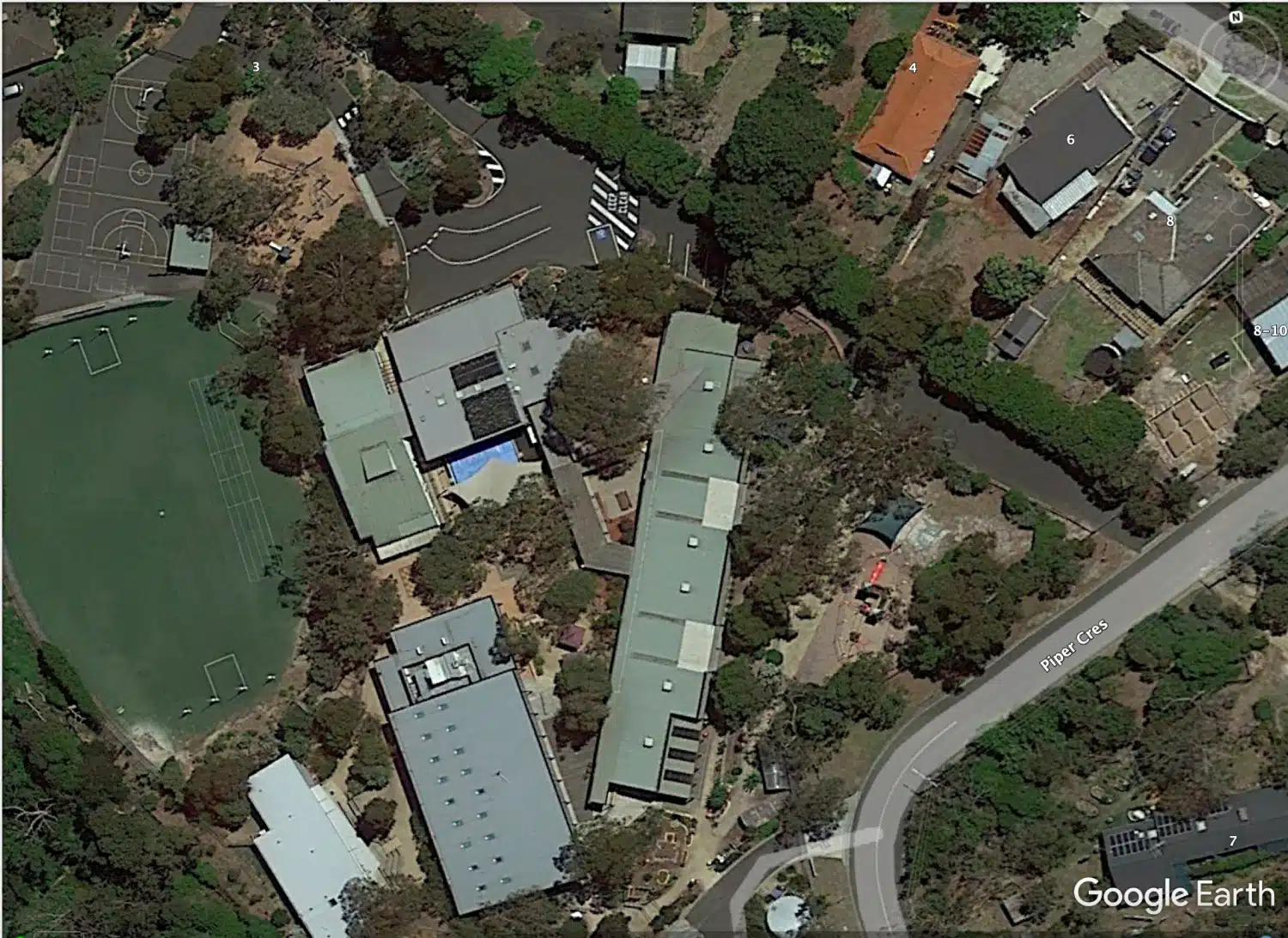
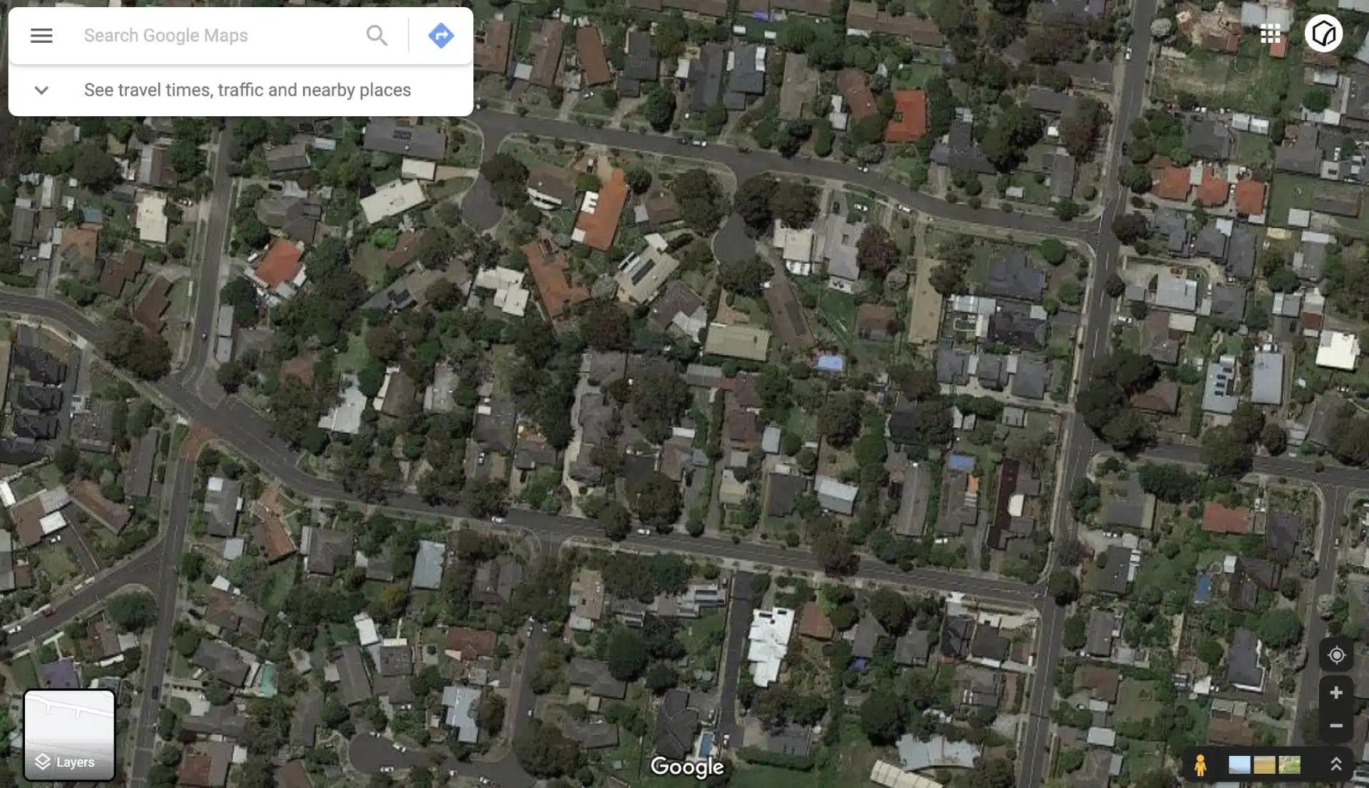
Our 3D Laser Scanning Projects in Sydney
The Benefits of Partnering with Avian
Robust Insurance Coverage
We protect every project with comprehensive commercial insurance, including $20 million in public liability, WorkCover, and professional indemnity coverage up to $1 million.
Advanced 3D Visualisation
Our expert data processing team transforms scan data into detailed 3D Revit models, terrain maps, and geospatial outputs using cutting-edge photogrammetry and modelling software.
Commitment to Safety
Our strict Safe Work Methods guarantee that certified personnel with Construction White Cards (CWC) and Rail Industry Worker Cards (RIWC) are on-site, even at complex rail or large-scale construction environments.
Seamless Workflow Integration
We ensure all 3D models and point clouds are fully compatible with GIS, BIM, and other industry-standard platforms.
Precision and Quality
Our Melbourne-based 3D laser scanning specialists in Sydney use advanced surveying techniques and top-tier equipment to deliver highly accurate and reliable data every time.
Statewide Service Across NSW
We provide rapid deployment for projects across Sydney and surrounding suburbs within hours, and service rural locations promptly within days.
Our Office in Sydney
FAQs About 3D Scanning Services Sydney
We have answered some common questions AEC clients have about 3D laser scanning services in Sydney
For architecture, engineering, and construction projects in Sydney, hiring a 3D laser scanning technician typically ranges between $1600 and $2200 per visit. This price covers on-site data capture. For a detailed breakdown of pricing and factors affecting costs, you can explore our comprehensive laser scanning cost guide for Australia.
Scanning the interior and exterior of large commercial properties, like warehouses, generally takes one to two days, depending on the building’s size and complexity. More intricate spaces, such as multiple rooms or detailed HVAC systems, may require additional time.
For a real-world example, see our case study of a commercial warehouse scan, highlighting the workflow and advantages.
3D Revit models offer superior precision in the design and construction phases, benefiting from exact measurements derived from laser scanning. Additionally, Revit allows for efficient extraction of 2D drawings from the 3D model, enhancing accuracy and productivity.
We produce a wide array of drawings, including floor plans, reflected ceiling plans, elevations, sections, as-built updates, BIM models, and asset management documentation, catering to diverse project needs.
3D scanning services in Sydney are becoming increasingly popular among AEC professionals. They are popularly searched on Google with the search strong “3D scanning sydney”. This is because LiDARs offer better accuracy and convenience when compared to the traditional land surveying methods.
At Avian, we employ a comprehensive and strict quality management process:
- Our team of AEC professionals and land surveyors is experienced in surveying and laser scanning and understands the common pitfalls in this type of work.
- Using reliable and industry-leading scanning and surveying equipment and workflows.
- Quality control gateways of all data at key stages: acquisition, pre and post-processing and bespoke client reporting.
Sydney’s AEC professionals prefer 3D scanning for its accuracy and efficiency over traditional surveying. At Avian, we maintain strict quality protocols by:
- Employing experienced surveyors familiar with scanning challenges
- Using top-tier scanning and surveying equipment
- Implementing rigorous quality checks during data collection, processing, and reporting tailored to client requirements.
3D scanning has revolutionised construction projects across Sydney and NSW. Our land surveyors use 3D laser scanning to accurately measure site conditions, calculate volumes, monitor progress, and create detailed site plans showing features, levels and breaklines.
During the build phase, interior 3D scanning supports BIM modelling, design verification, and updating of site drawings. This is invaluable for project managers and contractors working to tight deadlines, ensuring they have precise site data and up-to-date construction monitoring.
For more insights, check out our blog on the role of How 3D laser scanning is used in construction.
We securely deliver 3D models and drawings via our cloud platform, customised to your preferred file format. In Sydney, scans are collected as point clouds and converted into 3D models using BIM or CAD software. We commonly provide files compatible with Revit and AutoCAD, as well as Microstation, Civil 3D and ArchiCAD.
Our outputs are designed to integrate smoothly with your existing software and workflows.
To prepare an accurate quote, we ask clients to share a project brief along with any relevant supporting materials, such as drawings or sketches outlining the specific surveys required. We typically request these details when you book a consultation with us.
Absolutely. 3D scanning is perfect for capturing detailed, non-contact measurements of heritage and historic structures. This technology supports restoration and conservation efforts by creating precise digital records and archives without risking damage to the original fabric.
3D laser scanning and surveying achieve millimetre-level precision and rapidly gather millions of data points. This results in far richer and more comprehensive datasets than traditional surveying, which often relies on limited, manual measurements.
Yes, 3D scanning is a fast, non-intrusive method that can be carefully scheduled around site activities to avoid disruption. Our team works closely with site managers to ensure the scanning process is safe and efficient, keeping projects running smoothly.
3D scanning is widely used in construction, architecture, civil engineering, manufacturing, heritage conservation, and facility management. Any sector requiring highly accurate spatial data or detailed as-built records can benefit from this technology.