Are you tired of hand drawing designs and blueprints only to have them rejected or redrawn over and over again? Have you ever considered how much time multiple site visits and a the measure up process costs the business? Do you want to upgrade your firm’s 2D designs to 3D modelling and bring the company into the present?
I have the perfect solution for you.
Table of Contents
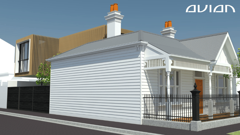
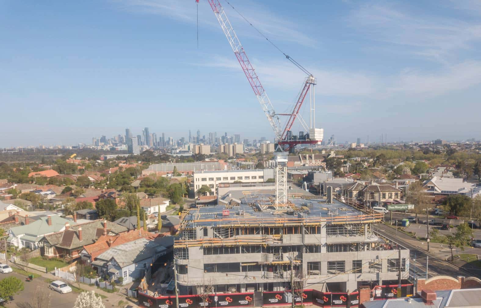
Our Project Portfolio
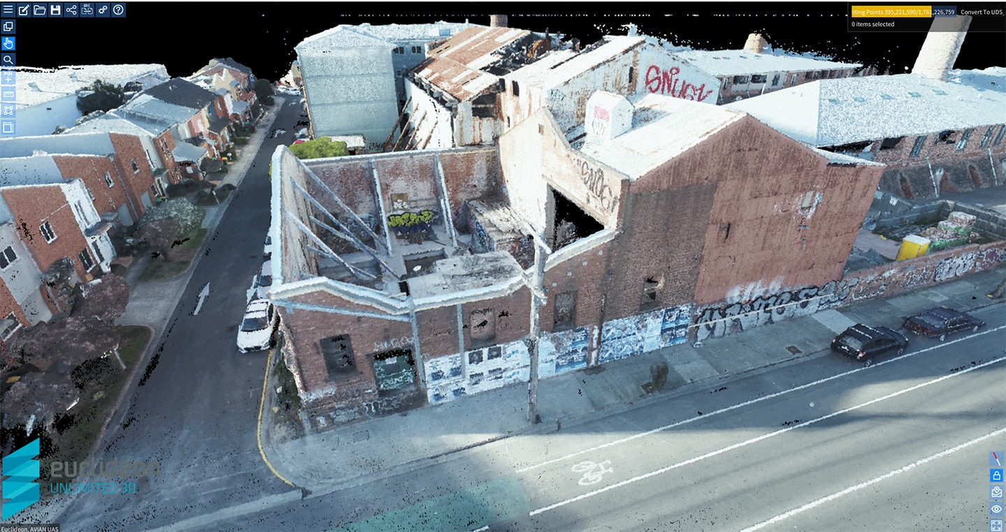
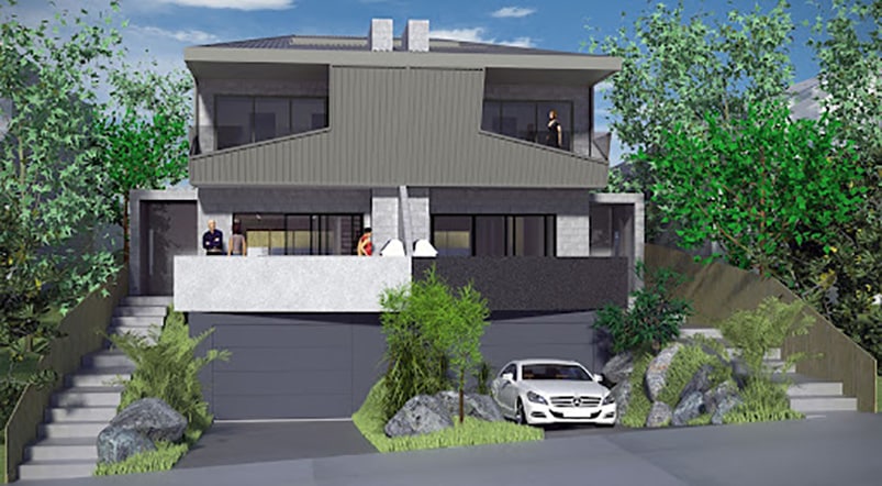
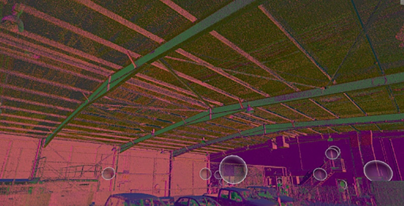
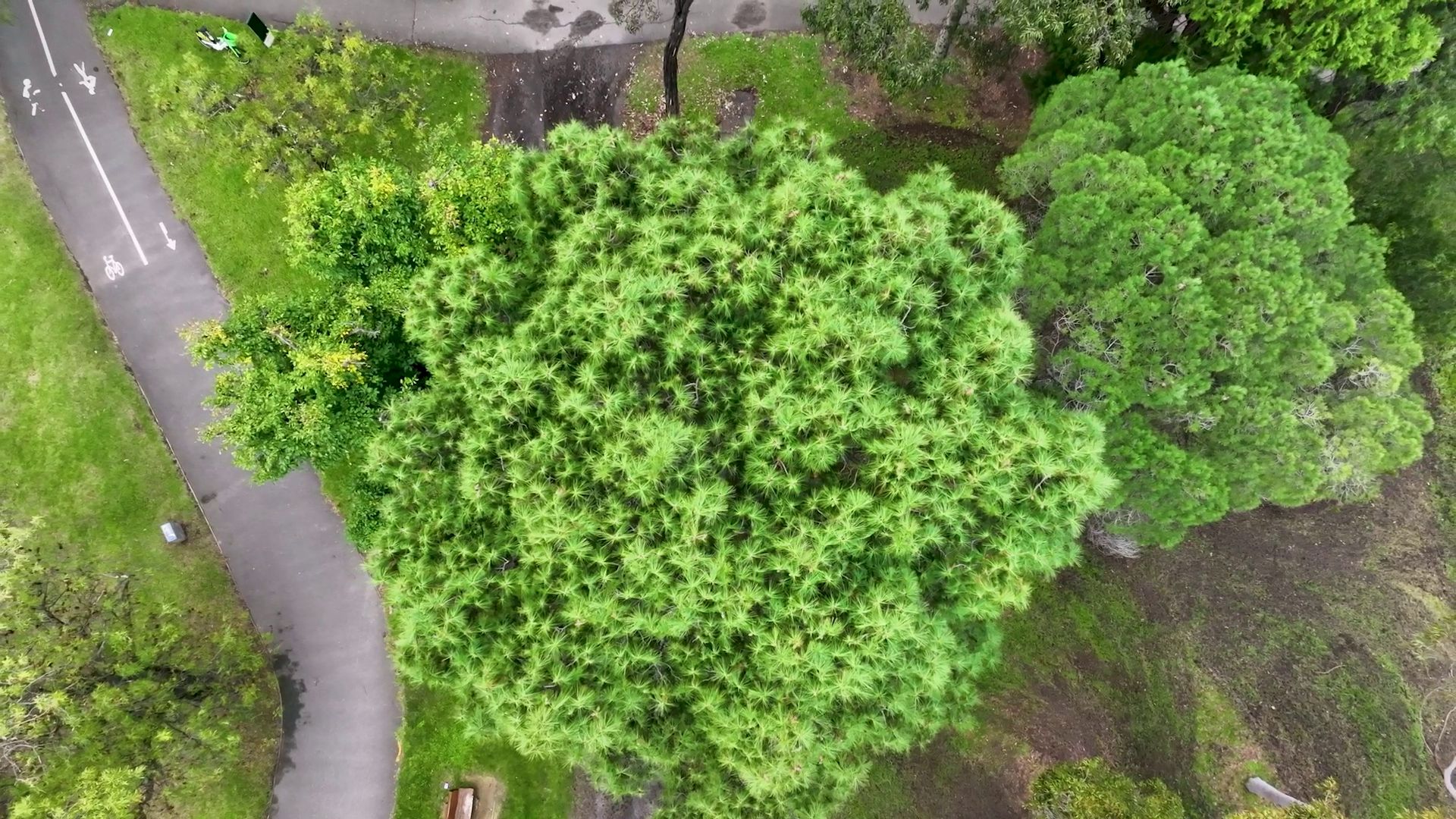
A few of our past projects from our years of experience of working with 100+ clients in AEC Industry carrying out 3D Laser Scanning, modelling, volumetric calculations, aerial inspections, mapping & contour surveys, aerial land surveying, photomontage and much more.
Let’s talk about digital visualisationand how architects make building 3D models by using laser scanning.
If you are an engineer or architect in Australia, I’m sure you’re familiar with 3D modelling and 3D architectural visualisation.
By using building 3D models expedites the design process and makes your design proposal easier to visualize and present. It’s a great way to plan, simulate and present new ideas and these models help pitch your designs to potential investors and gain approval for a project from clients and stakeholders.
These models assist you every step of the way, from conception to the project presentation and on-site construction. Read on to learn more about 3D modelling in architecture and how architects make the best use of this innovative technology in their projects. Cutting edge drone technology is also fast changing the architecture industry with applications which are both cost saving and more accurate than traditional methods of surveying.
Types of Architectural Models
There are various types of 3D architectural models that you can pick from depending on your specific design requirements. The main purpose of these models is to create a clear visual picture for the clients, so that they can actually understand what the project is all about.
Many people don’t have the ability to easily visualize a 2D drawing into the 3D world.
Plus why make it difficult to imagine your vision?
In addition, 3D terrestrial laser scanning is crucial for accurate building 3d model information and creating a baseline reference frame for architects, engineers and site contractors
3D architectural models: 3D architectural models are created in 3D modeling software (Revit, ArchiCAD). These building 3D models convert the point cloud or 2D designs into 3D models wherein you can gauge the shape, height, size etc of the as built space.
3D printed architectural models: 3D printed models are similar to 3D architectural models. The only difference is, 3D printed models are printed using 3D printers to create a miniature version of the building to provide a physical, 3D built-to-scale representation of your design.
Sketched 3D architectural models: These are basically hand drawn 3D models of buildings that architects make on paper. The handmade designs are part of the conceptualization stage and add a personal touch to the project
What Is the Purpose of Architectural Models?
With 3D architectural models, you save a lot of time and money. The design process is expedited, the baseline reference frame is accurate and you can move through the building in 3D space.
Plus, it also makes your designs come to life.
There are different types of architectural models that are used in different stages of the design planning process.
The concept model for instance is the rough draft that architects usually hand draw on paper when brainstorming the building design plan. This would be a very basic version of the building plan and later subject to lots of alterations and upgrades.
Pricing packages to suit your business
Plans with inclusions for Drone Inspection, Land Surveying, 3D Laser Scanning, Drone Photography & Videography. Get custom quote for your specific requirement.
Conceptual models give the architects some crucial inputs about the project, such as the location, site perimeters, height of the building, the number of floors, the shape/size of the building etc.
Based on the insights gathered from the concept model, the architects then create a working model for the project. This working model contains more design inputs and on-site insights about the project.
For this to be an accurate and efficient process, surveyors use laser scanning techniques to capture site data and process this data into usable models and site drawings and then send it across to the architect.
And finally, the working model is modified to prepare the final presentation model.
The presentation model is a miniature version of the building in virtual space. It helps the clients visualize exactly how the building is going to look on the ground or in a virtual walk-through of the building 3d model. This can be combined with architectural renders or visualisations for virtual walkthroughs and different views or perspectives.
How to Make an Architectural Concept Model
Now that you are aware of the different types of 3D architectural models, let’s check out some tips on how to create a concept model.
Accurate measurements
Get accurate measurements of the site and talk to the clients about where they want the building and its key features. For instance, if you are building a mall, you must know some basic details such as:
The size of the land
How big should the building be?
How many stores or storeys should the mall have
What would be the shape of the building
What would the exterior of the building look like
Where is the building located?
What building features are to be incorporated?
These insights are gathered during client consultation and on-site surveys. This is where 3D laser scanning comes into play.
With 3D laser scanners, surveyors capture the as-built structure from multiple angles both interior and exterior of the building and then reproduce them into building 3D models.
3D laser scanners capture site details with millimetre precision and replicate it as point cloud. This point cloud data is then validated and transferred to a CAD (Computer aided design) or BIM (Building Information Model) application software like AutoCAD, Revit or Civil 3D to generate 2D CAD plans or 3D models as digital replicas of the building.
Make 2D/3D prototypes
Once you have the point cloud containing important site dimensions and detail, you can proceed with creating multiple 2D/3D prototypes. These prototype models define the basic shape, size and structure of your design plan.
3D prototypes and concept models are more visually appealing, comprehensive and easier to understand. You can create these prototypes using either CAD or BIM applications.
Have a custom requirement ?
Get a quick estimate for your specific project requirements with listed inclusions/exclusions.
CAD or computer aided design is an application that converts 2D drawing to 3D models. The application uses a complex structure of algorithms for desired tasks.
With CAD software you can create 2D or 3D blueprints, concept models and accurate building prototypes. Architects can also customise the various elements of the design including colour palette, building shape, exterior/interior, decor, aspects etc.
BIM or Building Information Modelis another software application that architects use to create dynamic building 3D models. Here, you can not only work with the building 3D model prototype but also customise the environment, internal workings, structure, materials, lighting and much more.
Using BIM software, architects can easily collaborate with on-site contractors to detect and resolve all design related issues in real-time with a baseline set of blueprints.
Using the right methodology
Choosing the right equipment is only half the picture, as the surveying methodology behind how to validate the laser scan data to ensure its accuracy can result in costly errors in calculations. The surveyor or engineer should have in place a detailed methodology to ensure the provided results are within agreed accuracy tolerances.
A 3D laser scanner can make all the difference to your design process and plan. With the right equipment and methodology, you can get accurate measurements of the site details that would be impossible to manually measure to the same extent.
The difference is millions of laser points measured per second versus manually measuring 1 measurement per minute!
This abundance of accurate measurements allows you to confidently create precise 2D plans and 3D models of the site to inform key design elements and planning.
Add landscaping elements
And finally, a design is never created in isolation. As an architect you must also consider the neighbourhood and include elements such as nearby buildings, windows, property access, etc.
Adding nearby elements such as adjacent buildings, elevations and topographical features make your designs and 3D building models more realistic and useful.
Hire the best laser scanning experts in Australia
3D Building modelling and digital visualisation give your designs a much-needed edge over the competition. At Avian Australia, we have a team of surveying and laser scanning professionals to support your land surveying and laser scanning projects.
We also help architects replicate and visualise their designs to 3D models, walkthroughs, renders and more. We are experienced and well placed to support your 3D visualisation solutions. Contact us today to book a consultation!
Have a question for us ?
Our team is eagerly waiting to know about your queries. Please call us at the number below during business hours and our team will help you out.