The construction industry has made significant strides from its past practices, where manual inspections were relied upon by builders and construction managers for gathering site information.
Today, we are fortunate to have an array of cutting-edge technologies, such as GPS, laser scanners, drones, and other advanced tools, which facilitate efficient data gathering, management and communication of key activities, thereby expediting the construction process.
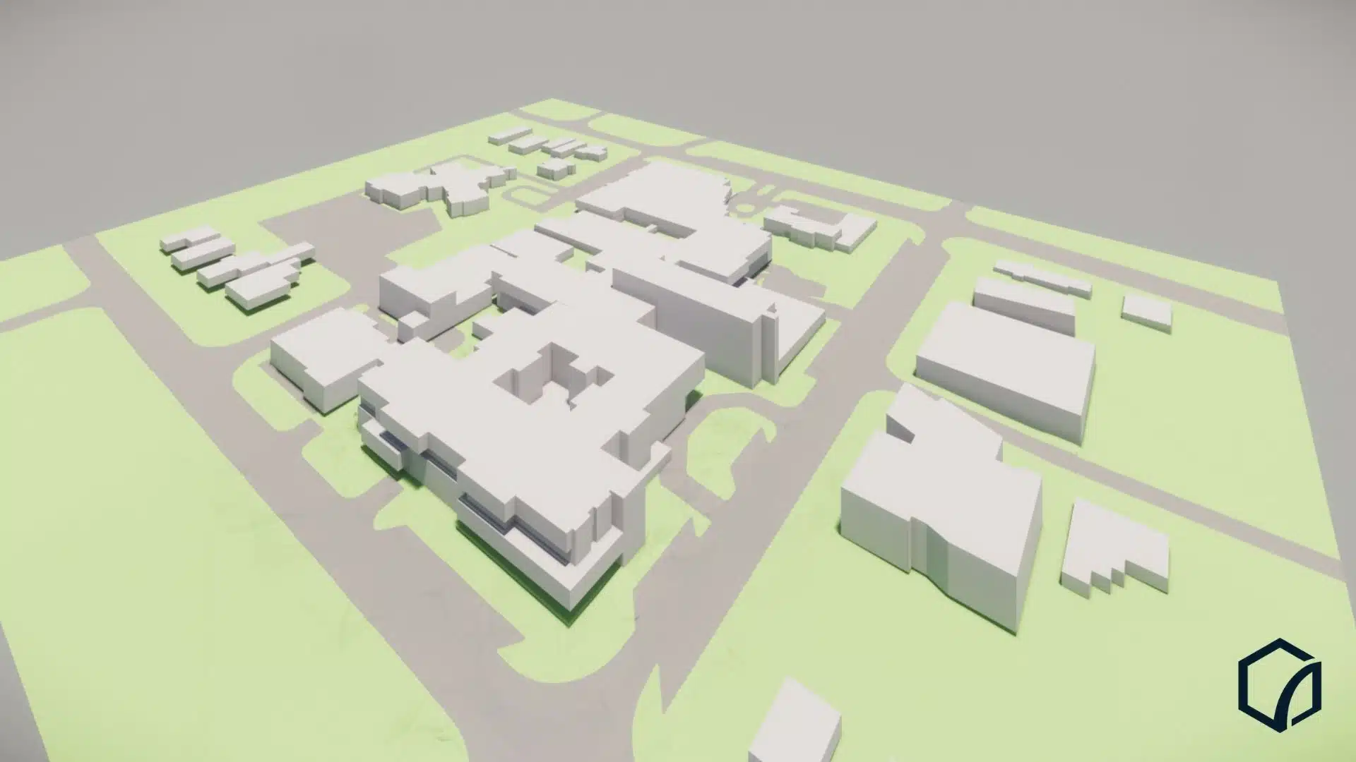
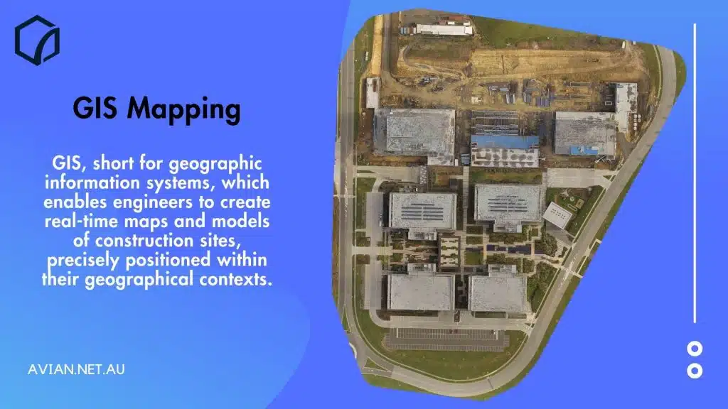
One of these ground breaking technologies is GIS, short for geographic information systems, which enables engineers to create real-time maps and models of construction sites, precisely positioned within their geographical contexts. By utilising GIS mapping services in Melbourne, professionals in the architecture, engineering, and construction (AEC) field can obtain accurate site data and ensure its proper alignment with the geographic surroundings.
GIS mapping services also provide invaluable insights into the geographical context and topography of the property. This valuable information plays a vital role in improving the overall construction plan, as site engineers and project managers can adjust the design, identify design or structural weaknesses, and implement necessary modifications at an early stage. This proactive approach saves them significant time, effort, and valuable resources.
Table of Contents
How is GIS data captured and used?
Maps serve as highly effective tools for presenting the topography of a site, offering AEC professionals a comprehensive understanding of the property and its surrounding neighbourhoods.
Taking it a step further, GIS mapping service providers leverage geographical information systems to enable engineers to swiftly generate data-centric maps with valuable insights.
These GIS maps play a significant role in the navigation apps we utilise on our smartphones. In fact, approximately 77% of the maps we encounter on our mobile devices are produced using GIS data capture technology.
The impact of GIS technology extends far beyond navigation, penetrating various sectors such as urban planning, asset management, construction design plans, and environmental analysis.
Now, let’s delve into the application of GIS mapping services in the AEC industries. A GIS map comprises five essential components:
- Vector data
- Raster data
- Terrain attributes
- Geographic coordinate system
- Georeferencing.
The combination of these components results in a comprehensive GIS map. Engineers can harness geospatial data across multiple sectors, including:
- Infrastructure management
- Land management
- Land reform
- Urban planning
GIS in mapping
GIS mapping process takes on a significant portion of the workload, assuming you possess the appropriate site data. It becomes considerably simpler to generate GIS maps when armed with precise site survey data.
Moreover, drone surveying proves to be one of the most efficient methods for conducting extensive surveys of large land areas. When conducting drone surveys, we employ GCPs or ground control points as reference markers on the ground. These GCPs enable accurate georeferencing of the project in its correct geographical location and by leveraging photogrammetry software, the resultant maps are corrected for distortions and errors, ensuring their positional and geometrical accuracy.
Some of the common types of GIS maps are:
A. Category maps
Category maps focus on a specific section of the property. With these maps, you can divide the site into categories depending on particular characteristics such as terrain, soil quality, vegetation etc. You can also apply different colours to these categories to identify them.
B. Heat maps
Heat maps are also known as quality maps. These maps are also colour-coded but are divided based on the numerical density, temperature or other metrics of the area. Heat maps are easier to interpret, and UX designers often use heat mapping software to create a better user experience for AEC professionals.
They are generated usually using drones equipped with thermal imaging cameras to help identify any temperature changes between the exterior and interior of the building. This can expose heat leakage and inadequate coverings that allow heat or cooling to escape the building. This can help architects design buildings which are energy efficient and hence play a key role in estimating the true cost of executing a aerial building inspection which includes heat maps.
C. Cluster maps
Cluster maps also function in a similar way to heat and category maps. These maps help on-site staff analyse specific sections of the site. Cluster maps are often used for property listings. It gives the viewer a comprehensive view of the neighbourhood and the street. With cluster maps, you can divide the area into subsections and focus on a particular cluster without zooming in.

GIS in data analysis
GIS maps simplify data analysis, making it easier for UX/UI designers to toggle between the different property sections using the GIS maps. However, that is not all; you can stack multiple GIS maps to create a complete picture of the building, subject site and surrounding areas.
Designers can also use GIS maps to create 3D maps, animations and other visualisations such as satellite views, street views, 3D street maps and terrain views.
GIS for spatial analysis
The human eye possesses the ability to swiftly discern various colours and shapes. GIS mapping services aid in partitioning an area into distinct colour groups and clusters, thereby simplifying the data pertaining to the region. Even an individual without expertise can glance at a GIS map, differentiate between different sections, and utilise the accompanying reference to comprehend its meaning.
Any survey data can serve as a foundation for constructing a GIS map, upon which additional layers can be built. Engineers or UX designers can seamlessly switch between different survey sections or GIS map layers based on their specific requirements. Given the ease of understanding GIS maps, this expedites the process of spatial analysis.
Understanding the terrain
Surveying techniques in Australia have come a long way from traditional manual site inspections. And while physical site visits and manual checks are still required, techniques like laser scanning, drone surveying and 360 site tours have become quite popular among AEC professionals.
Drone surveying in construction helps on-site teams, engineers and project managers with interactive site maps and data. This is presented in a 3D format so site features and context can be easily understood and interpreted. Often a 2D site plan is presented to various stakeholders assuming everyone understands how to read and interpret the drawing. Still, it doesn’t offer the same flexibility or as easily understood as a digitally enhanced map or 3D model.
With a GIS map, you can do the following things:
- Zoom in or zoom out on a specific region or area
- Focus on a single building, street or region
- Focus on a different layer of the building or region
- Project different scenarios using various data streams i.e. flood plain mapping, traffic density, population growth
- Switch between different maps such as satellite view, terrain view or street view
- Click on a particular object to learn more about it.
Identify structural problems
Another thing that GIS maps improve the construction project is helping on-site engineers with site design or structural problems.
Imagine a situation where you identify a mistake or a design flaw after the construction process is underway. It’s often a considerable cost to rectify this mistake and conduct rectification works or revise the site or building design.
With a GIS maps, you can quickly identify any errors and resolve them in real time. It helps engineers gain on-site insights from different types of survey data and make immediate and informed decisions.
Forecasting trends
GIS maps also play a crucial role in assisting AEC professionals in predicting environmental and demographic trends. The utilisation of GIS mapping software, such as ArcGIS, enables comprehensive site analysis and presents an excellent opportunity for innovation.
ArcGIS is compatible with various user devices, including laptops and mobile phones, offering enhanced flexibility and accessibility.
Through GIS maps, it becomes possible to make predictions regarding population density, watershed analysis, traffic patterns, and a wide range of other scenarios and trends. Furthermore, when combined with technologies like drones, 360 photography, and 3D laser scanning, the possibilities for creating innovative solutions become limitless.
Check out our ArcGIS Case Study – Construction Site Monitoring.
Better resources management
Effective resource management is a vital aspect of any construction plan and GIS maps facilitate the understanding of the local area and its geographic limitations or potential strengths such as the most optimal areas nearby for sourcing raw materials. This saves significant time and effort that would otherwise be spent on searching for suitable sources and arranging transportation for material delivery to/from the construction site.
Drone surveying also proves invaluable in enabling project managers and project teams to monitor project progress, communicate critical information and prepare accurate site plans. It provides visibility into the utilisation of machinery, resources and aids in estimating whether additional resources are required based on changing site conditions, to ensure timely completion of the project.
Get the most out of your survey data
Site surveys and monitoring construction progress are a time-intensive process. We understand that every construction project is different and needs a different surveying and monitoring approach.
Check out our Construction Site Assessment & Monitoring Costing Guide 2023.
At Avian, we have a wealth of experience in surveying and geospatial analysts with ample experience working on commercial and civil construction projects. We recommend you book a consultation where we can discuss and understand your project requirements and help us understand where you can benefit the most from GIS maps, drone surveying and laser scanning.
We’ve answered some common questions in our land surveying price guide. However, its important to discuss your project with you and your team or even conduct a quick site inspection before coming up with a suitable solution.
We want to help constructors and engineers get the most out of their site data and integrate seamlessly with their existing systems and workflows to realise the true benefits of GIS mapping technology and ensure project success.